MyTopo
Casto Canyon Utah US Topo Map
Couldn't load pickup availability
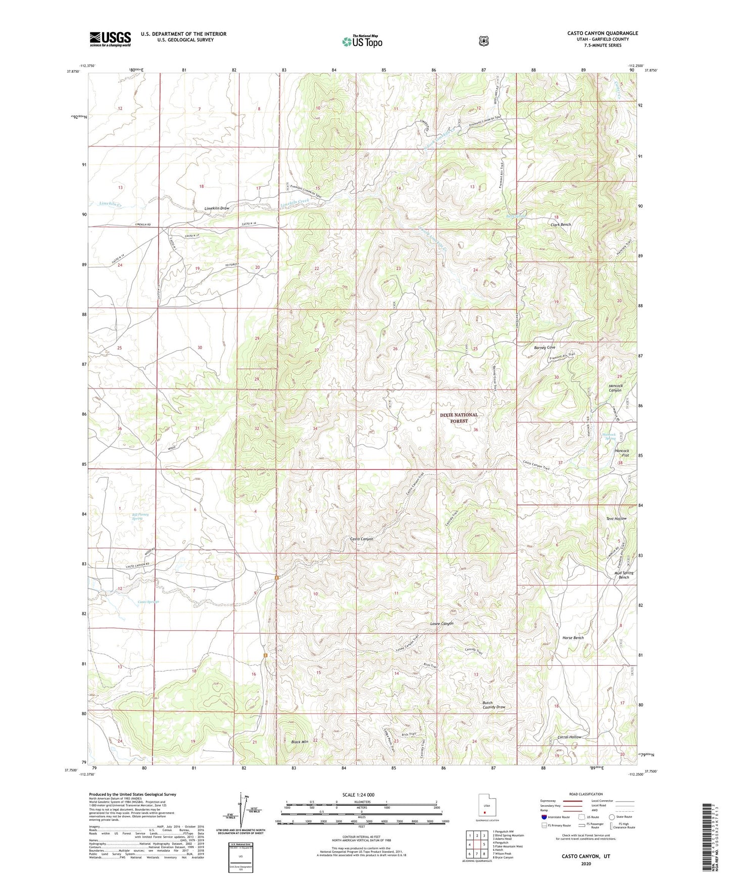
2020 topographic map quadrangle Casto Canyon in the state of Utah. Scale: 1:24000. Based on the newly updated USGS 7.5' US Topo map series, this map is in the following counties: Garfield. The map contains contour data, water features, and other items you are used to seeing on USGS maps, but also has updated roads and other features. This is the next generation of topographic maps. Printed on high-quality waterproof paper with UV fade-resistant inks.
Quads adjacent to this one:
West: Panguitch
Northwest: Panguitch NW
North: Blind Spring Mountain
Northeast: Adams Head
East: Flake Mountain West
Southeast: Bryce Canyon
South: Wilson Peak
Southwest: Hatch
Contains the following named places: Barney Cove, Bill Pinney Spring, Birch Spring, Black Mountain, Casto Canyon, Casto Springs, Clark Bench, Hancock Canyon, Hancock Spring, Horse Bench, Losee Canyon, North Fork Limekiln Creek, South Fork Limekiln Creek, Tent Hollow