MyTopo
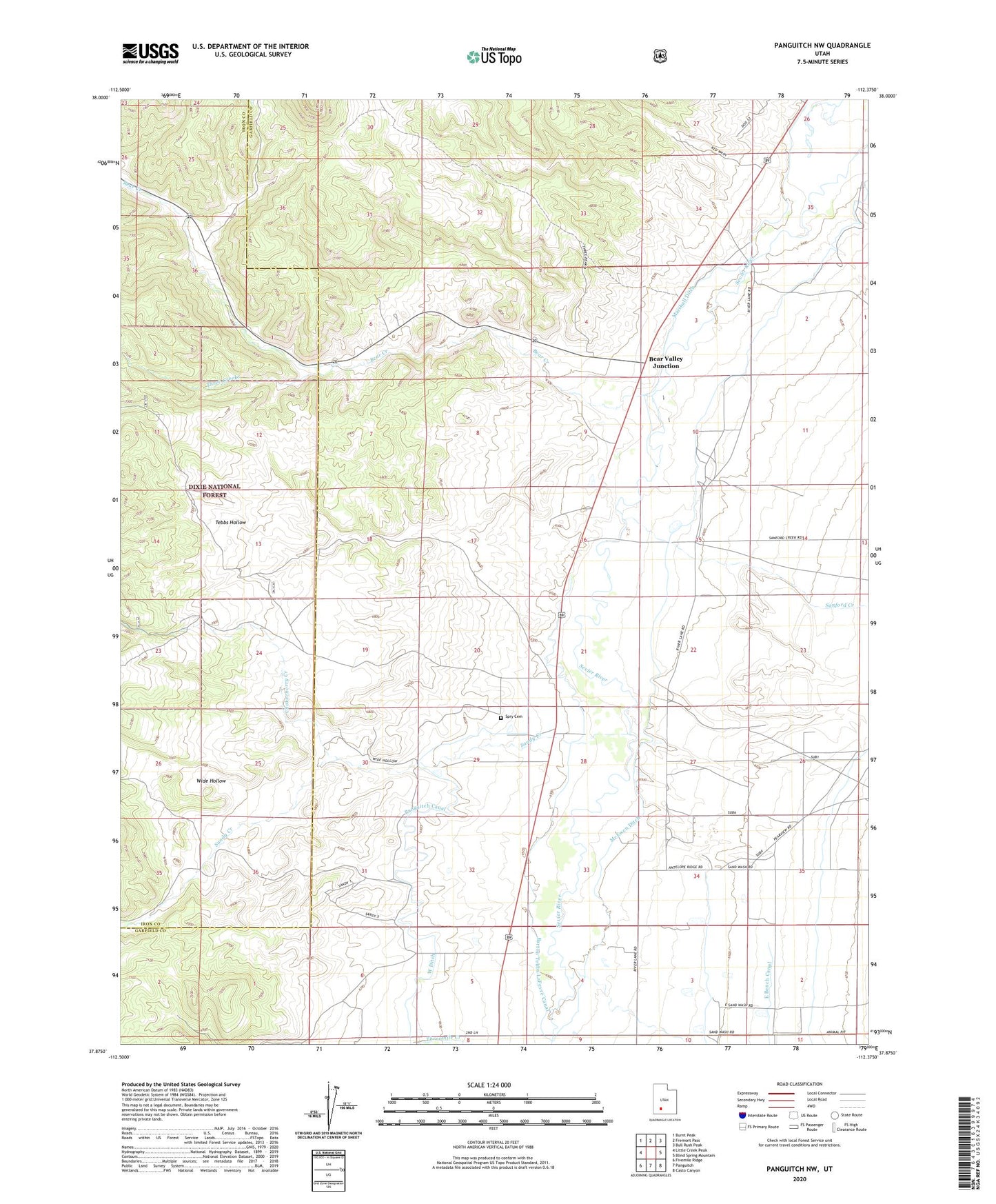
Panguitch NW Utah US Topo Map
Couldn't load pickup availability
Also explore the Panguitch NW Forest Service Topo of this same quad for updated USFS data
2023 topographic map quadrangle Panguitch NW in the state of Utah. Scale: 1:24000. Based on the newly updated USGS 7.5' US Topo map series, this map is in the following counties: Garfield, Iron. The map contains contour data, water features, and other items you are used to seeing on USGS maps, but also has updated roads and other features. This is the next generation of topographic maps. Printed on high-quality waterproof paper with UV fade-resistant inks.
Quads adjacent to this one:
West: Little Creek Peak
Northwest: Burnt Peak
North: Fremont Pass
Northeast: Bull Rush Peak
East: Blind Spring Mountain
Southeast: Casto Canyon
South: Panguitch
Southwest: Fivemile Ridge
This map covers the same area as the classic USGS quad with code o37112h4.
Contains the following named places: Barton Tebbs LaFevre Canal, Bear Creek, Bear Valley Junction, Chokecherry Creek, Marshall Ditch, McEwen Ditch, Miry Creek, Old State Ditch, Panguitch Canal, Sand Wash, Sandy Creek, Sanford Creek, Spry, Spry Cemetery, Tebbs Hollow, Three Creeks, Wide Hollow, ZIP Code: 84759