MyTopo
Causey Dam Utah US Topo Map
Couldn't load pickup availability
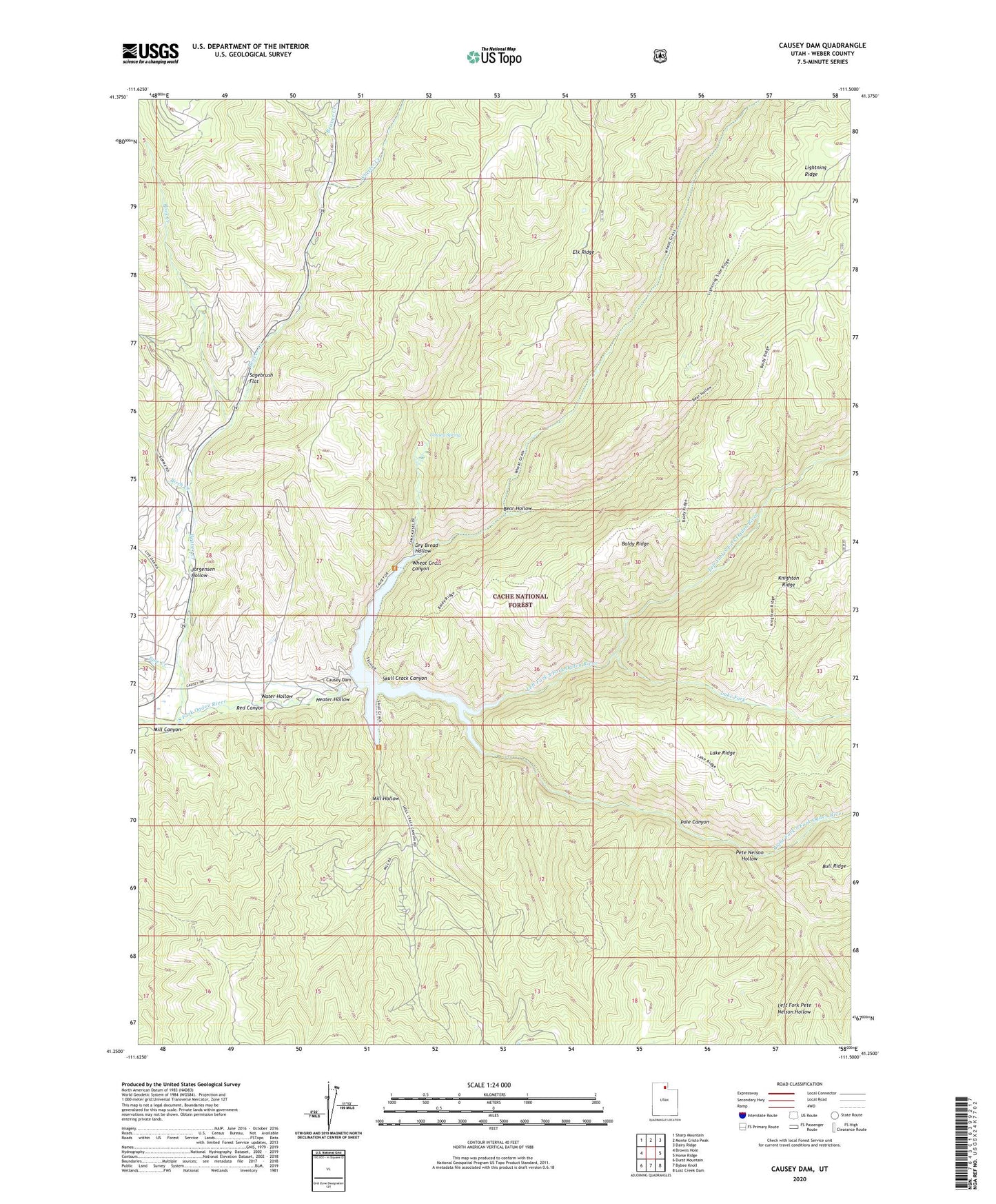
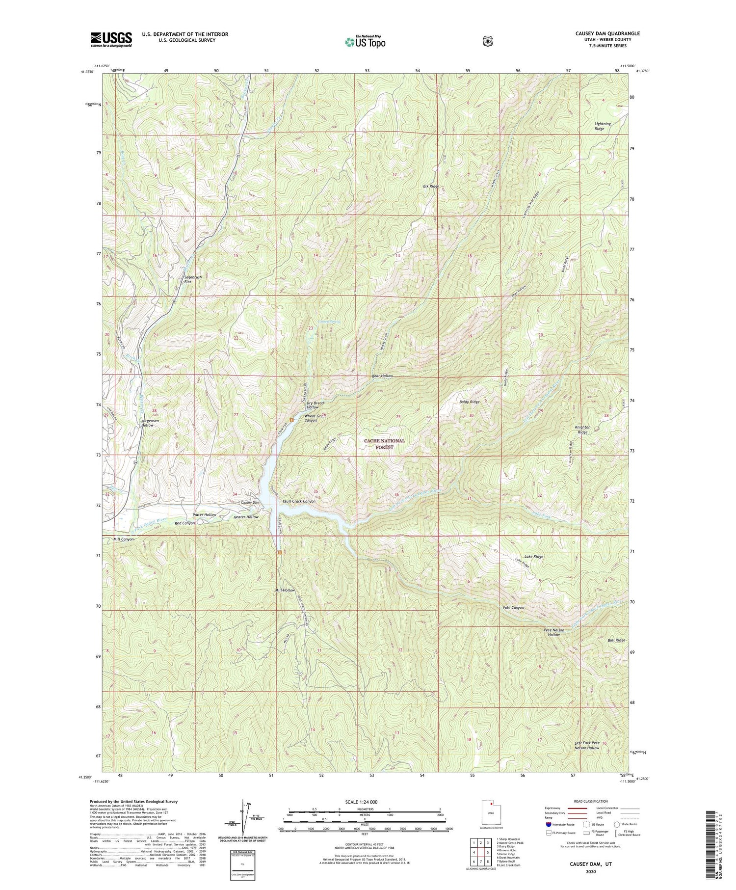
2020 topographic map quadrangle Causey Dam in the state of Utah. Scale: 1:24000. Based on the newly updated USGS 7.5' US Topo map series, this map is in the following counties: Weber. The map contains contour data, water features, and other items you are used to seeing on USGS maps, but also has updated roads and other features. This is the next generation of topographic maps. Printed on high-quality waterproof paper with UV fade-resistant inks.
Quads adjacent to this one:
West: Browns Hole
Northwest: Sharp Mountain
North: Monte Cristo Peak
Northeast: Dairy Ridge
East: Horse Ridge
Southeast: Lost Creek Dam
South: Bybee Knoll
Southwest: Durst Mountain
Contains the following named places: Bear Hollow, Beaver Creek, Birch Creek, Camp Kiesel, Camp Red Cliff, Causey Dam, Causey Estates, Causey Reservoir, Causey Spring, Dry Bread Hollow, Heater Hollow, Jorgensen Hollow, Lake Fork, Left Fork Pete Nelson Hollow, Left Fork South Fork Ogden River, Mill Canyon, Mill Hollow, Pete Nelson Hollow, Pine Creek, Pole Canyon, Red Canyon, Red Rock Ranch, Right Fork South Fork Ogden River, Rock Creek, Sagebrush Flat, Skull Crack Campground, Skull Crack Canyon, Skull Crack Trailhead, Water Hollow, Weber County Memorial Park, Wheat Grass Canyon, Wheeler Creek, ZIP Code: 84317