MyTopo
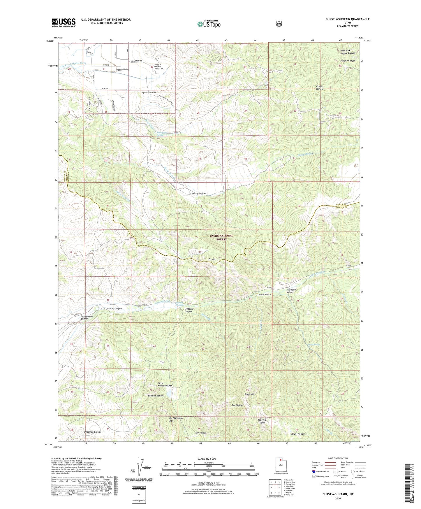
Durst Mountain Utah US Topo Map
Couldn't load pickup availability
Also explore the Durst Mountain Forest Service Topo of this same quad for updated USFS data
2023 topographic map quadrangle Durst Mountain in the state of Utah. Scale: 1:24000. Based on the newly updated USGS 7.5' US Topo map series, this map is in the following counties: Morgan, Weber. The map contains contour data, water features, and other items you are used to seeing on USGS maps, but also has updated roads and other features. This is the next generation of topographic maps. Printed on high-quality waterproof paper with UV fade-resistant inks.
Quads adjacent to this one:
West: Snow Basin
Northwest: Huntsville
North: Browns Hole
Northeast: Causey Dam
East: Bybee Knoll
Southeast: Devils Slide
South: Morgan
Southwest: Peterson
This map covers the same area as the classic USGS quad with code o41111b6.
Contains the following named places: Abbey of the Holy Trinity Cemetery, Arbuckle Canyon, Bally Watts Creek, Bennett Creek, Big Mahogany Mountain, Brushy Canyon, Cottonwood Canyon, Durst Creek, Durst Mountain, Durst Spring, Elk Mountain, Hardy Hollow, Layton Creek, Little Mahogany Mountain, Miller Gulch, Monastery Spring, Quarry Hollow, Sheep Herd Creek, Spring Branch, Stoddard Canyon, Sulphur Springs, Taylor Creek, West Fork Magpie Canyon