MyTopo
Erickson Basin Utah US Topo Map
Couldn't load pickup availability
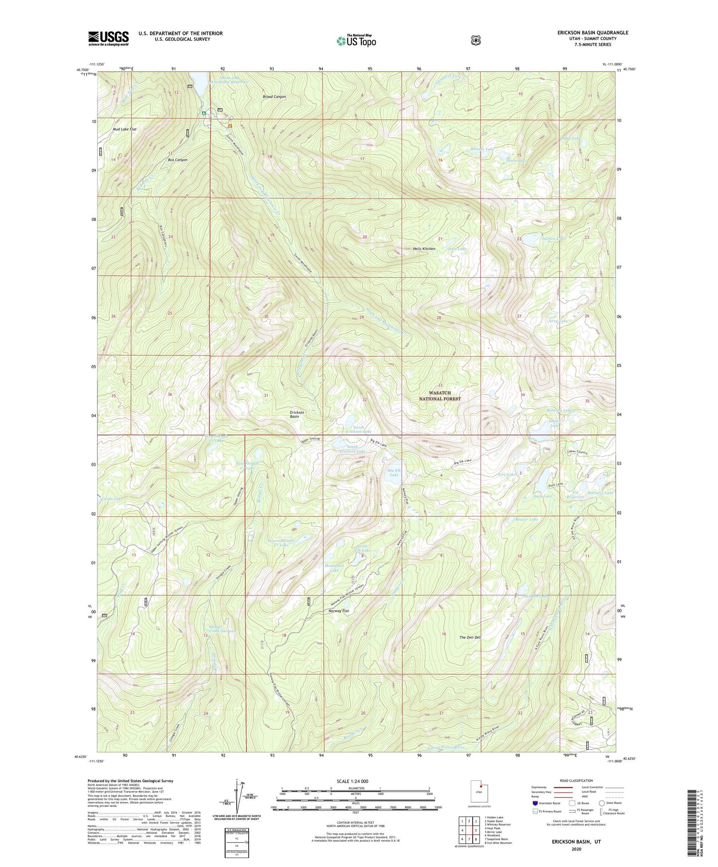
2020 topographic map quadrangle Erickson Basin in the state of Utah. Scale: 1:24000. Based on the newly updated USGS 7.5' US Topo map series, this map is in the following counties: Summit. The map contains contour data, water features, and other items you are used to seeing on USGS maps, but also has updated roads and other features. This is the next generation of topographic maps. Printed on high-quality waterproof paper with UV fade-resistant inks.
Quads adjacent to this one:
West: Hoyt Peak
Northwest: Hidden Lake
North: Slader Basin
Northeast: Whitney Reservoir
East: Mirror Lake
Southeast: Iron Mine Mountain
South: Soapstone Basin
Southwest: Woodland
Contains the following named places: Adax Lake, Anchor Lake, Anchor Lake Reservoir Dam, Beaver Lake, Big Elk Lake, Big Elk Lake Dam, Box Canyon, Broad Canyon, Cutthroat Lake, Duck Lake, Duck Lake Dam, East Shingle Creek Lake, Erickson Basin, Erickson Creek, Fire Lake, Fire Lake Dam, Hells Kitchen, Hidden Lake, Hourglass Lake, Island Lake, Jean Lake, Jerry Lake, Ledgefork Campground, Ledgefork Guard Station, Little Elk Lake, Lower Shingle Creek Lake, Mud Lake Flat, North Erickson Lake, Norway Flat, Olsen Lake, Pot Dam, Pot Reservoir, Ramona Lake, Red Pine Creek, Rhoads Lake, Shingle Creek Narrows, Smith Morehouse Trail, South Erickson Lake, The Deli Dell, Weir Dam, West Shingle Creek Lake, ZIP Code: 84036