MyTopo
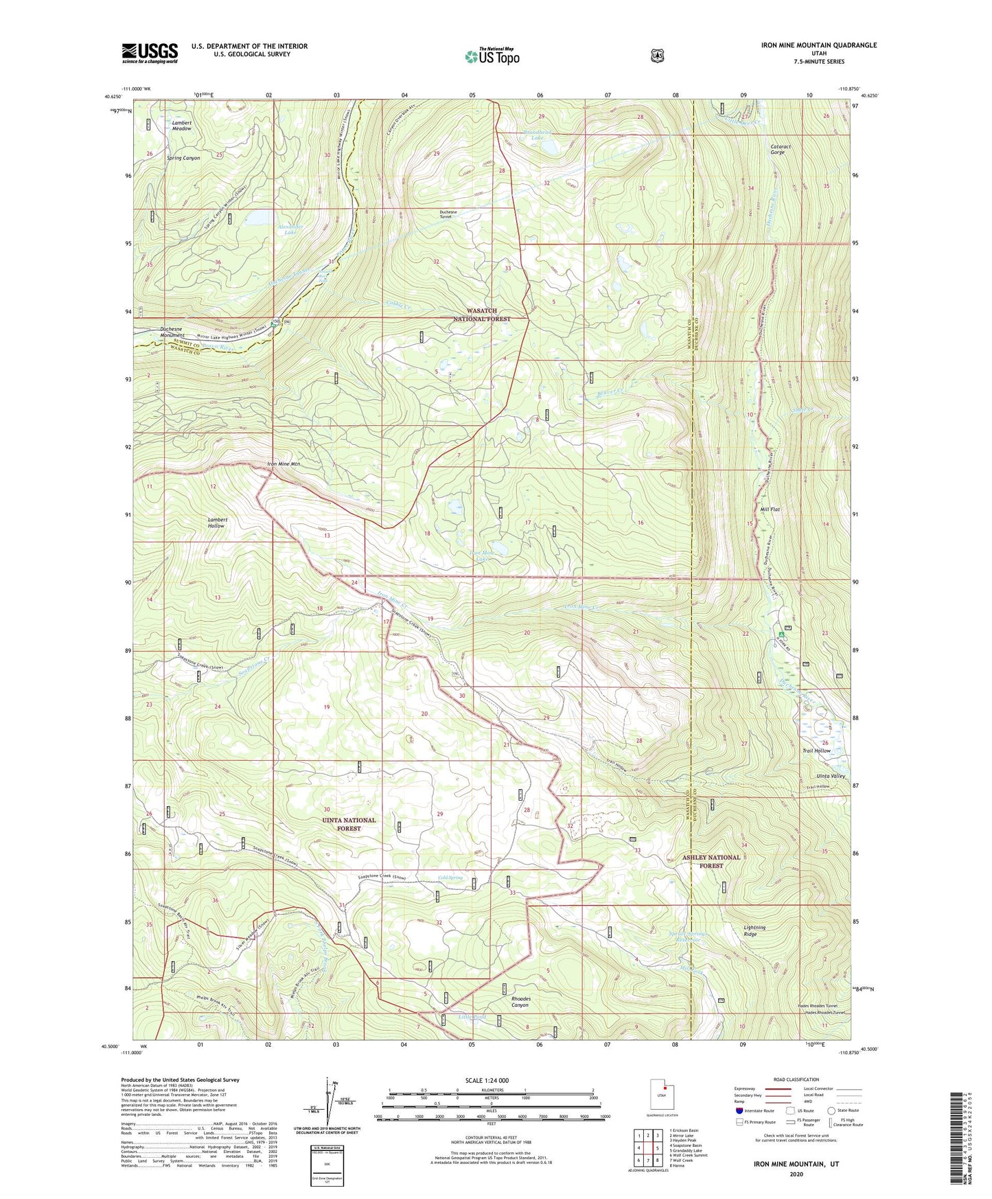
Iron Mine Mountain Utah US Topo Map
Couldn't load pickup availability
Also explore the Iron Mine Mountain Forest Service Topo of this same quad for updated USFS data
2023 topographic map quadrangle Iron Mine Mountain in the state of Utah. Scale: 1:24000. Based on the newly updated USGS 7.5' US Topo map series, this map is in the following counties: Wasatch, Duchesne, Summit. The map contains contour data, water features, and other items you are used to seeing on USGS maps, but also has updated roads and other features. This is the next generation of topographic maps. Printed on high-quality waterproof paper with UV fade-resistant inks.
Quads adjacent to this one:
West: Soapstone Basin
Northwest: Erickson Basin
North: Mirror Lake
Northeast: Hayden Peak
East: Grandaddy Lake
Southeast: Hanna
South: Wolf Creek
Southwest: Wolf Creek Summit
This map covers the same area as the classic USGS quad with code o40110e8.
Contains the following named places: Alexander Lake, Beaver Creek, Broadhead Lake, Cataract Gorge, Cobble Creek, Cobblerest Campground, Cold Spring, Defas Dude Ranch, Duchesne Monument, Duchesne Tunnel, East Portal, East Portal Duchesne Tunnel, Hades Recreation Site, Hades Rhoades Tunnel, Iron Mine Campground, Iron Mine Creek, Iron Mine Lake, Iron Mine Mountain, Lambert Meadow, Little Deer Creek, Little Pond, Mill Flat, Mill Flat Campground, Shale Creek, Smooth Rock Falls, Spruce Springs Reservoir, Trail Hollow, West Portal