
MyTopo
Firewater Canyon North Utah US Topo Map
Couldn't load pickup availability
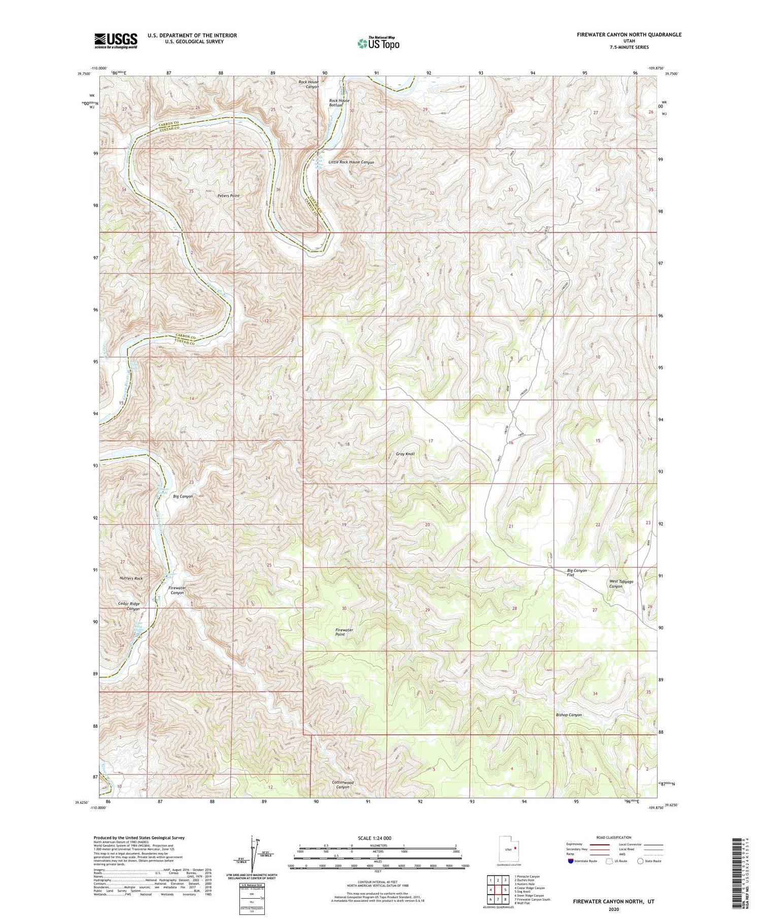
2020 topographic map quadrangle Firewater Canyon North in the state of Utah. Scale: 1:24000. Based on the newly updated USGS 7.5' US Topo map series, this map is in the following counties: Uintah, Carbon. The map contains contour data, water features, and other items you are used to seeing on USGS maps, but also has updated roads and other features. This is the next generation of topographic maps. Printed on high-quality waterproof paper with UV fade-resistant inks.
Quads adjacent to this one:
West: Cedar Ridge Canyon
Northwest: Pinnacle Canyon
North: Duches Hole
Northeast: Nutters Hole
East: Dog Knoll
Southeast: Wolf Flat
South: Firewater Canyon South
Southwest: Steer Ridge Canyon
Contains the following named places: Big Canyon, Big Canyon Flat, Big Canyon Rapids, Bishop Canyon, Cedar Ridge Canyon, Cedar Ridge Rapids, Cottonwood Canyon, Firewater Canyon, Firewater Point, Firewater Rapids, Gray Knoll, Jack Creek, Jack Creek Rapids, Little Rock House Canyon, Little Rock House Riffle, Nutters Rock, Peters Point, Rock House Bottom, Rock House Canyon


