MyTopo
Wolf Flat Utah US Topo Map
Couldn't load pickup availability
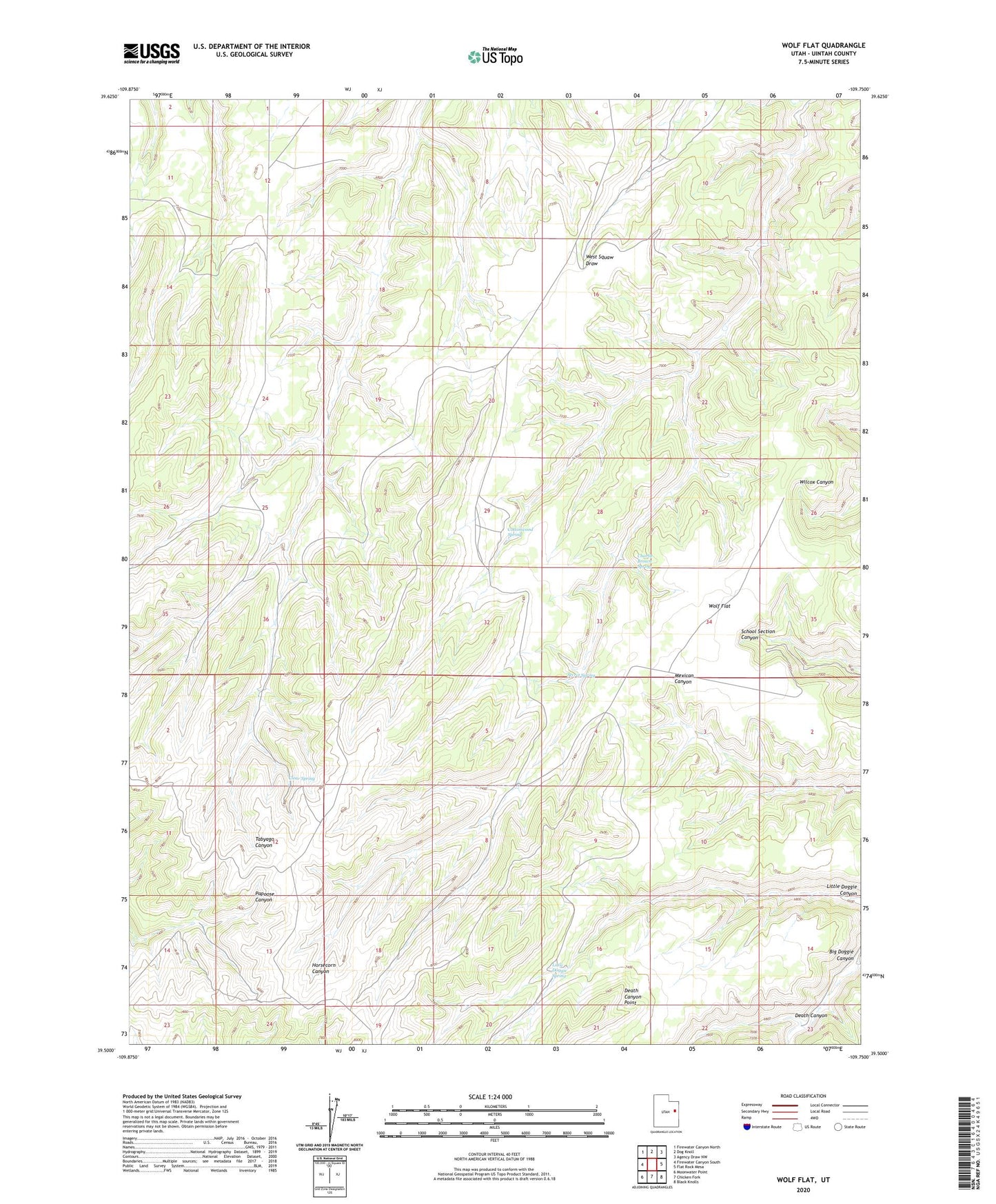
2023 topographic map quadrangle Wolf Flat in the state of Utah. Scale: 1:24000. Based on the newly updated USGS 7.5' US Topo map series, this map is in the following counties: Uintah. The map contains contour data, water features, and other items you are used to seeing on USGS maps, but also has updated roads and other features. This is the next generation of topographic maps. Printed on high-quality waterproof paper with UV fade-resistant inks.
Quads adjacent to this one:
West: Firewater Canyon South
Northwest: Firewater Canyon North
North: Dog Knoll
Northeast: Agency Draw NW
East: Flat Rock Mesa
Southeast: Black Knolls
South: Chicken Fork
Southwest: Moonwater Point
This map covers the same area as the classic USGS quad with code o39109e7.
Contains the following named places: Charlie Brown Spring, Clear Spring, Cottonwood Canyon, Cottonwood Spring, Death Canyon, Death Canyon Point, Little Doggie Spring, Secret Spring, Wolf Flat