MyTopo
Fumarole Butte Utah US Topo Map
Couldn't load pickup availability
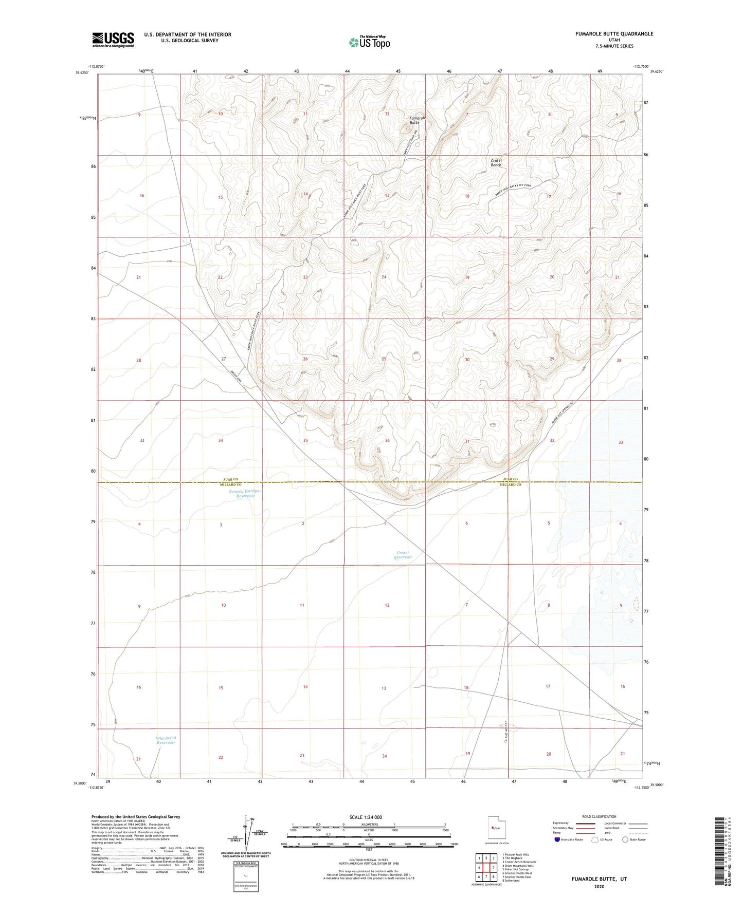
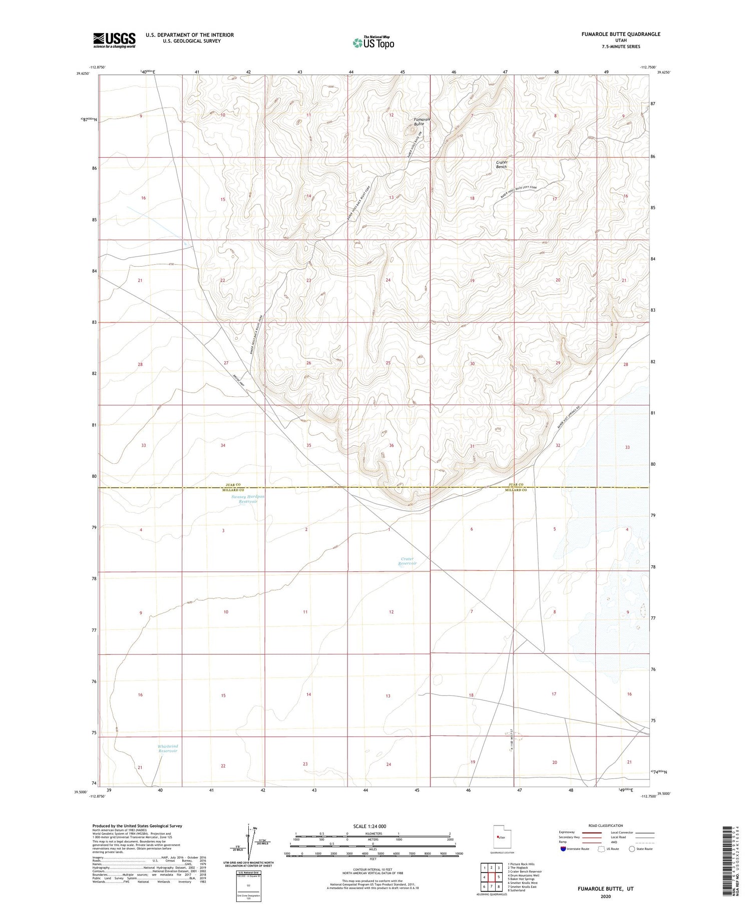
2020 topographic map quadrangle Fumarole Butte in the state of Utah. Scale: 1:24000. Based on the newly updated USGS 7.5' US Topo map series, this map is in the following counties: Juab, Millard. The map contains contour data, water features, and other items you are used to seeing on USGS maps, but also has updated roads and other features. This is the next generation of topographic maps. Printed on high-quality waterproof paper with UV fade-resistant inks.
Quads adjacent to this one:
West: Drum Mountains Well
Northwest: Picture Rock Hills
North: The Hogback
Northeast: Crater Bench Reservoir
East: Baker Hot Springs
Southeast: Sutherland
South: Smelter Knolls East
Southwest: Smelter Knolls West
Contains the following named places: Crater Bench, Crater Reservoir, Fumarole Butte, Swasey Hardpan Reservoir, Whirlwind Reservoir