MyTopo
Grassy Utah US Topo Map
Couldn't load pickup availability
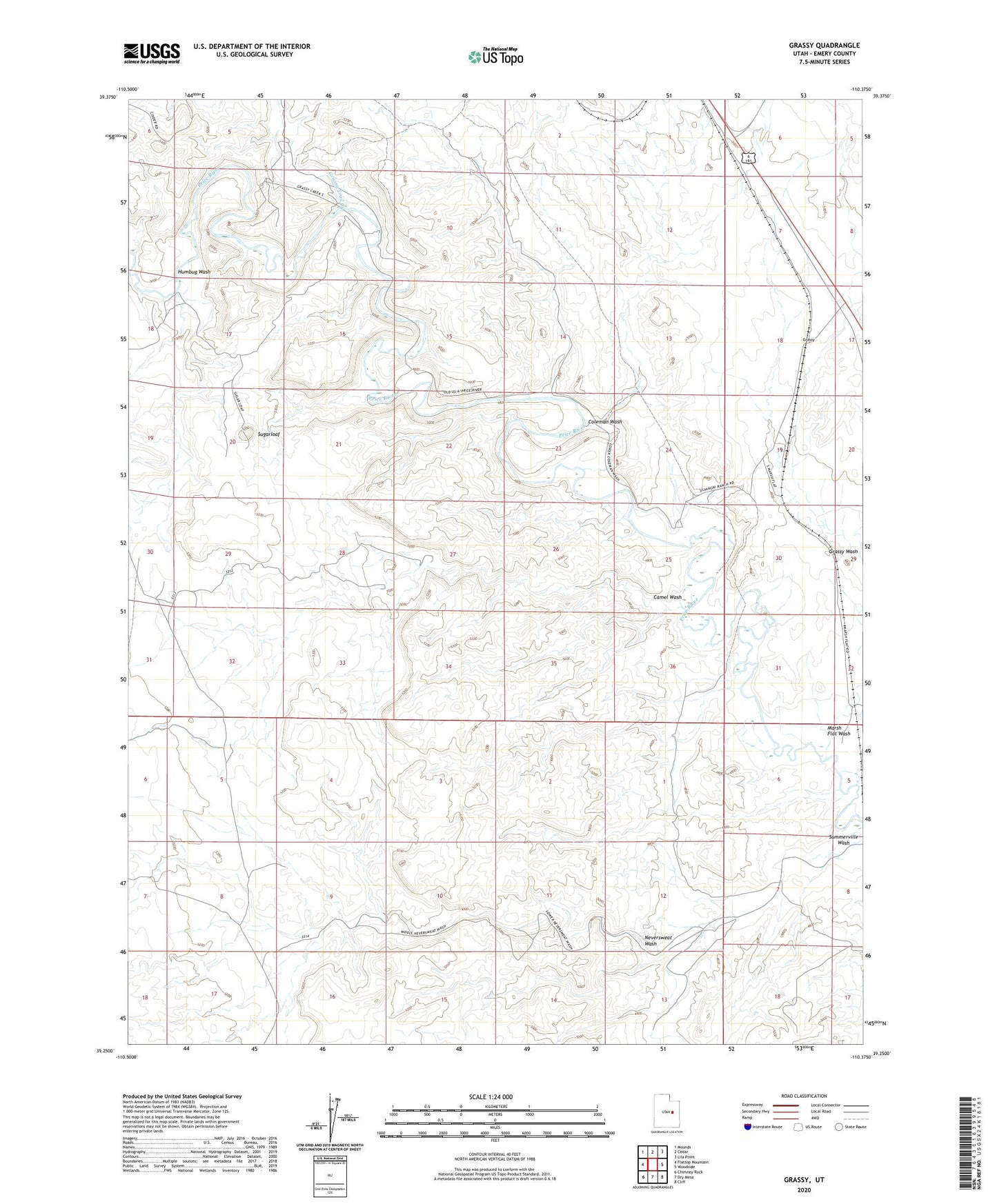
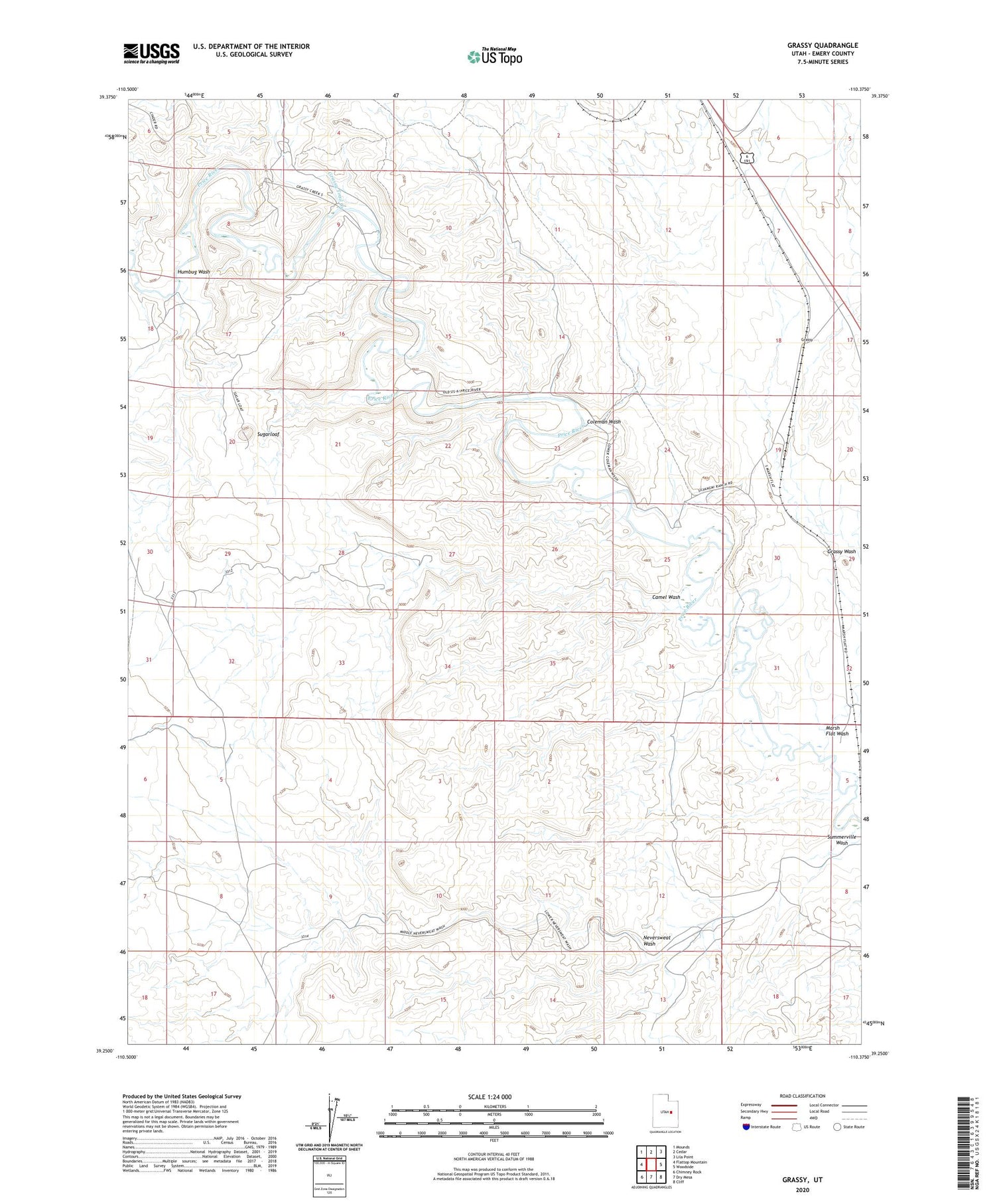
2020 topographic map quadrangle Grassy in the state of Utah. Scale: 1:24000. Based on the newly updated USGS 7.5' US Topo map series, this map is in the following counties: Emery. The map contains contour data, water features, and other items you are used to seeing on USGS maps, but also has updated roads and other features. This is the next generation of topographic maps. Printed on high-quality waterproof paper with UV fade-resistant inks.
Quads adjacent to this one:
West: Flattop Mountain
Northwest: Mounds
North: Cedar
Northeast: Lila Point
East: Woodside
Southeast: Cliff
South: Dry Mesa
Southwest: Chimney Rock
Contains the following named places: Camel Wash, Coleman Wash, Grassy, Grassy Trail Creek, Grassy Wash, Humbug Wash, Marsh Flat Wash, Neversweat Wash, Silvagni Ranch, Sugarloaf, Summerville Wash