MyTopo
Cedar Utah US Topo Map
Couldn't load pickup availability
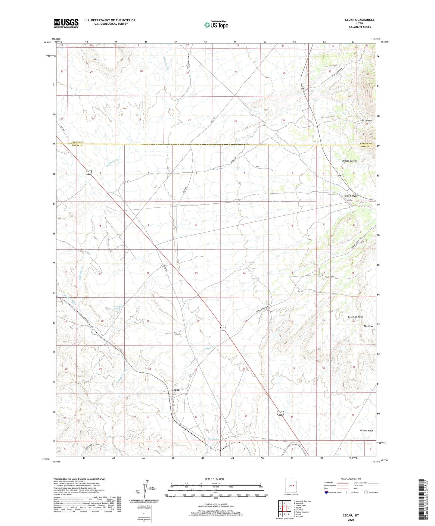
2023 topographic map quadrangle Cedar in the state of Utah. Scale: 1:24000. Based on the newly updated USGS 7.5' US Topo map series, this map is in the following counties: Emery, Carbon. The map contains contour data, water features, and other items you are used to seeing on USGS maps, but also has updated roads and other features. This is the next generation of topographic maps. Printed on high-quality waterproof paper with UV fade-resistant inks.
Quads adjacent to this one:
West: Mounds
Northwest: Sunnyside Junction
North: Sunnyside
Northeast: Patmos Head
East: Lila Point
Southeast: Woodside
South: Grassy
Southwest: Flattop Mountain
This map covers the same area as the classic USGS quad with code o39110d4.
Contains the following named places: Cedar, Coon Spring, Fan Canyon, Good Water Spring, Horse Canyon, Horse Creek, Icelander Creek, Middle Canyon, The Cove