MyTopo
Hardware Ranch Utah US Topo Map
Couldn't load pickup availability
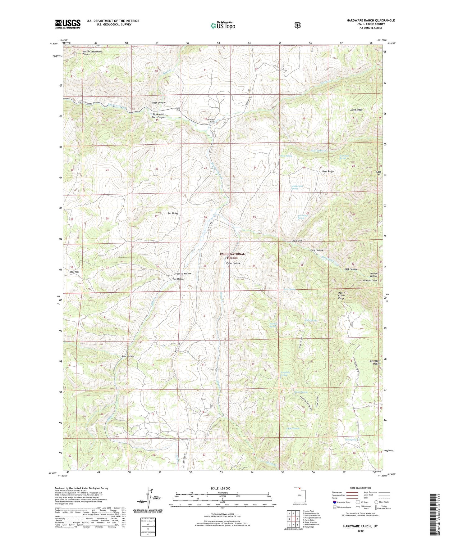
2020 topographic map quadrangle Hardware Ranch in the state of Utah. Scale: 1:24000. Based on the newly updated USGS 7.5' US Topo map series, this map is in the following counties: Cache. The map contains contour data, water features, and other items you are used to seeing on USGS maps, but also has updated roads and other features. This is the next generation of topographic maps. Printed on high-quality waterproof paper with UV fade-resistant inks.
Quads adjacent to this one:
West: Porcupine Reservoir
Northwest: Logan Peak
North: Boulder Mountain
Northeast: Red Spur Mountain
East: Curtis Ridge
Southeast: Dairy Ridge
South: Monte Cristo Peak
Southwest: Sharp Mountain
Contains the following named places: Anderson Ranch, Ant Valley, Bear Hollow, Blacksmith Fork, Boundary Spring, Buck Spring, Burn Spring, Camp Wapiti, Cart Hollow, Curtis Creek, Curtis Hollow, Deer Ridge, Deer Ridge Spring, Dry Curtis Creek, Dry Gulch, East Mud Spring, Elbow Spring, Fox Hollow, Gold Hill, Hardware Ranch, Hardware Ranch Game Management Area, Hayes Spring, Johnson Draw, Lions Hollow, Middle Mud Spring, Mill Creek, Mollens Hollow, Petes Hollow, Rock Canyon, Rock Creek, Sheep Creek, Tilda Spring, Whiskey Spring, Wilson Spring