MyTopo
Henrieville Utah US Topo Map
Couldn't load pickup availability
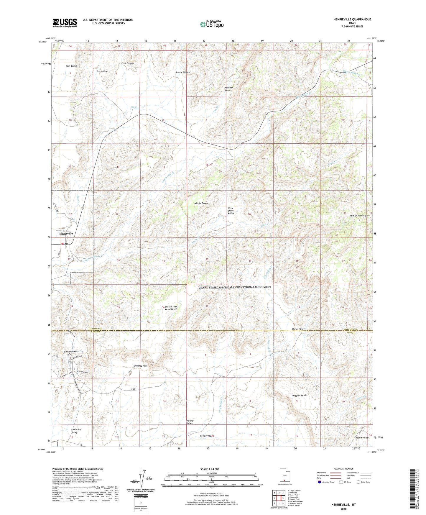
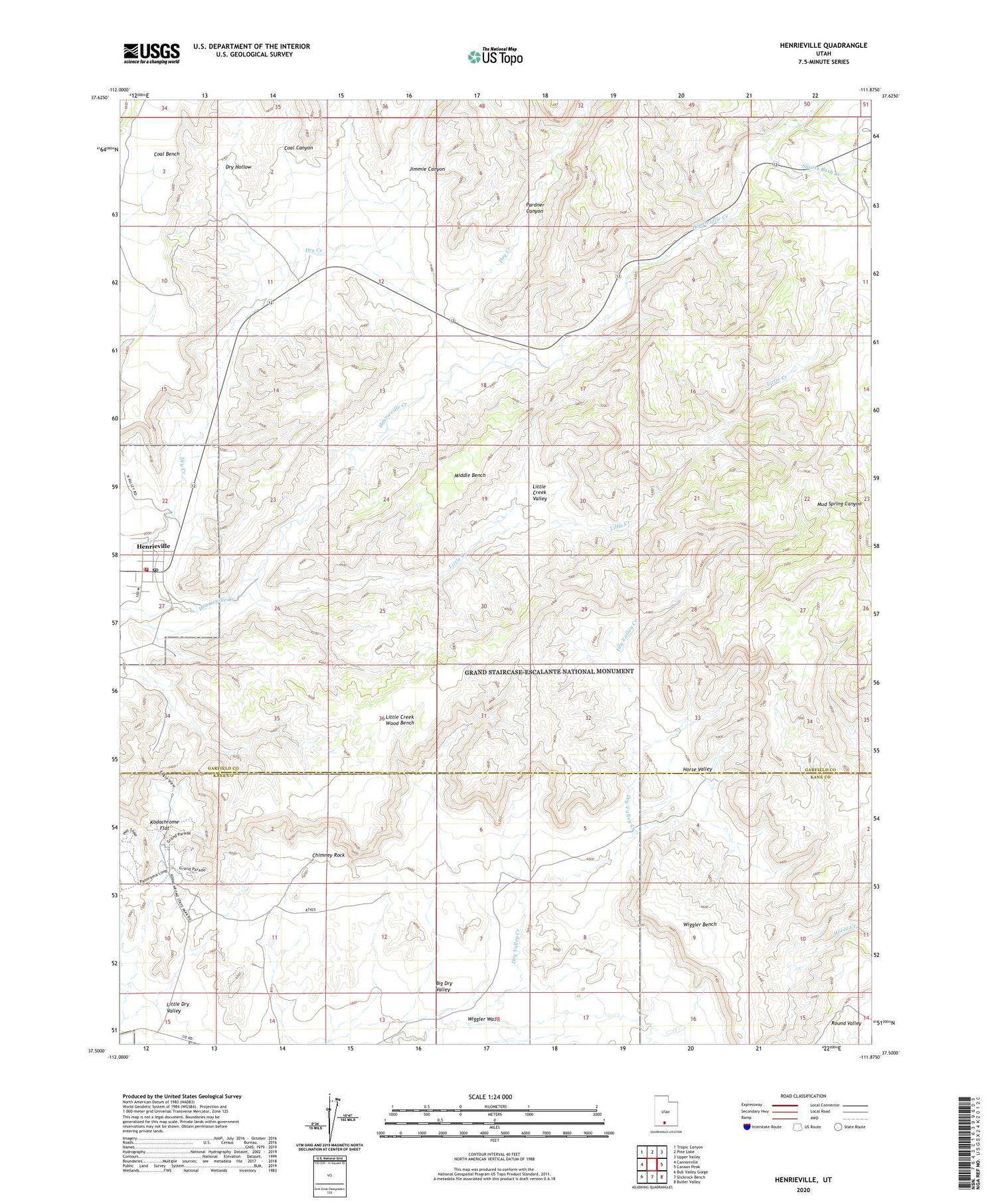
2020 topographic map quadrangle Henrieville in the state of Utah. Scale: 1:24000. Based on the newly updated USGS 7.5' US Topo map series, this map is in the following counties: Garfield, Kane. The map contains contour data, water features, and other items you are used to seeing on USGS maps, but also has updated roads and other features. This is the next generation of topographic maps. Printed on high-quality waterproof paper with UV fade-resistant inks.
Quads adjacent to this one:
West: Cannonville
Northwest: Tropic Canyon
North: Pine Lake
Northeast: Upper Valley
East: Canaan Peak
Southeast: Butler Valley
South: Slickrock Bench
Southwest: Bull Valley Gorge
Contains the following named places: Big Dry Valley, Chimney Rock, Coal Bench, Coal Canyon, Dry Hollow, Henrieville, Henrieville Post Office, Henrieville Volunteer Fire Department, Horse Creek, Horse Valley, Jimmie Canyon, Kodachrome Basin Campground, Kodachrome Flat, Little Creek, Little Creek Valley, Little Creek Wood Bench, Middle Bench, Pardner Canyon, Shurtz Bush Creek, The Church of Jesus Christ of Latter Day Saints, Wiggler Bench, Wiggler Wash, ZIP Code: 84736