MyTopo
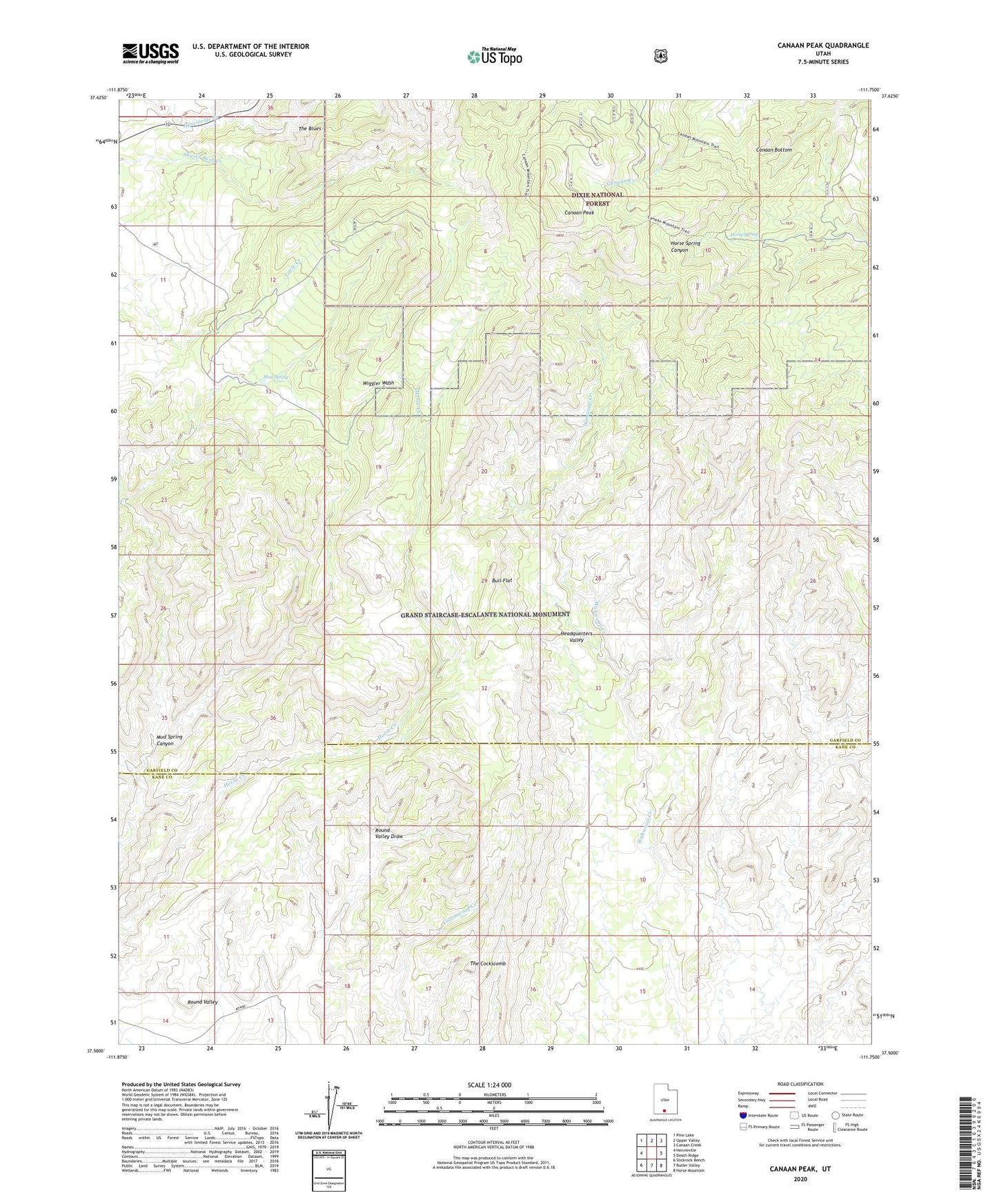
Canaan Peak Utah US Topo Map
Couldn't load pickup availability
Also explore the Canaan Peak Forest Service Topo of this same quad for updated USFS data
2023 topographic map quadrangle Canaan Peak in the state of Utah. Scale: 1:24000. Based on the newly updated USGS 7.5' US Topo map series, this map is in the following counties: Garfield, Kane. The map contains contour data, water features, and other items you are used to seeing on USGS maps, but also has updated roads and other features. This is the next generation of topographic maps. Printed on high-quality waterproof paper with UV fade-resistant inks.
Quads adjacent to this one:
West: Henrieville
Northwest: Pine Lake
North: Upper Valley
Northeast: Canaan Creek
East: Death Ridge
Southeast: Horse Mountain
South: Butler Valley
Southwest: Slickrock Bench
This map covers the same area as the classic USGS quad with code o37111e7.
Contains the following named places: Bull Flat, Canaan Bottom, Canaan Peak, Horse Spring, Mud Spring, Mud Spring Canyon, Shurtz Bush, The Cockscomb