MyTopo
Hinckley Utah US Topo Map
Couldn't load pickup availability
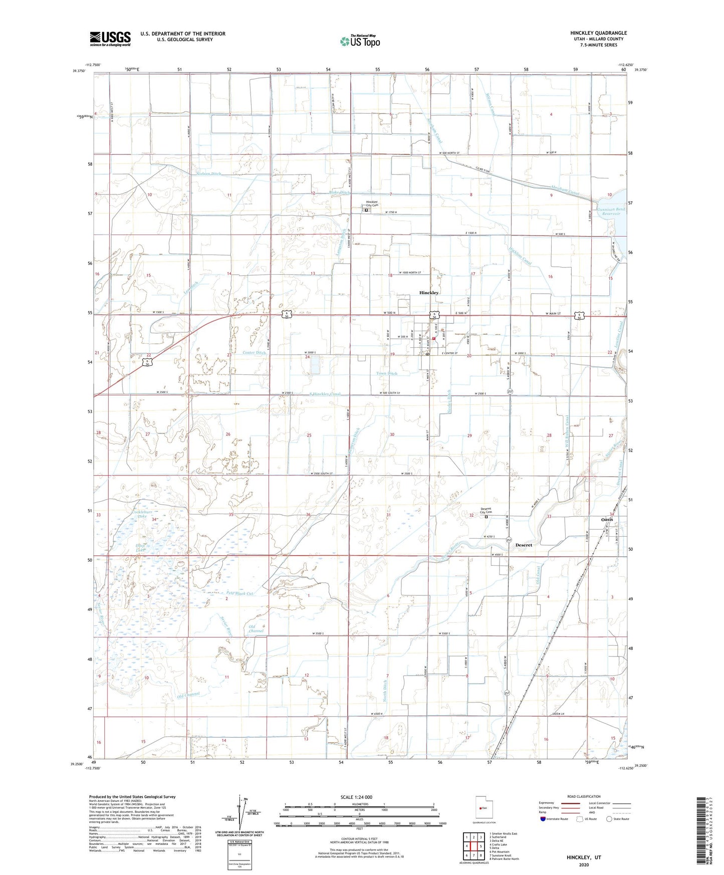
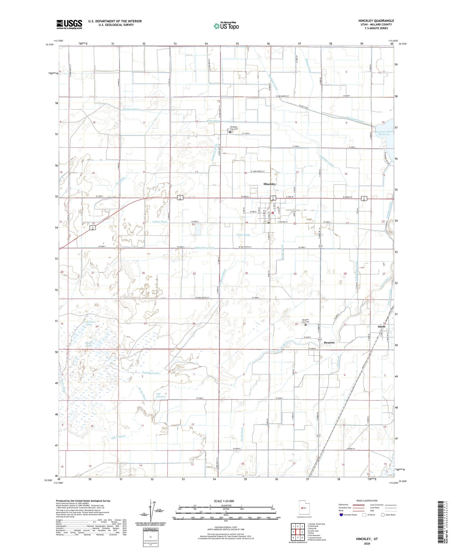
2020 topographic map quadrangle Hinckley in the state of Utah. Scale: 1:24000. Based on the newly updated USGS 7.5' US Topo map series, this map is in the following counties: Millard. The map contains contour data, water features, and other items you are used to seeing on USGS maps, but also has updated roads and other features. This is the next generation of topographic maps. Printed on high-quality waterproof paper with UV fade-resistant inks.
Quads adjacent to this one:
West: Crafts Lake
Northwest: Smelter Knolls East
North: Sutherland
Northeast: Delta NE
East: Delta
Southeast: Pahvant Butte North
South: Sunstone Knoll
Southwest: Pot Mountain
Contains the following named places: Blake Ditch, Bliss Canal, Center Ditch, Cockleburr Lake, Dameron Ditch, Deep Lake, Deseret, Deseret Canal, Deseret Census Designated Place, Deseret City Cemetery, Fort Deseret State Park, Highline Canal, Hinckley, Hinckley City Cemetery, Hinckley Fire Department, Hinckley Post Office, Langston Ditch, Lee Ditch, Lowline Canal, Neeley Ditch, Nielson Ditch, North Ditch, Oasis, Oasis Census Designated Place, Old Canal, Old Channel, Pete Black Cut, South Hinckley Canal, The Church of Jesus Christ of Latter Day Saints, Town Ditch, Town of Hinckley, Will Ruben Canal