MyTopo
Sunstone Knoll Utah US Topo Map
Couldn't load pickup availability
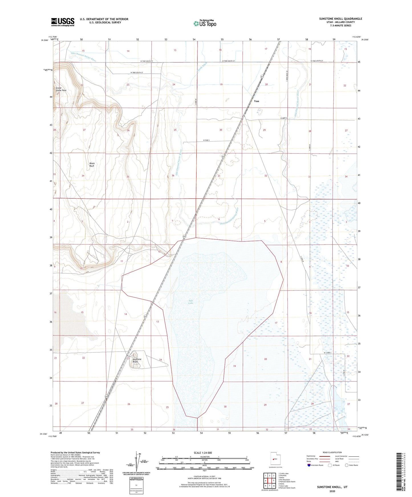
2023 topographic map quadrangle Sunstone Knoll in the state of Utah. Scale: 1:24000. Based on the newly updated USGS 7.5' US Topo map series, this map is in the following counties: Millard. The map contains contour data, water features, and other items you are used to seeing on USGS maps, but also has updated roads and other features. This is the next generation of topographic maps. Printed on high-quality waterproof paper with UV fade-resistant inks.
Quads adjacent to this one:
West: Pot Mountain
Northwest: Crafts Lake
North: Hinckley
Northeast: Delta
East: Pahvant Butte North
Southeast: Pahvant Butte South
South: Clear Lake
Southwest: Neels
This map covers the same area as the classic USGS quad with code o39112b6.
Contains the following named places: Clear Lake Waterfowl Management Area, Great Stone Face, Salt Lake, Sunstone Knoll, Van