MyTopo
Monte Cristo Peak Utah US Topo Map
Couldn't load pickup availability
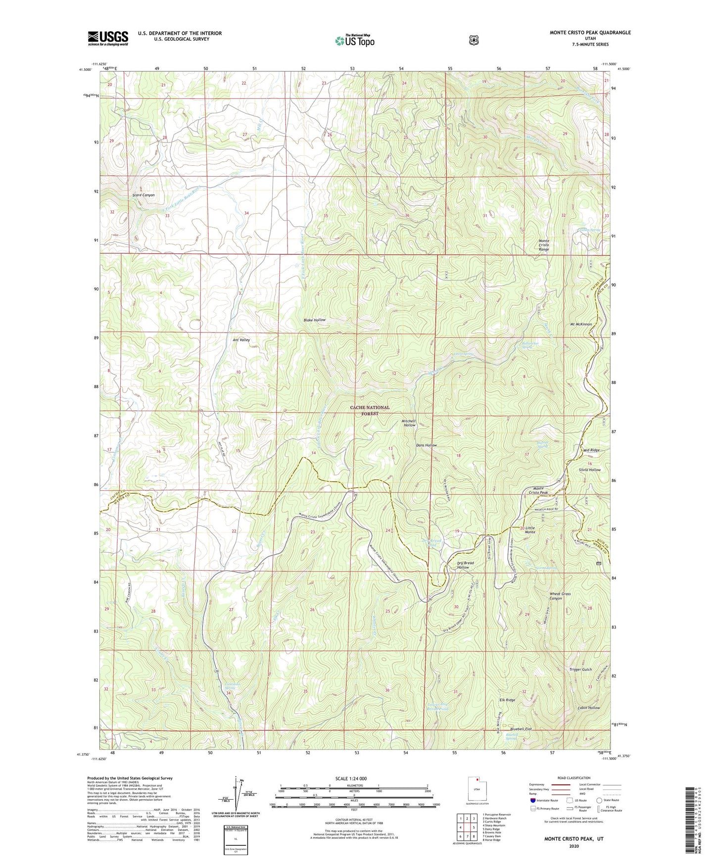
2020 topographic map quadrangle Monte Cristo Peak in the state of Utah. Scale: 1:24000. Based on the newly updated USGS 7.5' US Topo map series, this map is in the following counties: Cache, Weber, Rich. The map contains contour data, water features, and other items you are used to seeing on USGS maps, but also has updated roads and other features. This is the next generation of topographic maps. Printed on high-quality waterproof paper with UV fade-resistant inks.
Quads adjacent to this one:
West: Sharp Mountain
Northwest: Porcupine Reservoir
North: Hardware Ranch
Northeast: Curtis Ridge
East: Dairy Ridge
Southeast: Horse Ridge
South: Causey Dam
Southwest: Browns Hole
Contains the following named places: Blake Hollow, Bluebell Flat, Bluebell Spring, Buckskin Fork, Bullwacker Spring, Cabin Hollow, Coulee Creek, Dans Hollow, Dry Bread Pond, Elk Creek, Elk Ridge, Faucett Creek, Harriet Spring, Indian Spring, Lewis Spring, Limestone Spring, Little Monte, Lower Dry Bread Pond, Middle Ridge, Mitchell Hollow, Monte Cristo Forest Service Station, Monte Cristo Peak, Monte Cristo Range, Mount McKinnon, Norma Spring, Skunk Creek, Trigger Gulch