MyTopo
Mount Aire Utah US Topo Map
Couldn't load pickup availability
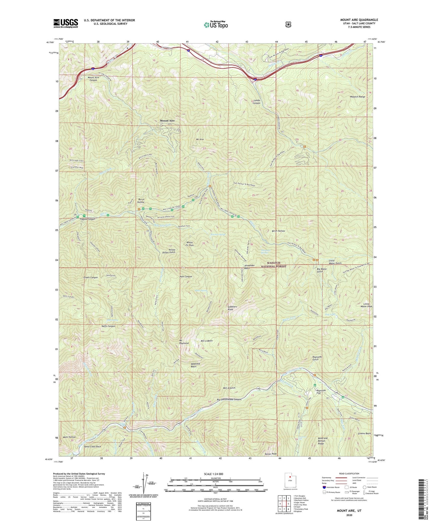
2020 topographic map quadrangle Mount Aire in the state of Utah. Scale: 1:24000. Based on the newly updated USGS 7.5' US Topo map series, this map is in the following counties: Salt Lake. The map contains contour data, water features, and other items you are used to seeing on USGS maps, but also has updated roads and other features. This is the next generation of topographic maps. Printed on high-quality waterproof paper with UV fade-resistant inks.
Quads adjacent to this one:
West: Sugar House
Northwest: Fort Douglas
North: Mountain Dell
Northeast: Big Dutch Hollow
East: Park City West
Southeast: Brighton
South: Dromedary Peak
Southwest: Draper
Contains the following named places: Alexander Basin, Baker Mine, Baker Spring, Big Water Gulch, Big Water Recreation Site, Big Water Trailhead, Birch Hollow, Bowman Fork, Bowman Spring, Box Elder Guard Station, Broads Fork, Burch Hollow, Butler Fork, Canyon Enterprises, Church Fork, Church Park Picnic Ground, Clover Springs Picnic Ground, Days Fork, Dog Lake, Doughnut Falls, Elbow Fork, Emigration Division, Evergreen Picnic Ground, Fircrest Picnic Ground, George Washington Memorial Grove, Gobblers Knob, Greens Basin, Hidden Falls, Jordan Pines Recreation Site, Kesler Peak, Lambs Canyon, Little Water Gulch, Little Water Peak, Lost Acres, Main Box Elder Picnic Ground, Maple Cove Campground, Maple Cove Picnic Ground, Maxfield Basin, Maxfield Lodge, Maxfield Mine, Merrywood, Mill A Basin, Mill A Gulch, Mill B North Fork, Mill B South Fork, Mill B South Fork Picnic Ground, Mill D North Fork, Mill D South Fork, Millcreek Forest Service Station, Mineral Fork, Moss Ledge Picnic Ground, Mount Aire, Mount Aire Canyon, Mount Olympus Wilderness, Mount Raymond, Mounthaven, Mule Hollow, Mule Hollow Inn, Neffs Spring, Pine Lodge, Pole Canyon, Porter Fork, Reynolds Flat, Reynolds Gulch, Santa Claus Rock, Soldier Fork, Storm Mountain Picnic Ground, Terrace Campground, Thayne Canyon, The Firs, The Spruces Campground, Thousand Springs, Township of Millcreek, Tracy Wigwam, Whipple Fork, White Fir Pass, Wilson Fork, Yellow Jacket Gulch, ZIP Code: 84109