MyTopo
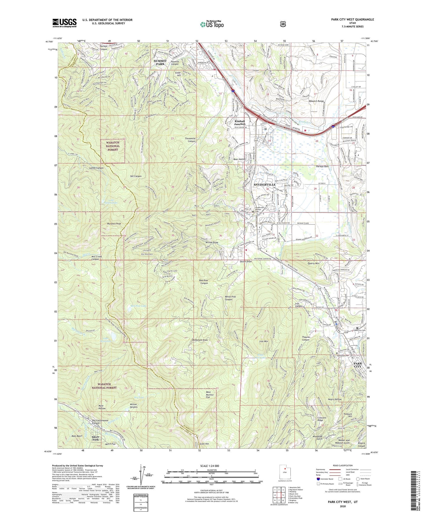
Park City West Utah US Topo Map
Couldn't load pickup availability
Also explore the Park City West Forest Service Topo of this same quad for updated USFS data
2023 topographic map quadrangle Park City West in the state of Utah. Scale: 1:24000. Based on the newly updated USGS 7.5' US Topo map series, this map is in the following counties: Summit, Salt Lake. The map contains contour data, water features, and other items you are used to seeing on USGS maps, but also has updated roads and other features. This is the next generation of topographic maps. Printed on high-quality waterproof paper with UV fade-resistant inks.
Quads adjacent to this one:
West: Mount Aire
Northwest: Mountain Dell
North: Big Dutch Hollow
Northeast: Wanship
East: Park City East
Southeast: Heber City
South: Brighton
Southwest: Dromedary Peak
This map covers the same area as the classic USGS quad with code o40111f5.
Contains the following named places: Alliance Tunnel, American Flag Shaft, Bear Hollow, Beartrap Fork, Burnt Flat, City of Park City, Creole Tunnel, Crescent Ridge, Crescent Tunnel, Dry Lake, Dutch Draw, Ecker Hill, Forest Home, Glenwood Cemetery, Hi Ute Ranch, Holiday Village Shopping Mall, Iron Canyon, Iron Mountain, Judge Tunnel, Kimball Creek, Kimball Junction, KPCW-FM (Park City), Lake Desolation, Lake Desolation Trail, Lake Salamander, Mats Basin, McDonald Draw, McLeod Creek, Mill F Flat, Miners Hospital Community Center, Mule Hollow, Murdock Peak, Negro Hollow, Neilson, Old Stage Station, Park City Baptist Church, Park City Cemetery, Park City Division, Park City Fire District Station 31, Park City Fire District Station 33, Park City Fire District Station 35, Park City Fire District Station 36, Park City Police Department, Park CIty Post Office, Park City Ski Area, Park City Ski Area Heliport, Park City West Ski Area, Park West Ski Area Heliport, Parleys Park, Parley's Park Elementary School, Pine Tree, Quarry Mountain, Red Pine Canyon, Red Pine Lake, Silver Fork, Silver Fork Big Cottonwood Canyon, Silver King Consolidated, Silver King Mine, Silver Springs, Silver Summit Census Designated Place, Snow Summit Ranch, Snyderville, Snyderville Census Designated Place, Snyderville Pioneer Cemetery, Snyderville Post Office, Solitude Ski Area, South Snyderville Basin Census Designated Place, Spiro Tunnel, Summit Park, Summit Park Census Designated Place, Thaynes Canyon, The Church of Jesus Christ of Latter Day Saints, Three Kings, Threemile Canyon, Treasure Hill, Twomile Canyon, Utley, Walker and Webster Gulch, West Monitor Flat, Western Monitor Shaft, White Pine Canyon, White Pine Lake, Willow Creek, Willow Draw, Willow Heights, ZIP Codes: 84060, 84098