MyTopo
Ogden Bay Utah US Topo Map
Couldn't load pickup availability
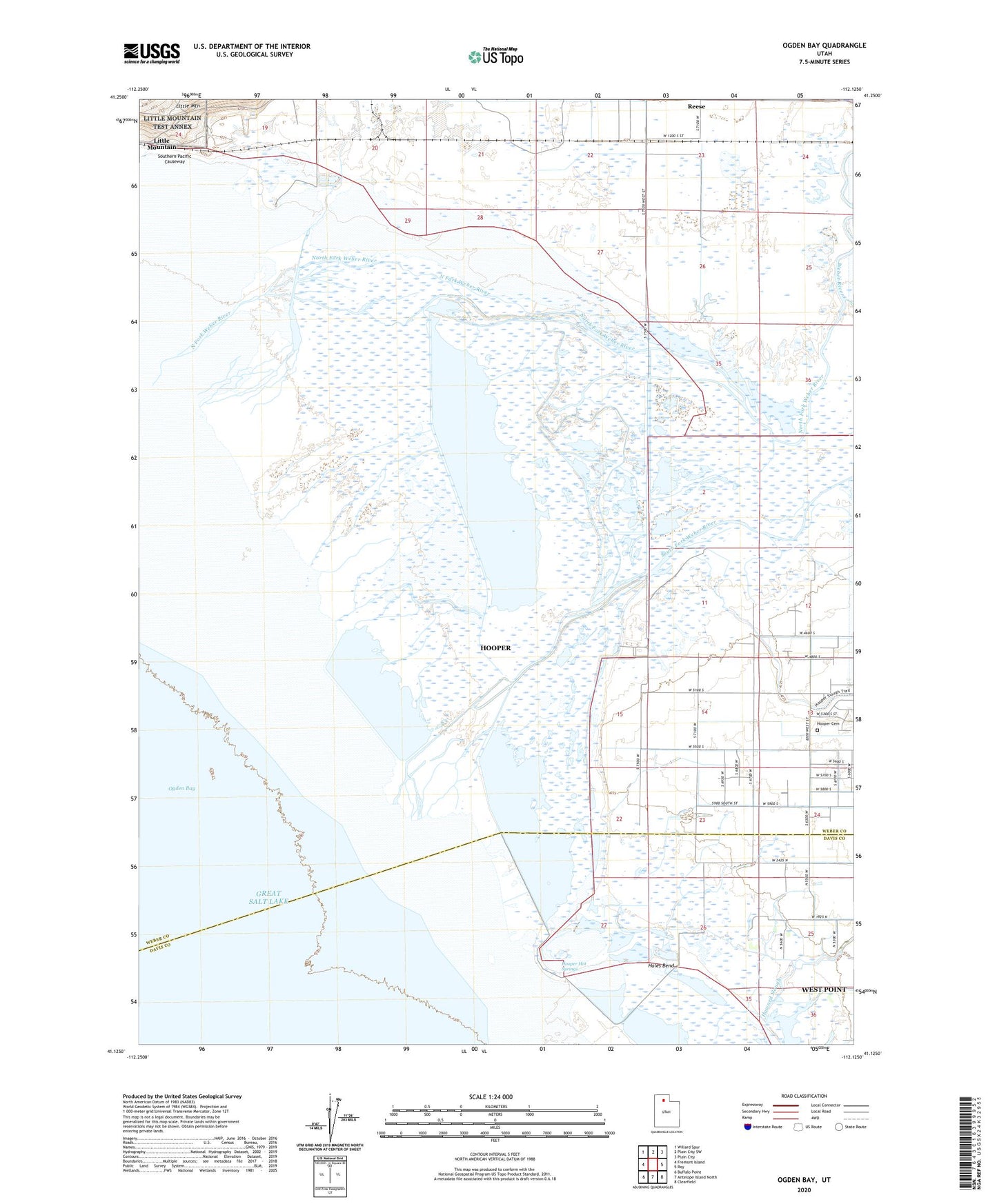
2020 topographic map quadrangle Ogden Bay in the state of Utah. Scale: 1:24000. Based on the newly updated USGS 7.5' US Topo map series, this map is in the following counties: Weber, Davis. The map contains contour data, water features, and other items you are used to seeing on USGS maps, but also has updated roads and other features. This is the next generation of topographic maps. Printed on high-quality waterproof paper with UV fade-resistant inks.
Quads adjacent to this one:
West: Fremont Island
Northwest: Willard Spur
North: Plain City SW
Northeast: Plain City
East: Roy
Southeast: Clearfield
South: Antelope Island North
Southwest: Buffalo Point
Contains the following named places: Hales Bend, Hooper Cemetery, Hooper Hot Springs, Hooper Slough, Howard Slough, Middle Fork Weber River, Naisbitt Acres, Northwest Weber Division, Ogden Bay Refuge Headquarters, Ogden Bay Waterfowl Management Area, South Fork Weber River, The Church of Jesus Christ of Latter Day Saints, Weber River, ZIP Code: 84315