MyTopo
Plain City SW Utah US Topo Map
Couldn't load pickup availability
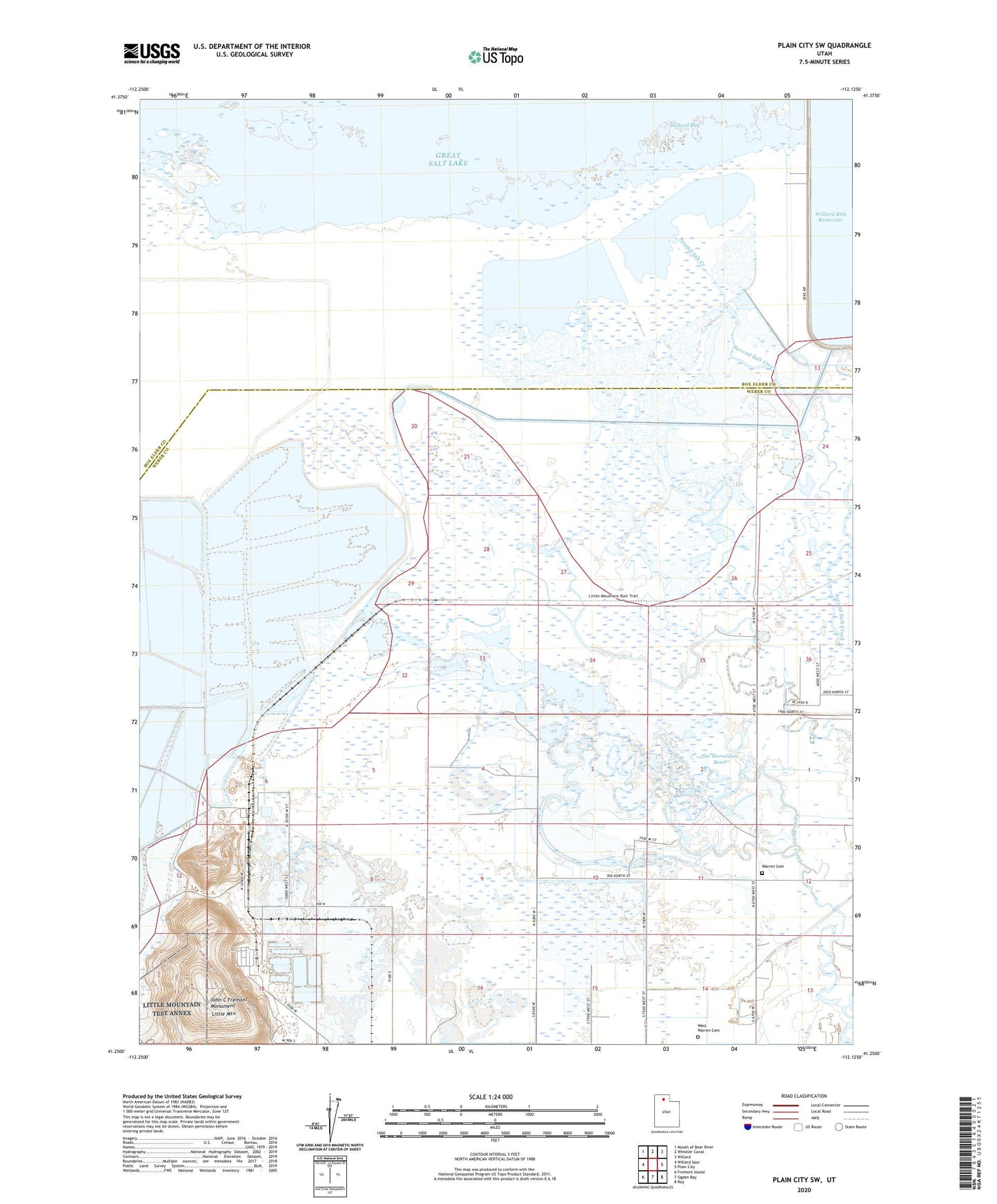
2023 topographic map quadrangle Plain City SW in the state of Utah. Scale: 1:24000. Based on the newly updated USGS 7.5' US Topo map series, this map is in the following counties: Weber, Box Elder. The map contains contour data, water features, and other items you are used to seeing on USGS maps, but also has updated roads and other features. This is the next generation of topographic maps. Printed on high-quality waterproof paper with UV fade-resistant inks.
Quads adjacent to this one:
West: Willard Spur
Northwest: Mouth of Bear River
North: Whistler Canal
Northeast: Willard
East: Plain City
Southeast: Roy
South: Ogden Bay
Southwest: Fremont Island
This map covers the same area as the classic USGS quad with code o41112c2.
Contains the following named places: George East Gun Club, Harold S Crane Waterfowl Management Area, John C Fremont Monument, KDAB-FM (Ogden), KOOG, KVFM-FM (Ogden), Little Mountain, Little Weber Creek, Ogden Gun Club, Pintail Gun Club, Rainbow Gun Club, Reese, Second Salt Creek, The Horseshoe Bend, Third Salt Creek, Township of Reese, Warren Cemetery, West Warren Cemetery, Willard Bay Upland Game Management Area