MyTopo
Pyramid Knoll Utah US Topo Map
Couldn't load pickup availability
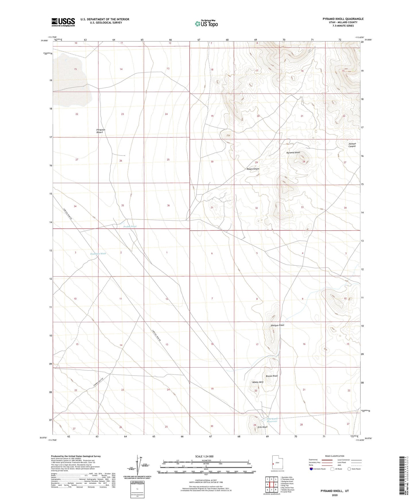
2020 topographic map quadrangle Pyramid Knoll in the state of Utah. Scale: 1:24000. Based on the newly updated USGS 7.5' US Topo map series, this map is in the following counties: Millard. The map contains contour data, water features, and other items you are used to seeing on USGS maps, but also has updated roads and other features. This is the next generation of topographic maps. Printed on high-quality waterproof paper with UV fade-resistant inks.
Quads adjacent to this one:
West: Deadman Point
Northwest: Buckskin Hills
North: Thompson Knoll
Northeast: Bullgrass Knoll
East: King Top
Southeast: Crystal Peak
South: Middle Mountain
Southwest: Big Jensen Pass
Contains the following named places: Brecks Knoll, Deadman Wash, Ecks Knoll, Ecks Knoll Reservoir, Ferguson Desert, Hawks Nest, Jackson Canyon, Probst Corral, Probst Pond, Pyramid Knoll, Road Canyon, Shotgun Knoll