MyTopo
Red Spur Mountain Utah US Topo Map
Couldn't load pickup availability
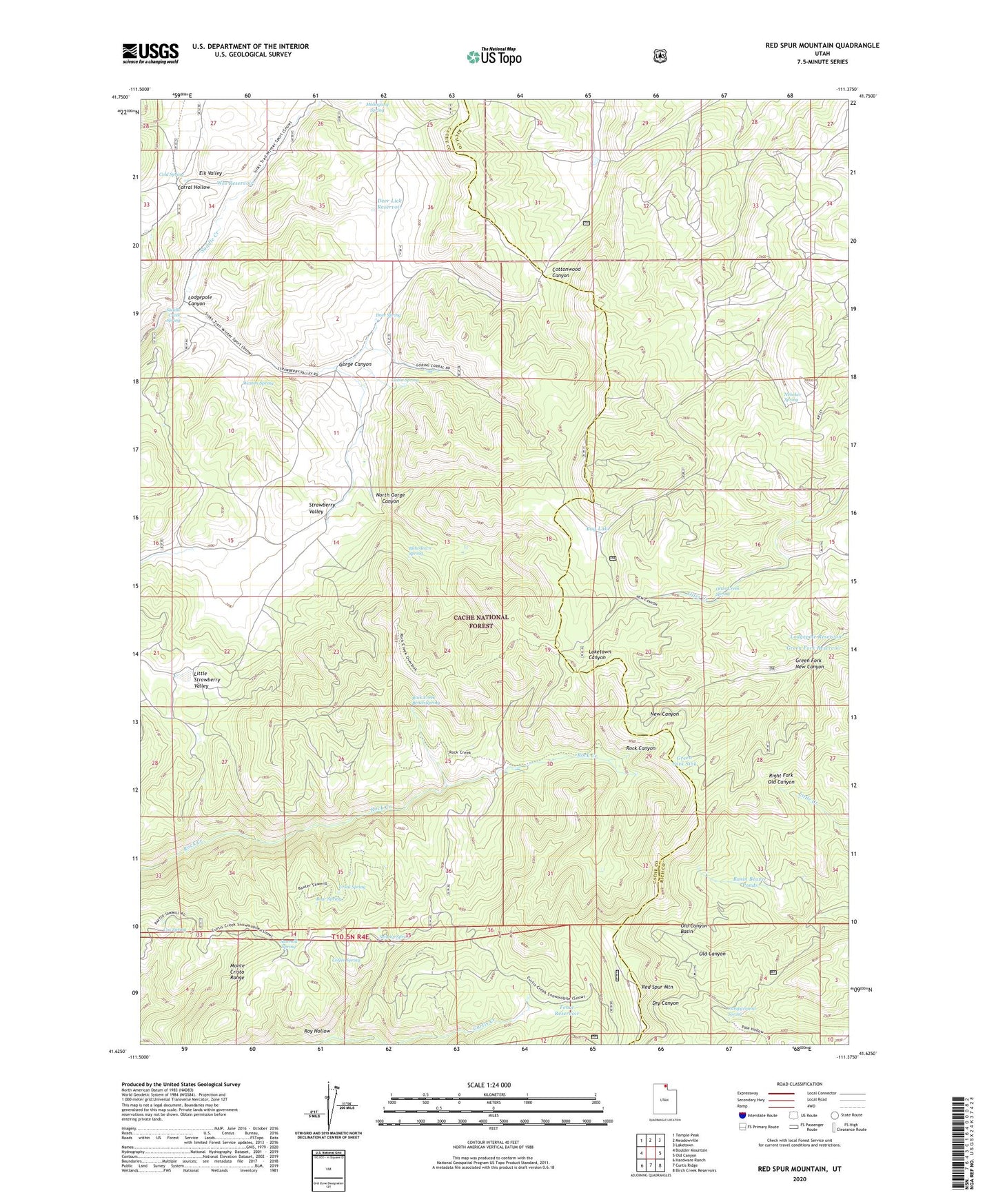
2020 topographic map quadrangle Red Spur Mountain in the state of Utah. Scale: 1:24000. Based on the newly updated USGS 7.5' US Topo map series, this map is in the following counties: Cache, Rich. The map contains contour data, water features, and other items you are used to seeing on USGS maps, but also has updated roads and other features. This is the next generation of topographic maps. Printed on high-quality waterproof paper with UV fade-resistant inks.
Quads adjacent to this one:
West: Boulder Mountain
Northwest: Temple Peak
North: Meadowville
Northeast: Laketown
East: Old Canyon
Southeast: Birch Creek Reservoirs
South: Curtis Ridge
Southwest: Hardware Ranch
Contains the following named places: Basin Beaver Ponds, Baxter Sawmill, Bear Spring, Blowdown Spring, Bug Lake, Cabin Spring, Campground Spring, Coffee Spring, Cold Spring, Corral Hollow, Cox Spring, Curtis Creek Guard Station, Deer Lick Reservoir, Deer Spring, Dry Lake, Elk Valley, Elk Valley Guard Station, Fence Reservoir, Gorge Canyon, Green Fork New Canyon, Green Fork Reservoir, Green Fork Sink, Little Strawberry Valley, Lodgepole Canyon, Lodgepole Reservoir, Nebeker Spring, North Gorge Canyon, Old Canyon Basin, Otter Creek Spring, Red Spur Mountain, Rock Creek Bench Spring, Roy Hollow, Saddle Creek Spring, Sawmill Spring, Strawberry Valley, Swamp Spring, Ursal Spring, Wes Reservoir, Weston Spring