MyTopo
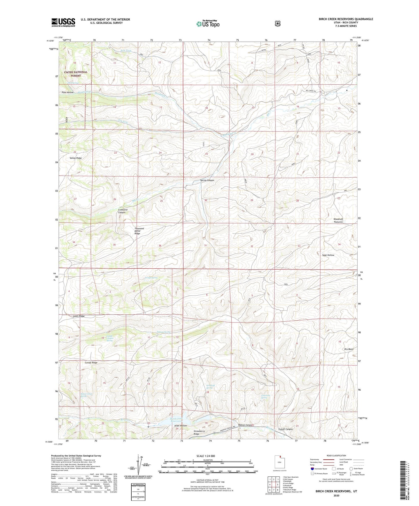
Birch Creek Reservoirs Utah US Topo Map
Couldn't load pickup availability
Also explore the Birch Creek Reservoirs Forest Service Topo of this same quad for updated USFS data
2023 topographic map quadrangle Birch Creek Reservoirs in the state of Utah. Scale: 1:24000. Based on the newly updated USGS 7.5' US Topo map series, this map is in the following counties: Rich. The map contains contour data, water features, and other items you are used to seeing on USGS maps, but also has updated roads and other features. This is the next generation of topographic maps. Printed on high-quality waterproof paper with UV fade-resistant inks.
Quads adjacent to this one:
West: Curtis Ridge
Northwest: Red Spur Mountain
North: Old Canyon
Northeast: Randolph
East: Woodruff
Southeast: Neponset Reservoir NW
South: Meachum Ridge
Southwest: Dairy Ridge
This map covers the same area as the classic USGS quad with code o41111e3.
Contains the following named places: Allan Hollow, Beaver Pond Spring, Birch Creek Campground, Birch Creek Reservoirs, Crawford Canyon, Cutoff Canyon, Cutoff Canyon Spring, Cutoff Ridge, Dry Fork, Lewis Ridge, Limestone Spring, Pole Fork, Pole Hollow, Putman Spring, Randolph Creek, Red Springs, Spring Canyon, Trough Spring, Valley Ridge, Walton Canyon, Woodruff Pastures, Woodruff Spring