MyTopo
Sally Mountain Utah US Topo Map
Couldn't load pickup availability
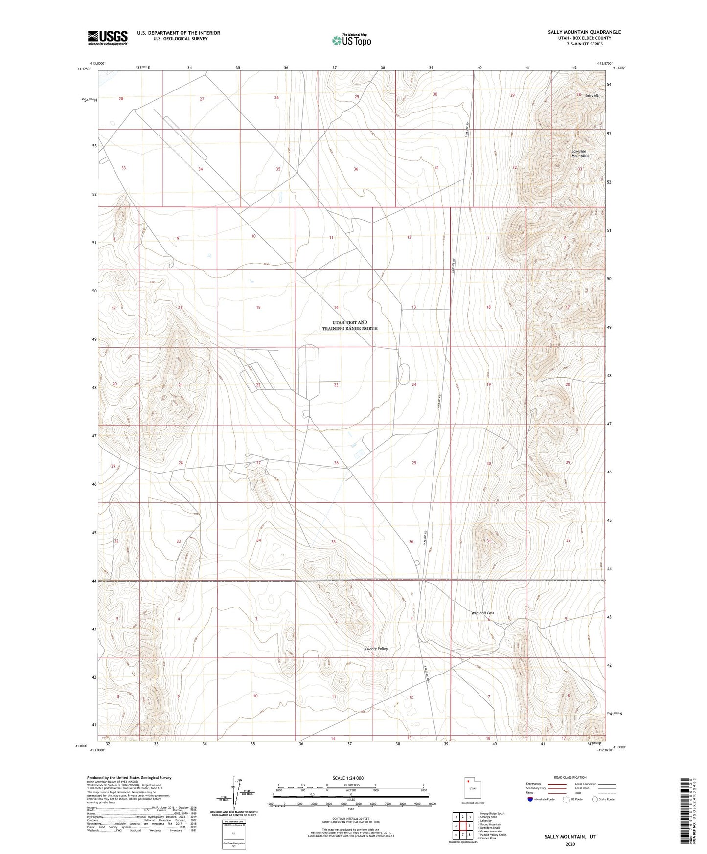
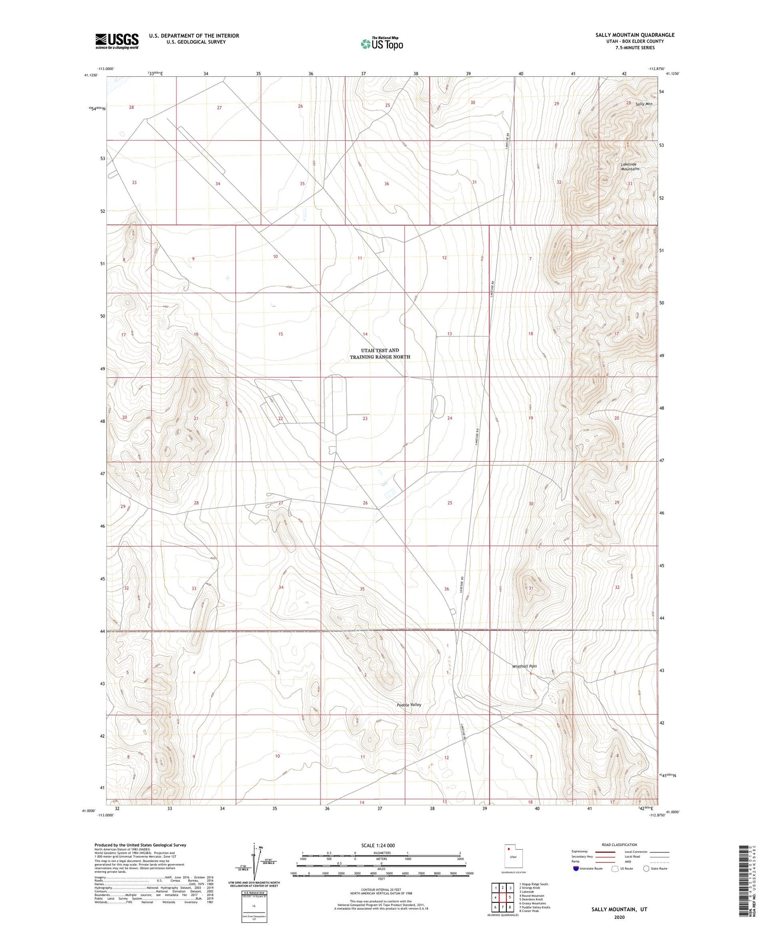
2020 topographic map quadrangle Sally Mountain in the state of Utah. Scale: 1:24000. Based on the newly updated USGS 7.5' US Topo map series, this map is in the following counties: Box Elder. The map contains contour data, water features, and other items you are used to seeing on USGS maps, but also has updated roads and other features. This is the next generation of topographic maps. Printed on high-quality waterproof paper with UV fade-resistant inks.
Quads adjacent to this one:
West: Round Mountain
Northwest: Hogup Ridge South
North: Strongs Knob
Northeast: Lakeside
East: Deardens Knoll
Southeast: Craner Peak
South: Puddle Valley Knolls
Southwest: Grassy Mountains
Contains the following named places: Oasis, Puddle Valley, Sally Mountain, Wrathall Pass