MyTopo
Craner Peak Utah US Topo Map
Couldn't load pickup availability
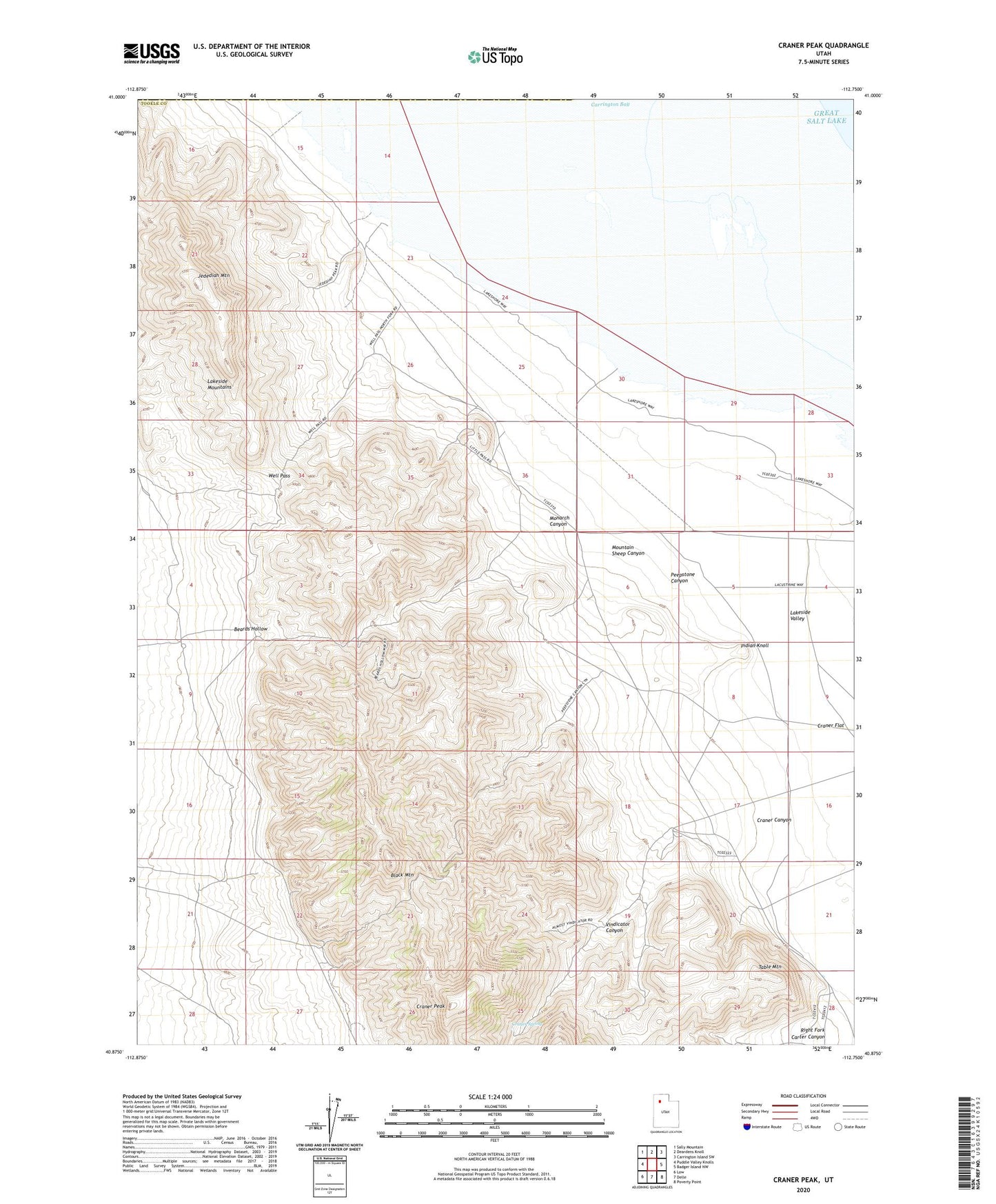
2023 topographic map quadrangle Craner Peak in the state of Utah. Scale: 1:24000. Based on the newly updated USGS 7.5' US Topo map series, this map is in the following counties: Tooele, Box Elder. The map contains contour data, water features, and other items you are used to seeing on USGS maps, but also has updated roads and other features. This is the next generation of topographic maps. Printed on high-quality waterproof paper with UV fade-resistant inks.
Quads adjacent to this one:
West: Puddle Valley Knolls
Northwest: Sally Mountain
North: Deardens Knoll
Northeast: Carrington Island SW
East: Badger Island NW
Southeast: Poverty Point
South: Delle
Southwest: Low
This map covers the same area as the classic USGS quad with code o40112h7.
Contains the following named places: Beards Hollow, Black Mountain, Craner Canyon, Craner Flat, Craner Peak, Craner Spring, Indian Knoll, Jedediah Mountain, Johnson Well, Lakeside Valley, Marblehead Quarry, Monarch Canyon, Monarch Mine, Monarch Well, Mountain Sheep Canyon, Old Wrathall Well, Peepstone Canyon, Right Fork Carter Canyon, Rowley, Table Mountain, Vindicator Canyon, Well Pass