MyTopo
Salt Mountain Utah US Topo Map
Couldn't load pickup availability
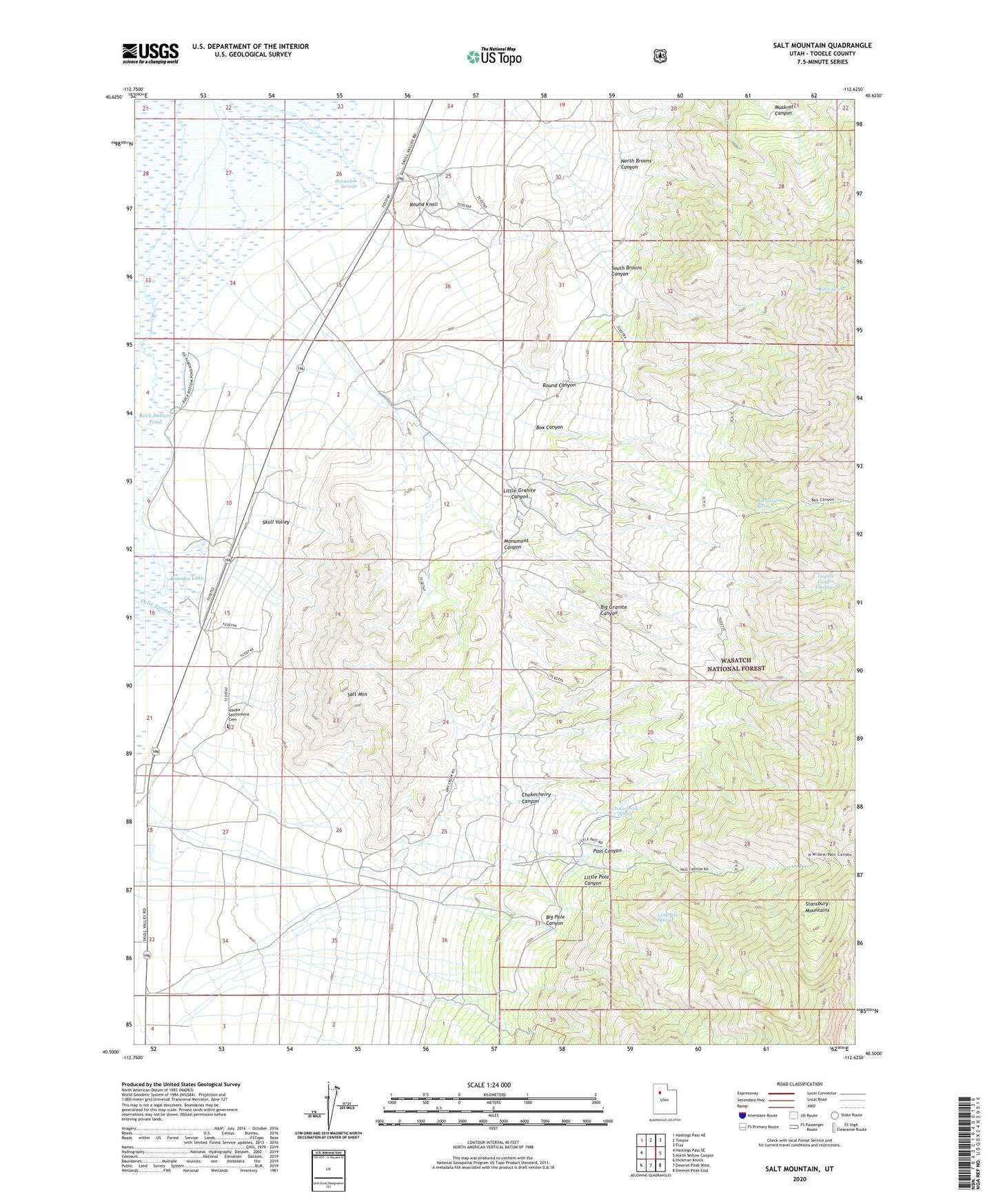
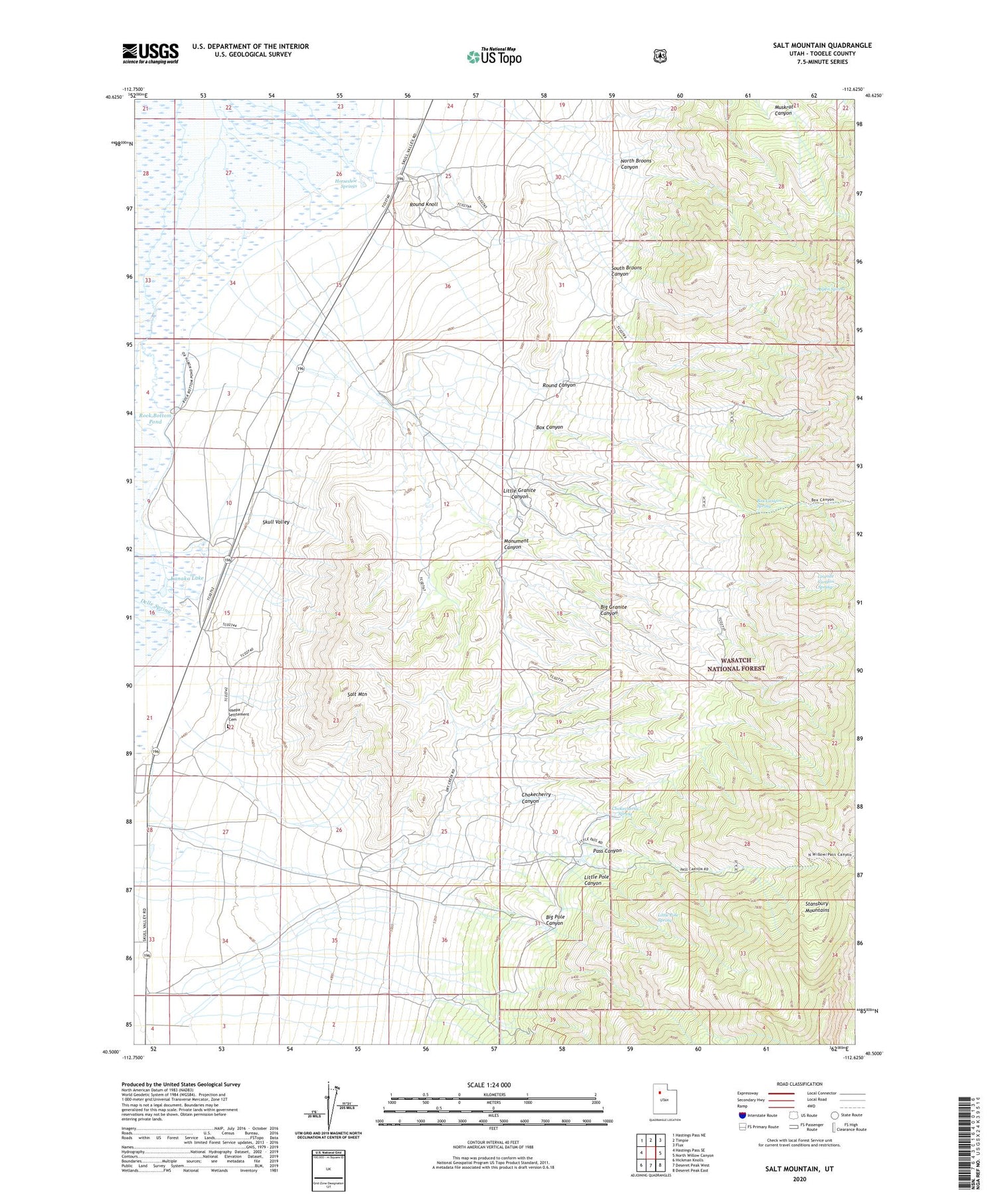
2020 topographic map quadrangle Salt Mountain in the state of Utah. Scale: 1:24000. Based on the newly updated USGS 7.5' US Topo map series, this map is in the following counties: Tooele. The map contains contour data, water features, and other items you are used to seeing on USGS maps, but also has updated roads and other features. This is the next generation of topographic maps. Printed on high-quality waterproof paper with UV fade-resistant inks.
Quads adjacent to this one:
West: Hastings Pass SE
Northwest: Hastings Pass NE
North: Timpie
Northeast: Flux
East: North Willow Canyon
Southeast: Deseret Peak East
South: Deseret Peak West
Southwest: Hickman Knolls
Contains the following named places: Aspen Spring, Big Granite Canyon, Big Pole Canyon, Box Canyon, Box Canyon Spring, Chokecherry Canyon, Chokecherry Spring, Delle Ranch, Deseret Ranch, Granite Canyon Spring, Horseshoe Springs, Iosepa, Iosepa Setttement Cemetery, Kanaka Lake, Little Granite Canyon, Little Pole Canyon, Little Pole Spring, Monument Canyon, North Broons Canyon, Pass Canyon, Rock Bottom Pond, Round Canyon, Round Knoll, Salt Mountain, South Broons Canyon