MyTopo
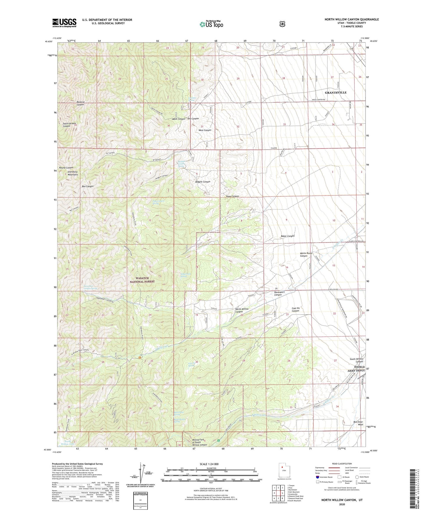
North Willow Canyon Utah US Topo Map
Couldn't load pickup availability
Also explore the North Willow Canyon Forest Service Topo of this same quad for updated USFS data
2023 topographic map quadrangle North Willow Canyon in the state of Utah. Scale: 1:24000. Based on the newly updated USGS 7.5' US Topo map series, this map is in the following counties: Tooele. The map contains contour data, water features, and other items you are used to seeing on USGS maps, but also has updated roads and other features. This is the next generation of topographic maps. Printed on high-quality waterproof paper with UV fade-resistant inks.
Quads adjacent to this one:
West: Salt Mountain
Northwest: Timpie
North: Flux
Northeast: Burmester
East: Grantsville
Southeast: South Mountain
South: Deseret Peak East
Southwest: Deseret Peak West
This map covers the same area as the classic USGS quad with code o40112e5.
Contains the following named places: Baker Canyon, Black Buck Spring, Black Bunch, Black Bunch Spring, Coal Pit Canyon, Coal Pit Spring, Cottonwood Campground, Davenport Canyon, Davenport Canyon Spring, Dragon Mine, Dry Canyon, Limekiln Spring, Mack Canyon, Mack Canyon Big Hollow Trail, Magpie Canyon, Magpie Canyon Spring, Metal Queen Mine, Monarch Mine, North Willow Canyon, North Willow Lake, Pope Canyon, Pope Canyon Spring, Rose Mine, Stansbury Mountains, Third Term Mine, West Canyon, Western Star Mine, White Rock Spring, White Rocks Canyon