MyTopo
South Mountain Utah US Topo Map
Couldn't load pickup availability
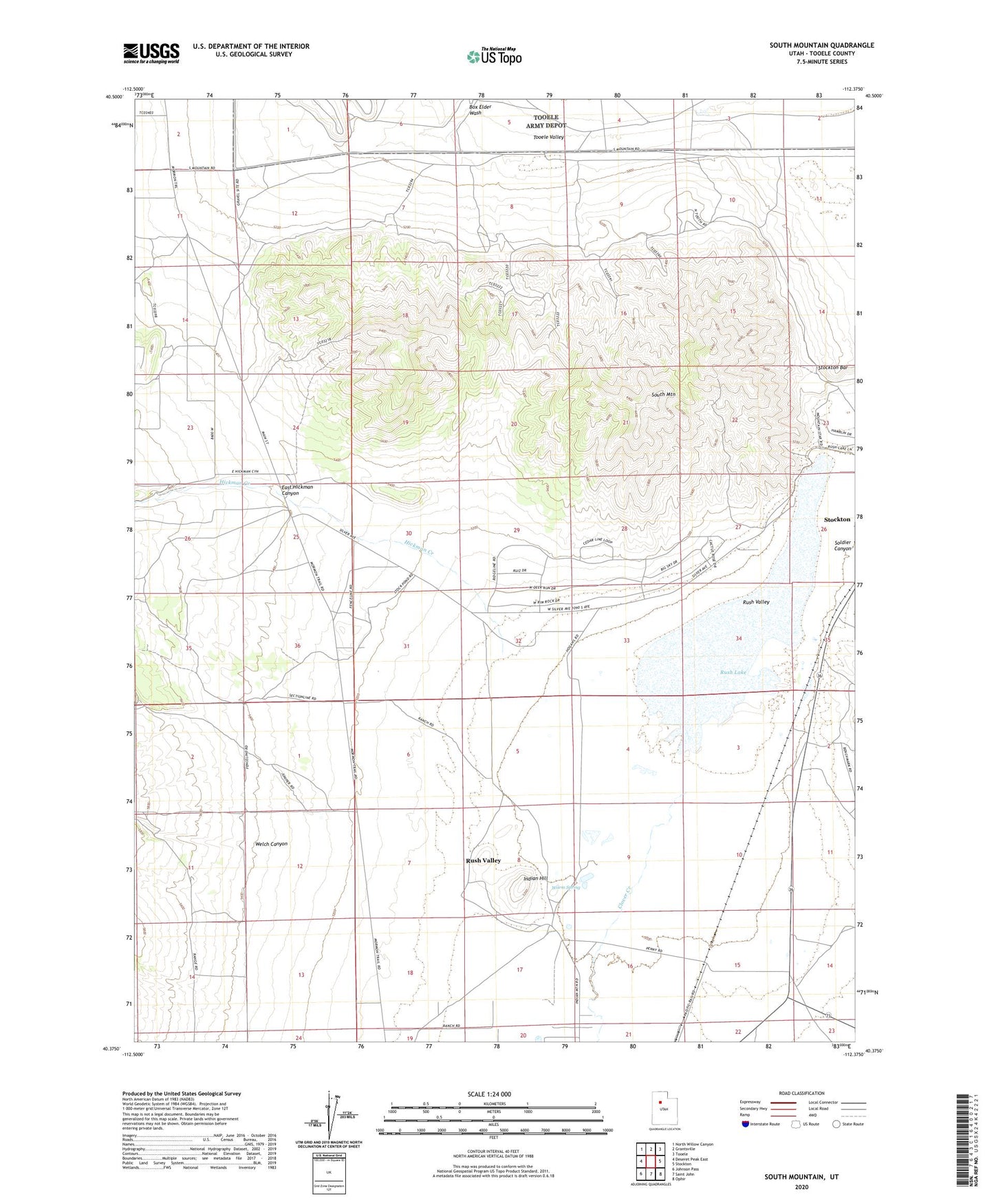
2020 topographic map quadrangle South Mountain in the state of Utah. Scale: 1:24000. Based on the newly updated USGS 7.5' US Topo map series, this map is in the following counties: Tooele. The map contains contour data, water features, and other items you are used to seeing on USGS maps, but also has updated roads and other features. This is the next generation of topographic maps. Printed on high-quality waterproof paper with UV fade-resistant inks.
Quads adjacent to this one:
West: Deseret Peak East
Northwest: North Willow Canyon
North: Grantsville
Northeast: Tooele
East: Stockton
Southeast: Ophir
South: Saint John
Southwest: Johnson Pass
Contains the following named places: Clover Creek, East Hickman Canyon, Hickman Creek, Indian Hill, Morgan Ranch, Rush Lake, Rush Valley, Soldier Canyon, Soldier Creek, South Mountain, Steptoe Historical Marker, Warm Spring, Welch Canyon, Youngs Ranch