MyTopo
Warm Creek Bay Utah US Topo Map
Couldn't load pickup availability
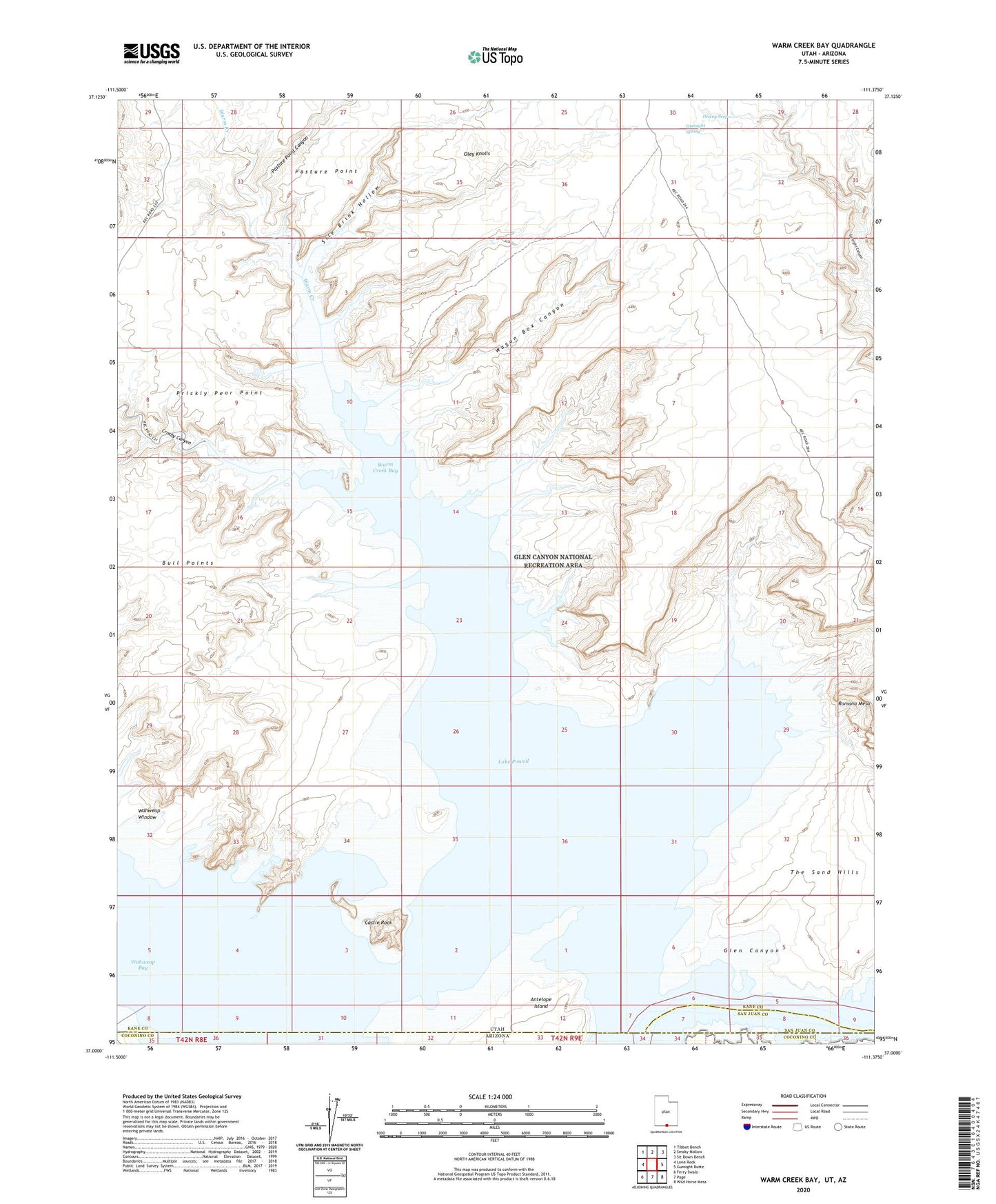
2020 topographic map quadrangle Warm Creek Bay in the state of Utah. Scale: 1:24000. Based on the newly updated USGS 7.5' US Topo map series, this map is in the following counties: Kane, Coconino, San Juan. The map contains contour data, water features, and other items you are used to seeing on USGS maps, but also has updated roads and other features. This is the next generation of topographic maps. Printed on high-quality waterproof paper with UV fade-resistant inks.
Quads adjacent to this one:
West: Lone Rock
Northwest: Tibbet Bench
North: Smoky Hollow
Northeast: Sit Down Bench
East: Gunsight Butte
Southeast: Wild Horse Mesa
South: Page
Southwest: Ferry Swale
Contains the following named places: Castle Rock, Cottonwood Wash, Crosby Canyon, Dewey Seep, Gunsight Spring, Oley Knolls, Pasture Point, Pasture Point Canyon, Prickly Pear Point, Romana Bench, Sile Brink Hollow, Spanish Trail Crossing at Warm Creek, Wagon Box Canyon, Wahweap Bay, Wahweap Window, Warm Creek, Warm Creek Bay, Warm Creek Cabins