MyTopo
Gunsight Butte Utah US Topo Map
Couldn't load pickup availability
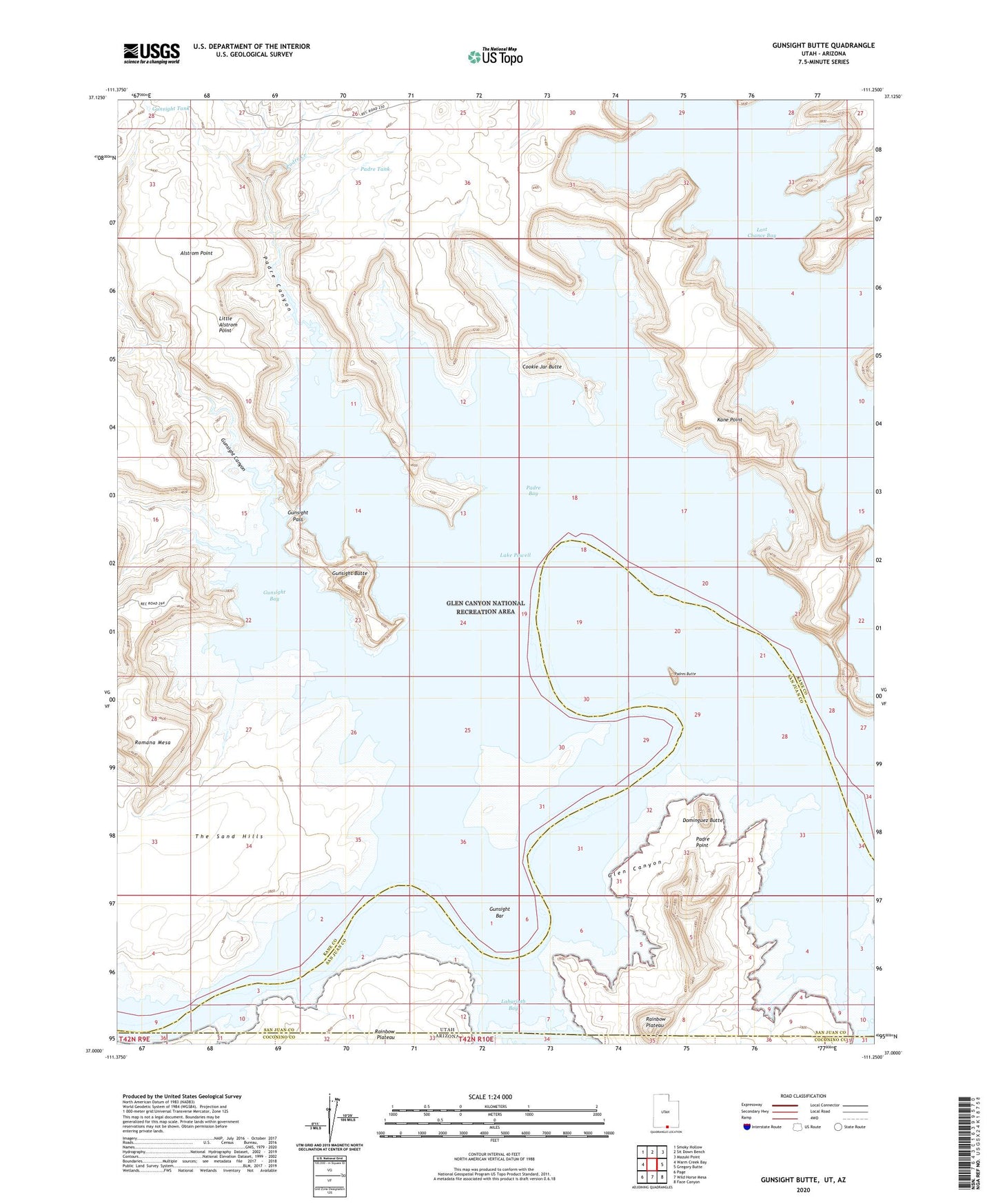
2023 topographic map quadrangle Gunsight Butte in the state of Utah. Scale: 1:24000. Based on the newly updated USGS 7.5' US Topo map series, this map is in the following counties: Kane, San Juan, Coconino. The map contains contour data, water features, and other items you are used to seeing on USGS maps, but also has updated roads and other features. This is the next generation of topographic maps. Printed on high-quality waterproof paper with UV fade-resistant inks.
Quads adjacent to this one:
West: Warm Creek Bay
Northwest: Smoky Hollow
North: Sit Down Bench
Northeast: Mazuki Point
East: Gregory Butte
Southeast: Face Canyon
South: Wild Horse Mesa
Southwest: Page
This map covers the same area as the classic USGS quad with code o37111a3.
Contains the following named places: Alstrom Point, Boundary Butte, Center Fork Kane Wash, Cookie Jar Butte, Crossing of the Fathers, Dominguez Butte, Face Canyon, Gunsight Bar, Gunsight Bay, Gunsight Butte, Gunsight Canyon, Gunsight Pass, Gunsight Tank, Kane Point, Kane Wash, Labyrinth Bay, Last Chance Bay, Left Fork Kane Wash, Little Alstrom Point, Mystery Canyon, Padre Bay, Padre Canyon, Padre Creek, Padre Point, Padre Tank, Padres Butte, Powell Camps, Right Fork Kane Wash, Romana Mesa, The Sand Hills