MyTopo
Middlebury Vermont US Topo Map
Couldn't load pickup availability
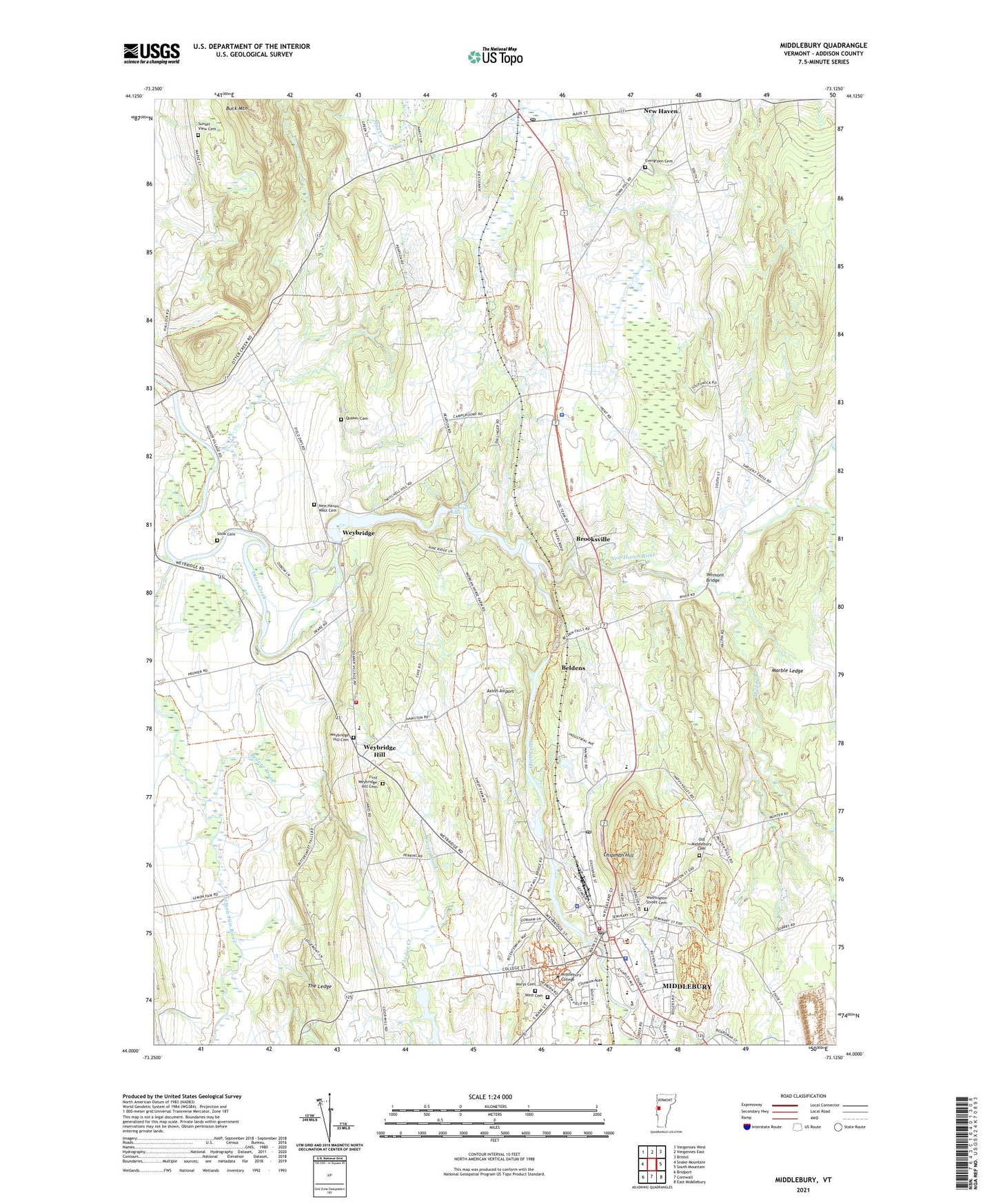
2021 topographic map quadrangle Middlebury in the state of Vermont. Scale: 1:24000. Based on the newly updated USGS 7.5' US Topo map series, this map is in the following counties: Addison. The map contains contour data, water features, and other items you are used to seeing on USGS maps, but also has updated roads and other features. This is the next generation of topographic maps. Printed on high-quality waterproof paper with UV fade-resistant inks.
Quads adjacent to this one:
West: Snake Mountain
Northwest: Vergennes West
North: Vergennes East
Northeast: Bristol
East: South Mountain
Southeast: East Middlebury
South: Cornwall
Southwest: Bridport
Contains the following named places: Addison Central Supervisory Union, Addison County, Addison County Chamber of Commerce, Addison County Child Care Services, Addison County Sheriff's Office, Aurora School, Axinn Airport, Beaver Brook, Beldens, Beldens Dam, Belding Cemetery, Bridge School, Brooksville, Chipman Hill, Congregational Church of Middlebury, Egbert Starr Library, Evergreen Cemetery, First Weybridge Hill Cemetery, Frank Mahady State and County Courthouse, Gailer School, Huntington Falls, Huntington Falls Dam, Ilsley Memorial Baptist Church, Ilsley Public Library, Julian W Abernathy Library of American Literature, Ledge Creek, Lemon Fair River, Marble Ledge, Mary Hogan Elementary School, Mary Johnson Children's Center, Marys Cemetery, Mead Memorial Chapel, Middlebury, Middlebury Census Designated Place, Middlebury College, Middlebury College Center for the Arts, Middlebury College Department of Public Safety, Middlebury College Museum of Art, Middlebury Fire Department, Middlebury Lower Dam, Middlebury Post Office, Middlebury Town Hall, Middlebury Union High School, Middlebury Village Historic District, Middlebury Volunteer Ambulance, Muddy Branch, New Haven, New Haven Community Library, New Haven Junction, New Haven Junction Depot, New Haven Post Office, New Haven River, New Haven West Cemetery, Old Middlebury Cemetery, Otter Creek Child Care, Patricia Hannaford Career Center, Quaker Cemetery, Ralph Myhre Golf Course of Middlebury College, Rivers Bend Campground, Saint Mary's Catholic Elementary School, Saint Marys Church, Saint Stephens Episcopal Church, Sheldon Museum, Sheldon Museum Research Center, Spring Grove Campgrounds, Stow Cemetery, Sunset View Cemetery, Town of New Haven, Town of Weybridge, University of Vermont Morgan Horse Farm, Vermont Bridge, Vermont Folklife Center, Vermont State Craft Center at Frog Hollow, Vermont State Police Troop B New Haven Barracks, Washington Street Cemetery, Washington Street Plaza, WCVM-FM (Middlebury), West Cemetery, Weybridge, Weybridge Cave Natural Area, Weybridge Congregational Church, Weybridge Dam, Weybridge Elementary School, Weybridge Fire Department, Weybridge Hill, Weybridge Hill Cemetery, Weybridge Municipal Forest, WRMC-FM (Middlebury), ZIP Code: 05472