MyTopo
Cornwall Vermont US Topo Map
Couldn't load pickup availability
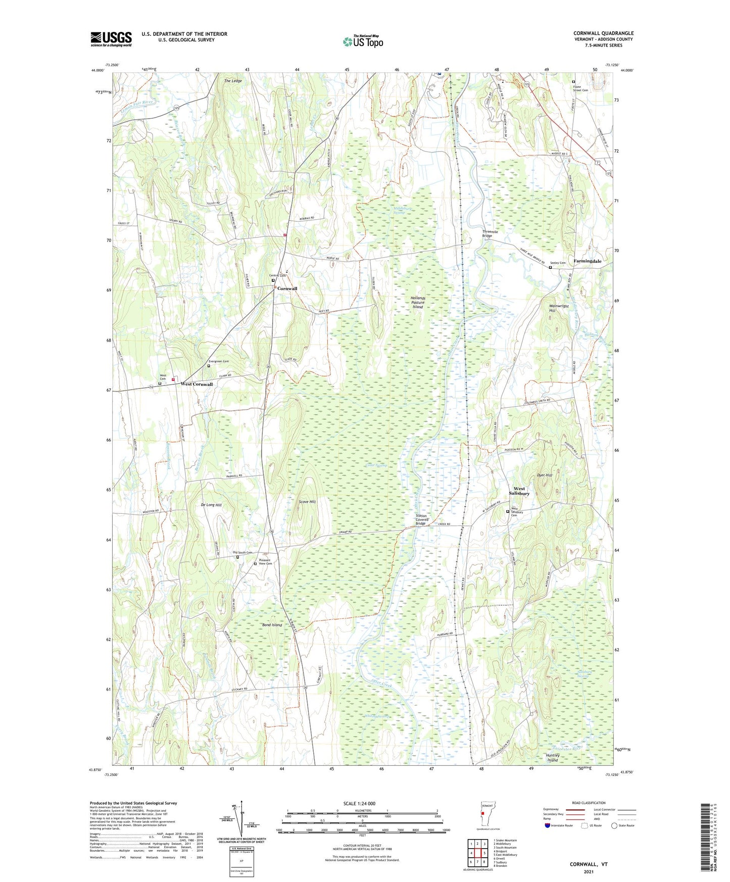
2024 topographic map quadrangle Cornwall in the state of Vermont. Scale: 1:24000. Based on the newly updated USGS 7.5' US Topo map series, this map is in the following counties: Addison. The map contains contour data, water features, and other items you are used to seeing on USGS maps, but also has updated roads and other features. This is the next generation of topographic maps. Printed on high-quality waterproof paper with UV fade-resistant inks.
Quads adjacent to this one:
West: Bridport
Northwest: Snake Mountain
North: Middlebury
Northeast: South Mountain
East: East Middlebury
Southeast: Brandon
South: Sudbury
Southwest: Orwell
This map covers the same area as the classic USGS quad with code o43073h2.
Contains the following named places: Beaver Brook, Bingham Memorial School, Bond Island, Cady School, Cedar Swamp, Central Cemetery, Central School, Cornwall, Cornwall Congregational Church, Cornwall Fire Department - West Station, Cornwall Swamp Wildlife Management Area, Cornwall Volunteer Fire Department, De Long Hill, Dyer Hill, Evergreen Cemetery, Farmingdale, Foote Street Cemetery, Halnon Brook, Helen Porter Healthcare and Rehabilitation Center, Hollands Pasture Island, Huntley Island, Jerusalem School, Middlebury Country Club, Middlebury River, Middlebury Swamp, Middlebury Union Middle School, Old South Cemetery, Piper Crossing, Pleasant View Cemetery, Porter Medical Center, Porter Medical Center Medical Library and Information Service, Salisbury Station, Salisbury Swamp, School Number 1, School Number 2, School Number 4, Scove Hill, Seeley Cemetery, Seymour Brook, Station Covered Bridge, The Ledge, Threemile Bridge, Town of Cornwall, Wainwright Hill, West Cemetery, West Cornwall, West Salisbury, West Salisbury Cemetery, WFAD-AM (Middlebury), Whiting Swamp, ZIP Codes: 05753, 05778