MyTopo
Middlesex Vermont US Topo Map
Couldn't load pickup availability
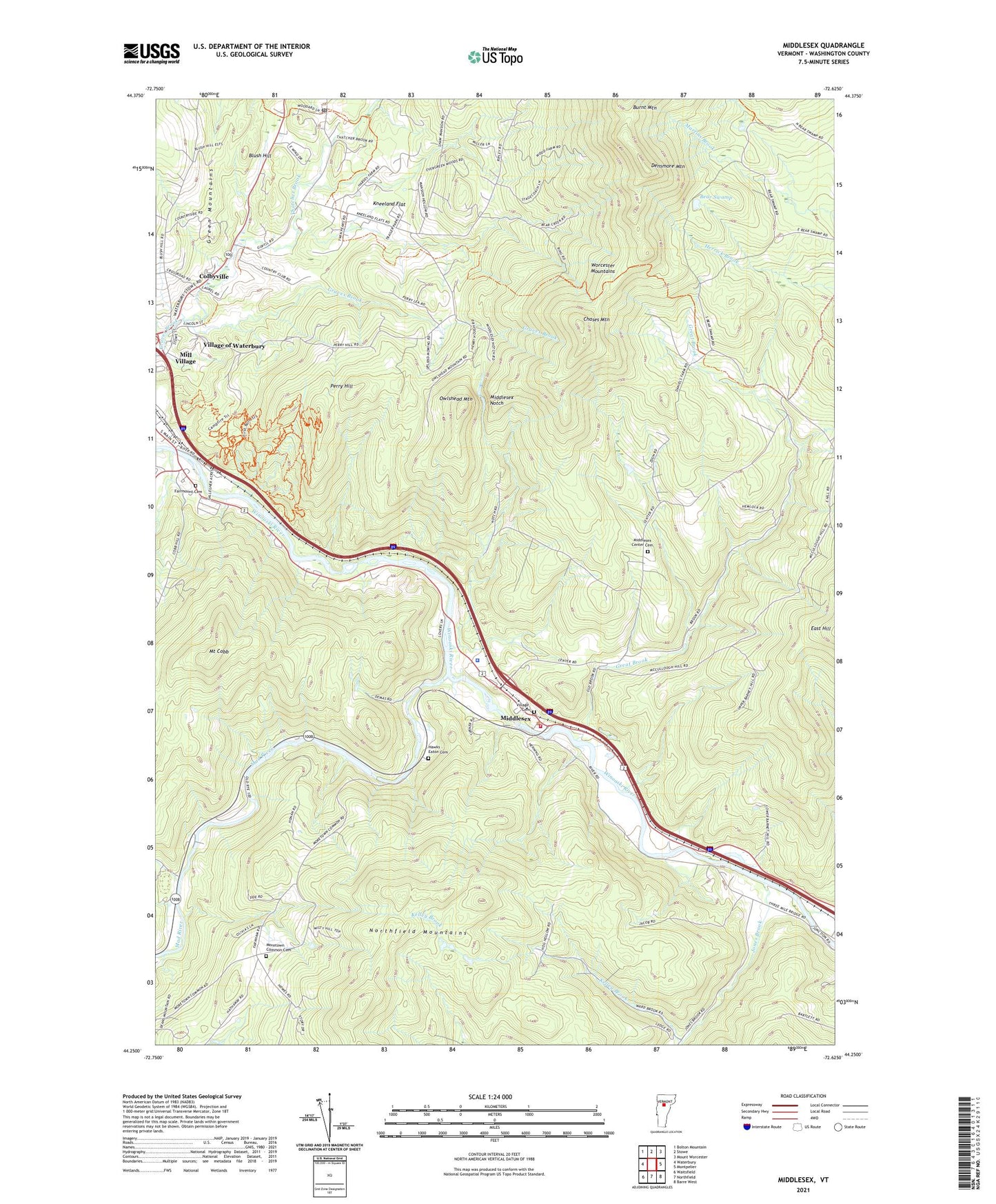
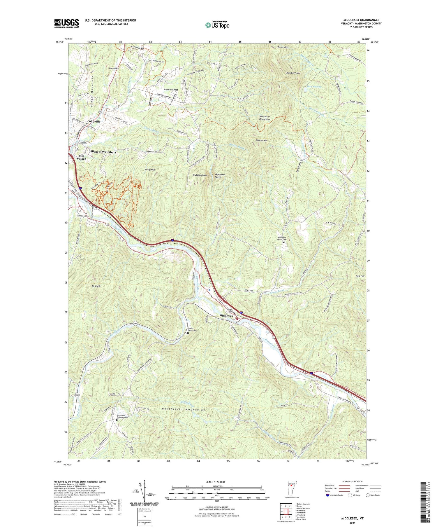
2021 topographic map quadrangle Middlesex in the state of Vermont. Scale: 1:24000. Based on the newly updated USGS 7.5' US Topo map series, this map is in the following counties: Washington. The map contains contour data, water features, and other items you are used to seeing on USGS maps, but also has updated roads and other features. This is the next generation of topographic maps. Printed on high-quality waterproof paper with UV fade-resistant inks.
Quads adjacent to this one:
West: Waterbury
Northwest: Bolton Mountain
North: Stowe
Northeast: Mount Worcester
East: Montpelier
Southeast: Barre West
South: Northfield
Southwest: Waitsfield
Contains the following named places: Bear Swamp, Blush Hill, Camp Meade Military Museum, Chases Mountain, Colbyville, Crossett Brook, Densmore Mountain, Fairmount Cemetery, Great Brook, Hawks - Eaton Cemetery, Jones Brook, Kelley Brook, Kneeland Flat, Mad River, Middlesex, Middlesex Center, Middlesex Center Cemetery, Middlesex Dam Number 2, Middlesex Fire Aid Stabilization Team Squad, Middlesex Notch, Middlesex Town Hall, Middlesex United Methodist Church, Middlesex Volunteer Fire Department - Station 1, Mill Village, Mill Village Historic District, Moretown Common, Moretown Common Cemetery, Moretown Number 8 Dam, Mount Cobb, North Moretown, Owlshead Mountain, Perry Hill, Sunny Brook, Thatcher Brook, Town of Middlesex, Town of Moretown, Vermont State Police Troop A Middlesex Barracks, Village Cemetery, Village of Waterbury, Waterbury Alliance Church, Waterbury Ambulance Service, Waterbury Center Post Office, Welder Brook, Winooski River Reservoir, ZIP Code: 05660