MyTopo
Mount Worcester Vermont US Topo Map
Couldn't load pickup availability
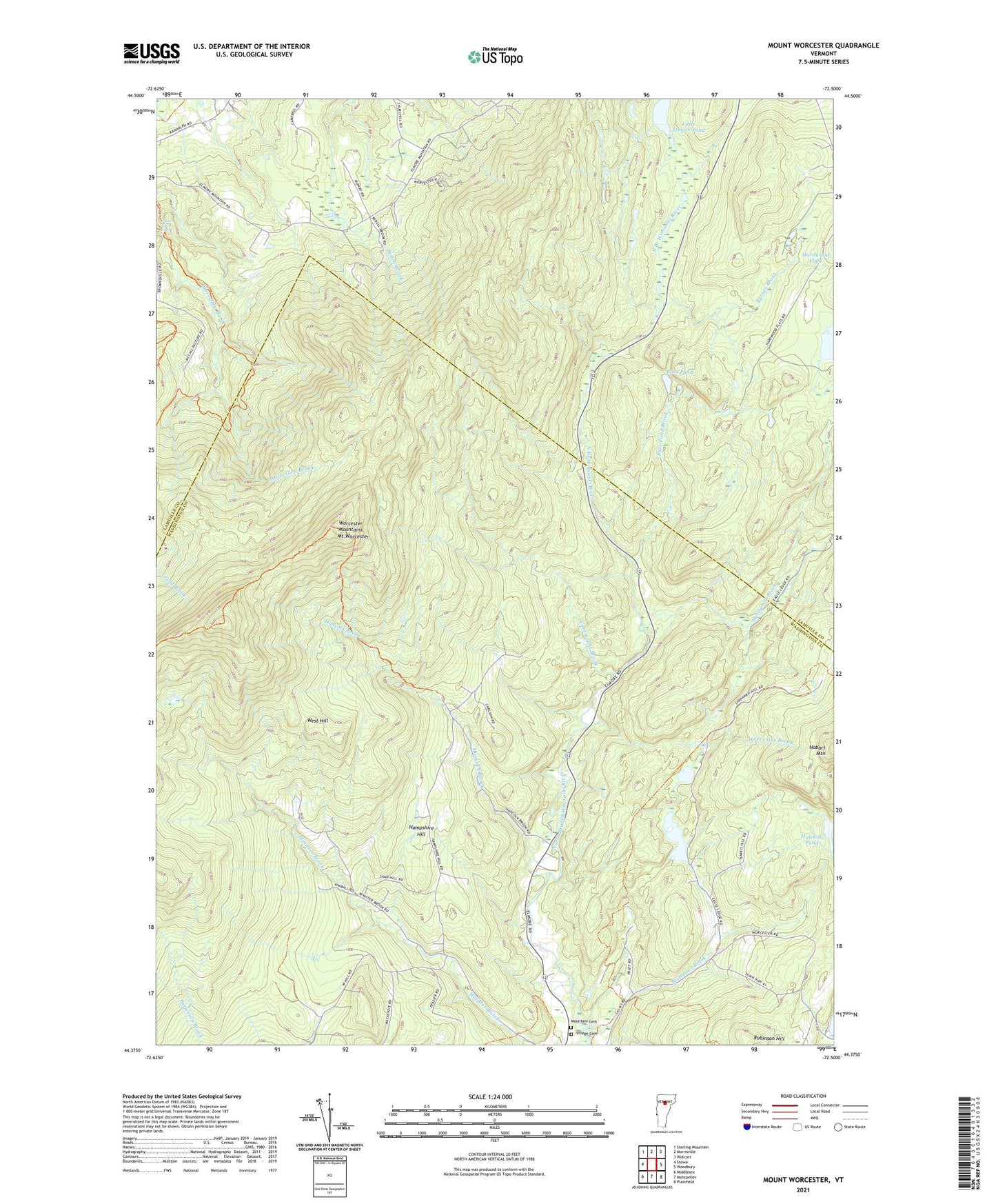
2024 topographic map quadrangle Mount Worcester in the state of Vermont. Scale: 1:24000. Based on the newly updated USGS 7.5' US Topo map series, this map is in the following counties: Washington, Lamoille. The map contains contour data, water features, and other items you are used to seeing on USGS maps, but also has updated roads and other features. This is the next generation of topographic maps. Printed on high-quality waterproof paper with UV fade-resistant inks.
Quads adjacent to this one:
West: Stowe
Northwest: Sterling Mountain
North: Morrisville
Northeast: Wolcott
East: Woodbury
Southeast: Plainfield
South: Montpelier
Southwest: Middlesex
This map covers the same area as the classic USGS quad with code o44072d5.
Contains the following named places: Barnes Brook, Catamount Brook, Hampshire Hill, Hancock Brook, Hardwood Brook, Hardwood Flats, Hawkins Pond, Ladds Mill Dam, Little Elmore Pond, Minister Brook, Moss Glen Falls, Mount Worcester, Mountain Cemetery, Putnam State Forest, Russ Pond, Russ Pond Brook, Town of Elmore, Town of Worcester, Village Cemetery, West Hill, Worcester Brook, Worcester Mountains, Worcester Pond, Worcester Pond Lower Dam, Worcester Ponds, ZIP Code: 05682