MyTopo
Bentonville Virginia US Topo Map
Couldn't load pickup availability
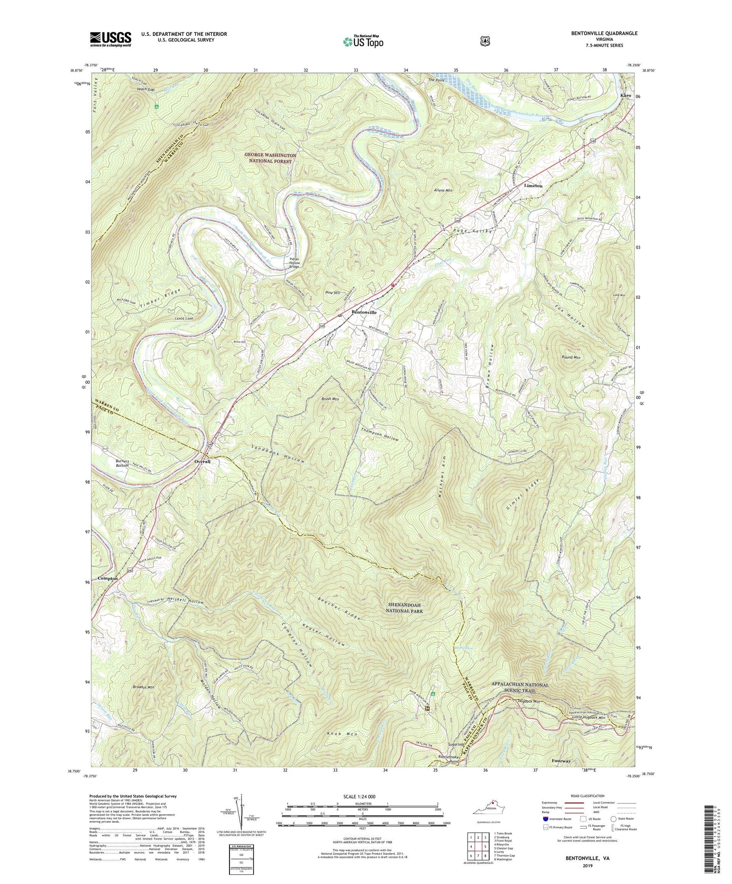
2019 topographic map quadrangle Bentonville in the state of Virginia. Scale: 1:24000. Based on the newly updated USGS 7.5' US Topo map series, this map is in the following counties: Warren, Page, Shenandoah, Rappahannock. The map contains contour data, water features, and other items you are used to seeing on USGS maps, but also has updated roads and other features. This is the next generation of topographic maps. Printed on high-quality waterproof paper with UV fade-resistant inks.
Quads adjacent to this one:
West: Rileyville
Northwest: Toms Brook
North: Strasburg
Northeast: Front Royal
East: Chester Gap
Southeast: Washington
South: Thornton Gap
Southwest: Luray
Contains the following named places: Academy at Innisfree, Acorn Hill, Allens Mountain, Bearwallow, Beecher Ridge, Beecher Ridge Trail, Bentonville, Bentonville Landing, Bentonville Post Office, Broadus Mountain, Brown Hollow, Brush Mountain, Buck Mountain Farm, Burners Bottom, Burners Ford, Camp Skymont, Community Tabernacle Assembly of God Church, Compton, Compton Hollow, Cool Spring Church, Dry Run, East Fork Dry Run, Flint Run, Flint Run Farms, Fox Hollow, Gimlet Ridge, Gimlet Ridge Trail, Gooney Run, Greasy Falls, Hazard Mill Recreation Area, Heiskell Hollow, Hogback Mountain, Indian Hollow Bridge, Karo, Karo Landing, Keyser Hollow, Limeton, Limeton Community United Methodist Church, Little Crease Shelter, Little Hogback Mountain, Long Mountain, Mathews Arm, McCoys Ford, Mine Run, Molden Hollow, Moody Creek, Mount Carmel Church, Mount Marshall Overlook, Mountain View Church, Overall, Overall Run, Overall Run Trail, Pine Hill, Rattlesnake Point, Round Mountain, Round Mountain Farm, Saint Pauls Church, Sandbank Hollow, Silver Spring Farm, Skyline Evergreen Farm, South River District, South Warren Volunteer Fire Department, Sugarloaf, Sycamore Spring Farm, Thompson Hollow, Timber Ridge, Valley Road Baptist Church, Veach Gap, Veach Gap Trail, Woodcliff, ZIP Codes: 22610, 22650