
MyTopo
Boonsboro Virginia US Topo Map
Couldn't load pickup availability
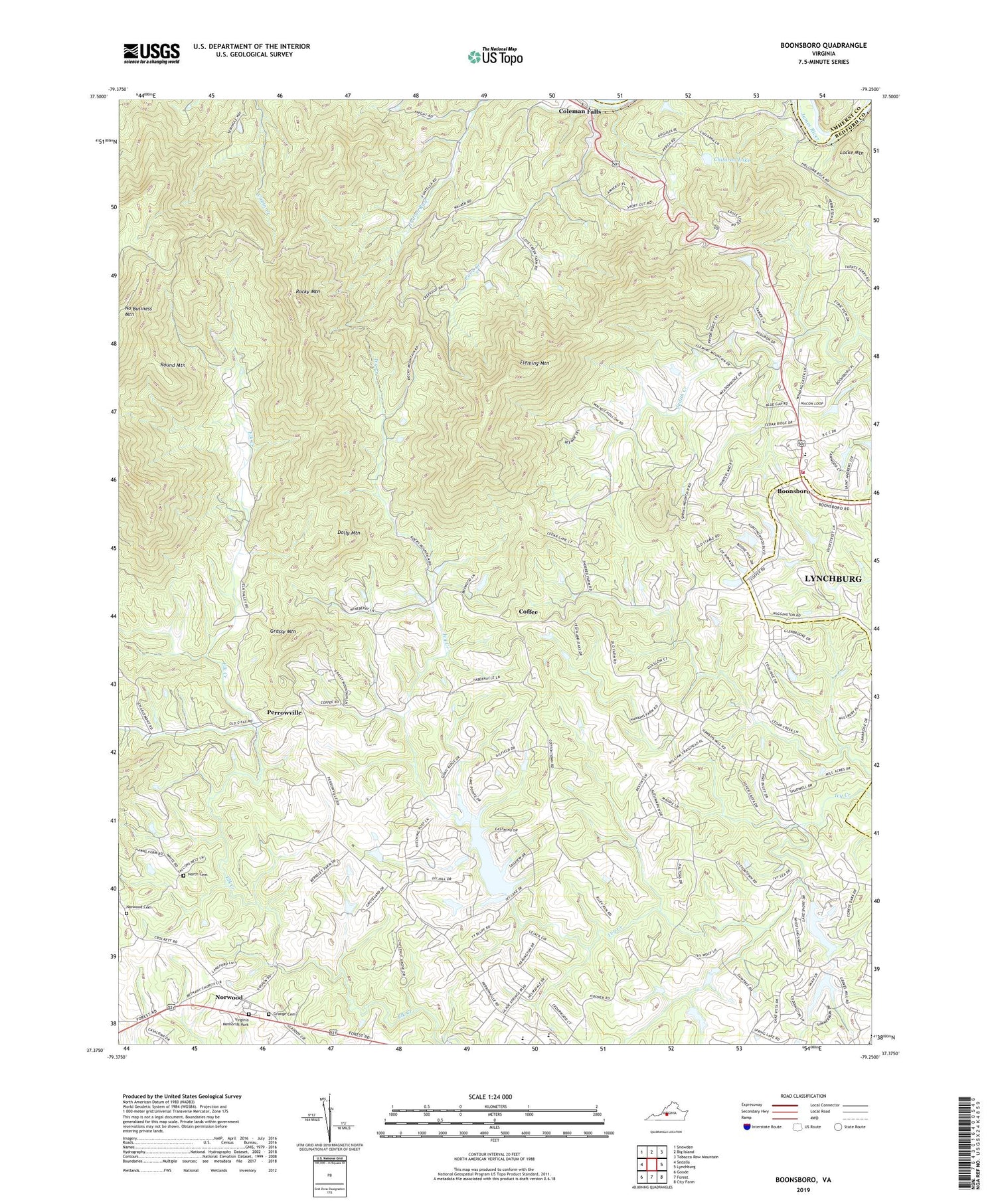
2019 topographic map quadrangle Boonsboro in the state of Virginia. Scale: 1:24000. Based on the newly updated USGS 7.5' US Topo map series, this map is in the following counties: Bedford, Lynchburg (city), Amherst. The map contains contour data, water features, and other items you are used to seeing on USGS maps, but also has updated roads and other features. This is the next generation of topographic maps. Printed on high-quality waterproof paper with UV fade-resistant inks.
Quads adjacent to this one:
West: Sedalia
Northwest: Snowden
North: Big Island
Northeast: Tobacco Row Mountain
East: Lynchburg
Southeast: City Farm
South: Forest
Southwest: Goode
Contains the following named places: Altha Grove Church, Antioch Church, Antioch School, Bear Camp, Bethany Church, Boonsboro, Boonsboro Country Club, Boonsboro Elementary School, Boonsboro United Methodist Church, Boonsboro Volunteer Fire and Rescue Company 3, Chestnut Grove Church, Chilarna Lake, Coffee, Colonial Hills Golf Course, Cove Church, Cove Creek, Dolly Mountain, Eagle Eyrie Virginia Baptist Assembly, Eagles Eyrie, Fleming Mountain, Forest Elementary School, Grange Cemetery, Grassy Mountain, Ivy Hill Airport, Ivy Hills Golf Club, Jefferson District, Jefferson Forest High School, Locke Mountain, Meriwether School, Moseley School, Mount Carmel Church, North Bedford Church, North Cemetery, Norwood, Norwood Cemetery, Norwood Church, Perrowville, Ramsey Dam, Rocky Mountain, Round Mountain, Saint Stephens Church, Trinity Church, Virginia Memorial Park, Whitten Road School, WYYD-FM (Amherst), ZIP Code: 24536


