MyTopo
Chincoteague West Virginia US Topo Map
Couldn't load pickup availability
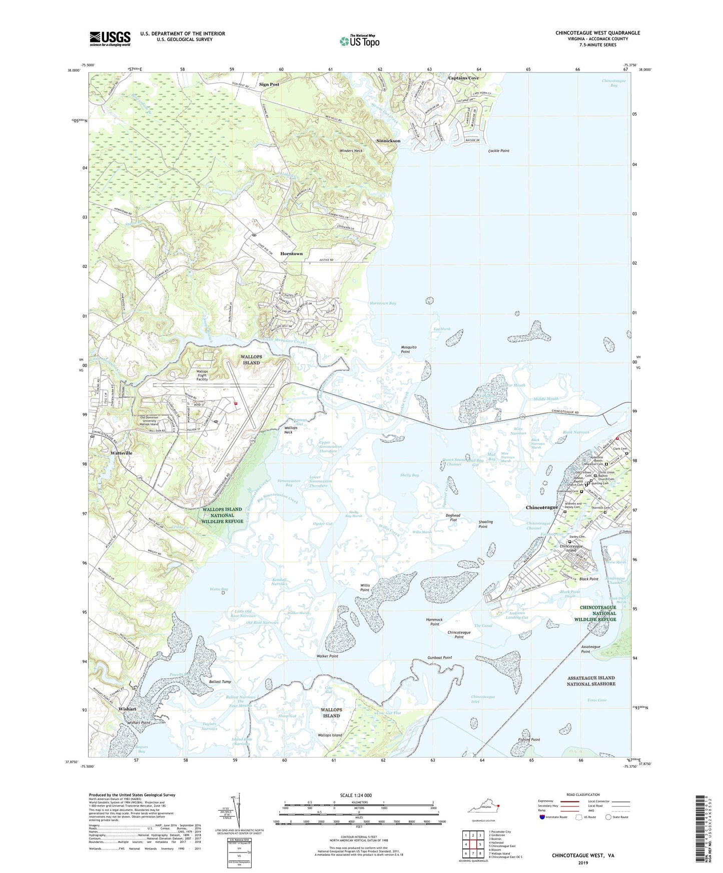
2019 topographic map quadrangle Chincoteague West in the state of Virginia. Scale: 1:24000. Based on the newly updated USGS 7.5' US Topo map series, this map is in the following counties: Accomack. The map contains contour data, water features, and other items you are used to seeing on USGS maps, but also has updated roads and other features. This is the next generation of topographic maps. Printed on high-quality waterproof paper with UV fade-resistant inks.
Quads adjacent to this one:
West: Hallwood
Northwest: Pocomoke City
North: Girdletree
Northeast: Boxiron
East: Chincoteague East
Southeast: Chincoteague East OE S
South: Wallops Island
Southwest: Bloxom
Contains the following named places: Andrews and Daisey Cemetery, Andrews Landing Gut, Assateague Point, Aydelotte - Booth-Whealton Cemetery, Ballast Narrows, Ballast Tump, Beulah Baptist Church Cemetery, Big Simoneaston Creek, Black Duck Creek, Black Narrows, Black Narrows Marsh, Black Point, Black Point Drain, Black Point Landing, Bunting Cemetery, Captains Cove, Captain's Cove Golf and Yacht Club, Cedar Creek, Chincoteague, Chincoteague Channel, Chincoteague Inlet, Chincoteague National Wildlife Refuge, Chincoteague Point, Chincoteague Pumping Station, Chincoteague Volunteer Fire Company, Christ Union Baptist Church Cemetery, Clark Cemetery, Cockle Creek, Cockle Point, Coldkall Creek, Cow Gut, Cow Gut Flat, Daisey Cemetery, Dees Church, District 2, Doghead Flat, Dublin Farms, Egg Marsh, Far Mouth, Fishing Point, Fowling Gut, Greenwood Cemetery, Gunboat Point, Hammock Point, Horntown, Horntown Bay, Horntown Census Designated Place, Horntown Landing, Horntown Post Office, Horse Marsh, Island Hole Narrows, Jenneys Gut, Kendall Narrows, Little Mosquito Creek, Little Old Root Narrows, Little Simoneaston Creek, Lower Simoneaston Thorofare, Middle Mouth, Mosquito Creek, Mosquito Point, Mud Bay, Mud Bay Gut, NASA Wallops Flight Facility Fire Department, New Virginia Cove, Odd Fellows Cemetery, Old Dominion University - Wallops Island, Old Root Narrows, Oyster Gut, Powells Bay, Queen Sound Channel, Red Hill, Shelly Bay, Shelly Bay Marsh, Shoaling Point, Sign Post, Simoneaston Bay, Sinnickson, Sloop Gut, Snead Branch, Squirrel Creek, Swans Gut Creek, Tabernacle Church, Taylors Narrows, The Canal, The Four Mouths, Thornton Cemetery, University of Virginia Eastern Shore Branch, Upper Simoneaston Thorofare, Walker Marsh, Walker Point, Wallops Flight Facility, Wallops Island National Wildlife Refuge, Wallops Island Post Office, Wallops Neck, Wallops Pond, Wallops Pond Dam, Watts Bay, Wattsville, Wattsville Branch, Wattsville Census Designated Place, Wattsville Post Office, Willis Creek, Willis Marsh, Willis Point, Winders Neck, Wire Narrows, Wire Narrows Marsh, Wishart, Wishart Point, ZIP Codes: 23337, 23356, 23395