
MyTopo
Boxiron Maryland US Topo Map
Couldn't load pickup availability
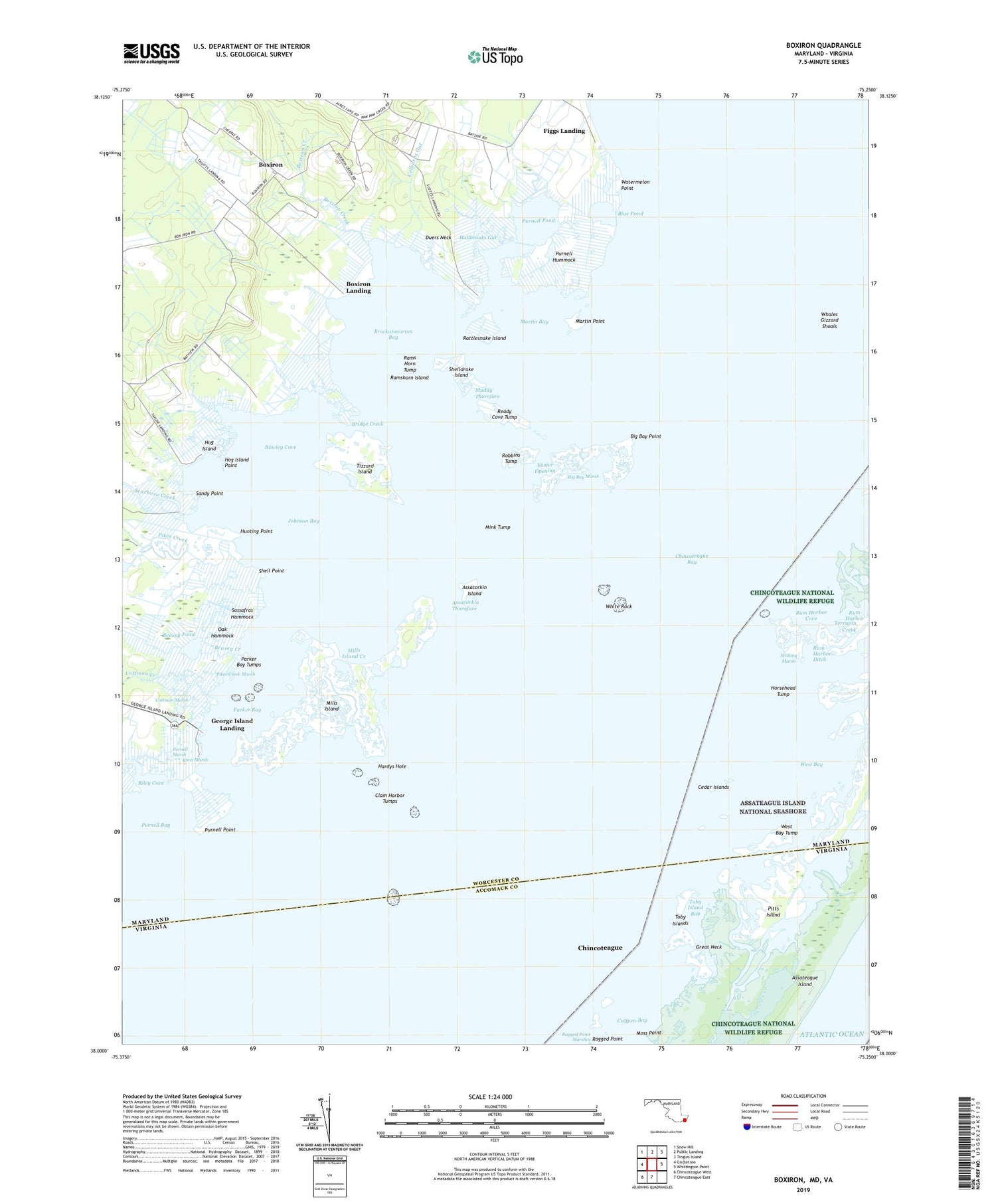
2023 topographic map quadrangle Boxiron in the states of Maryland, Virginia. Scale: 1:24000. Based on the newly updated USGS 7.5' US Topo map series, this map is in the following counties: Worcester, Accomack. The map contains contour data, water features, and other items you are used to seeing on USGS maps, but also has updated roads and other features. This is the next generation of topographic maps. Printed on high-quality waterproof paper with UV fade-resistant inks.
Quads adjacent to this one:
West: Girdletree
Northwest: Snow Hill
North: Public Landing
Northeast: Tingles Island
East: Whittington Point
South: Chincoteague East
Southwest: Chincoteague West
Contains the following named places: Assacorkin Island, Assacorkin Thorofare, Ayres Lane Estates, Bayview, Beasey Creek, Beasey Pond, Big Bay Marsh, Big Bay Point, Blue Pond, Boxiron, Boxiron Creek, Boxiron Landing, Boxiron Pond, Bridge Creek, Brimer Landing, Brockatonorton Bay, Cedar Islands, Clam Harbor Tumps, Colburns Gut, Cottman Creek, Cottman Marsh, Duers Neck, Duers Neck Landing, Easter Opening, Figgs Landing, George Island Landing, Great Neck, Hallbrooks Gut, Hardys Hole, Hog Island, Hog Island Point, Horsehead Tump, Hudson Landing, Hunting Point, Johnson Bay, Knox Marsh, Martin Bay, Martin Point, Mills Island, Mills Island Creek, Mink Tump, Moss Point, Muddy Thorofare, Oak Hammock, Parker Bay, Parker Bay Tumps, Pikes Creek, Pikes Creek Marsh, Pitts Island, Pope Island, Pope Island Ditch, Purnell Bay, Purnell Hummock, Purnell Marsh, Purnell Point, Purnell Pond, Ragged Point, Rams Horn Tump, Ramshorn Island, Rattlesnake Island, Ready Cove Tump, Riley Cove, Riley Creek, Robbins Tump, Rowley Cove, Rowley Creek, Rum Harbor, Rum Harbor Cove, Rum Harbor Ditch, Rum Harbor Marsh, Saint Matthew United Methodist Church, Sandy Point, Sassafras Hammock, Scarboro Creek, Scarboro Landing, Selbys Gut, Shell Point, Shelldrake Island, Striking Marsh, Taylor Landing, Terrapin Creek, The Ditch, Tizzard Island, Toby Island Bay, Toby Islands, Virginia Creek, Watermelon Point, West Bay, West Bay Tump, Whales Gizzard Shoals, White Rock, ZIP Code: 21829


