MyTopo
Cobb Island Virginia US Topo Map
Couldn't load pickup availability
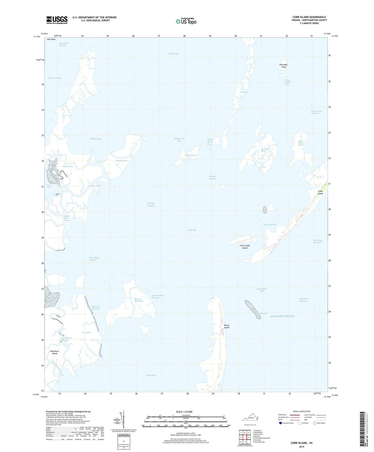
2019 topographic map quadrangle Cobb Island in the state of Virginia. Scale: 1:24000. Based on the newly updated USGS 7.5' US Topo map series, this map is in the following counties: Northampton. The map contains contour data, water features, and other items you are used to seeing on USGS maps, but also has updated roads and other features. This is the next generation of topographic maps. Printed on high-quality waterproof paper with UV fade-resistant inks.
Quads adjacent to this one:
West: Cheriton
Northwest: Franktown
North: Nassawadox
Northeast: Quinby Inlet
East: Great Machipongo Inlet
South: Ship Shoal Inlet
Southwest: Townsend
Contains the following named places: Big Easter Marsh, Black Perch Creek, Cedar Creek, Cobb Bay, Cockle Point Creek, Eckichy Channel, Eckichy Marsh, Elkins Marsh, Gull Marsh, Little Cobb Island, Little Easter Marsh, Loon Channel, Man and Boy Channel, Man and Boy Marsh, Mittigy Channel, New Marsh, New Marsh Channel, Northeast Channel, Outlet Bay, Parchaby Tump, Rowes Hole Channel, Running Channel, Sand Creek, Sand Shoal Channel, Sand Shoal Inlet, Shallow Bay, Shell Creek, South Channel, Southeast Channel, Spidercrab Bay, Sunday Ditch, Two Mouths Creek, Wreck Island