MyTopo
Nassawadox Virginia US Topo Map
Couldn't load pickup availability
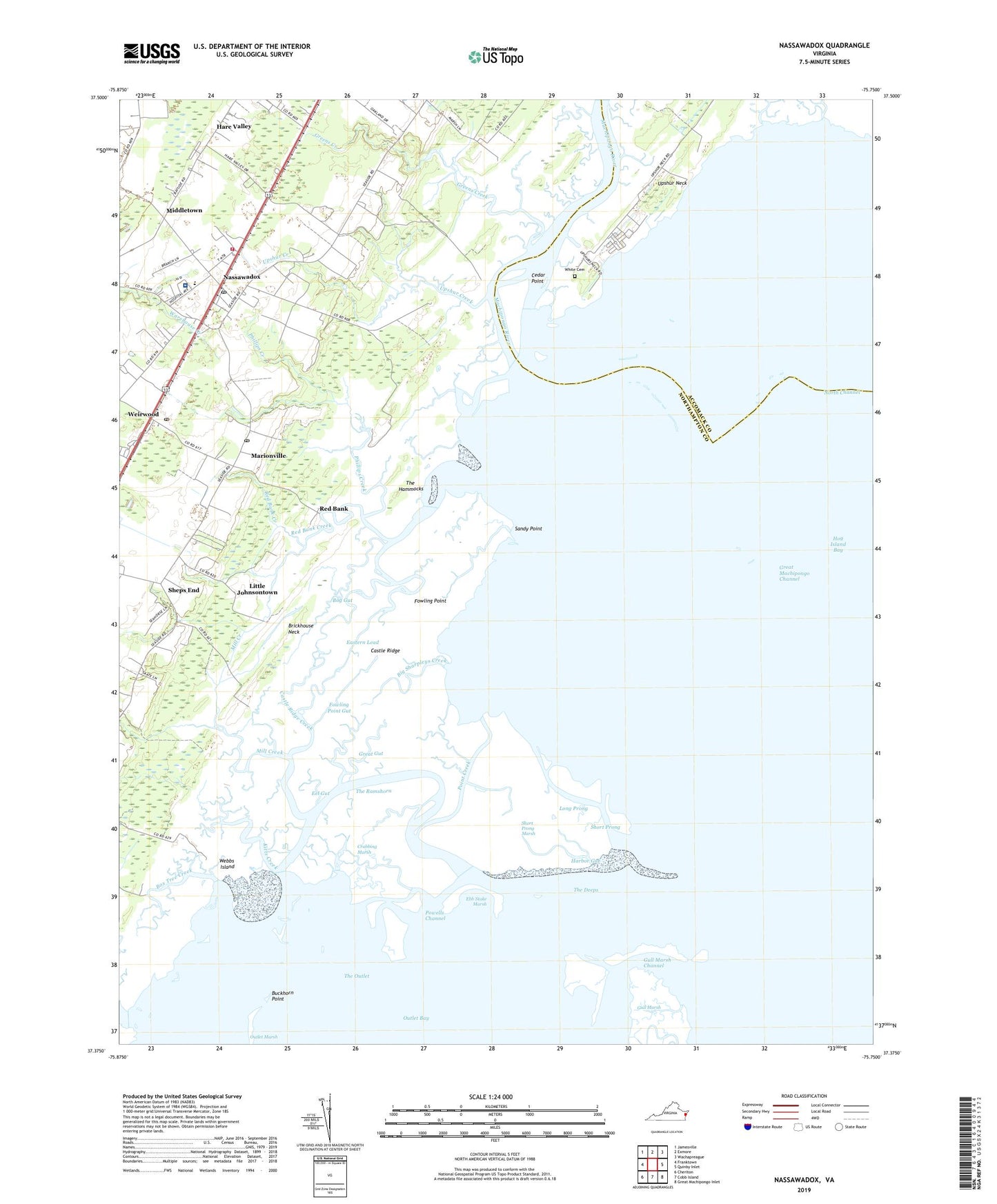
2022 topographic map quadrangle Nassawadox in the state of Virginia. Scale: 1:24000. Based on the newly updated USGS 7.5' US Topo map series, this map is in the following counties: Northampton, Accomack. The map contains contour data, water features, and other items you are used to seeing on USGS maps, but also has updated roads and other features. This is the next generation of topographic maps. Printed on high-quality waterproof paper with UV fade-resistant inks.
Quads adjacent to this one:
West: Franktown
Northwest: Jamesville
North: Exmore
Northeast: Wachapreague
East: Quinby Inlet
Southeast: Great Machipongo Inlet
South: Cobb Island
Southwest: Cheriton
This map covers the same area as the classic USGS quad with code o37075d7.
Contains the following named places: Allen Church, Big Sharpleys Creek, Bog Gut, Box Tree Creek, Brickhouse Neck, Broadwater Club House, Brownsville, Buckhorn Point, Castle Ridge, Castle Ridge Creek, Cedar Point, Collins Estates, Crabbing Marsh, District 3, District 6, Eastern Lead, Ebb Stake Marsh, Eel Gut, Fowling Point, Fowling Point Gut, Great Gut, Great Machipongo Channel, Greens Creek, Gull Marsh Channel, Harbor Gut, Hare Valley, Hare Valley Estates, Heritage Hall at Nassawadox Nursing Home, Hog Island Bay, Holt Creek, Kitts Creek, Little Johnsontown, Long Prong, Machipongo River, Marionville, Marionville Post Office, Middletown, Mill Creek, Montessori Childrens House of the Eastern Shore, Nassawadox, Nassawadox Estates, Nassawadox Post Office, North Channel, Northampton Accomack Memorial Hospital Heliport, Northampton Fire and Rescue, Northampton Free Library, Outlet Marsh, Phillips Creek, Point Creek, Powells Channel, Red Bank, Red Bank Church, Red Bank Creek, Riverside Shore Memorial Hospital, Sandy Point, Sheps End, Short Prong, Short Prong Marsh, The Deeps, The Hammocks, The Outlet, The Ramshorn, Thomas Wharf, Town of Nassawadox, Upshur Creek, Webbs Island, Weirwood, Weirwood Post Office, White Cemetery, Woodstock, ZIP Codes: 23307, 23408, 23413