MyTopo
Goodview Virginia US Topo Map
Couldn't load pickup availability
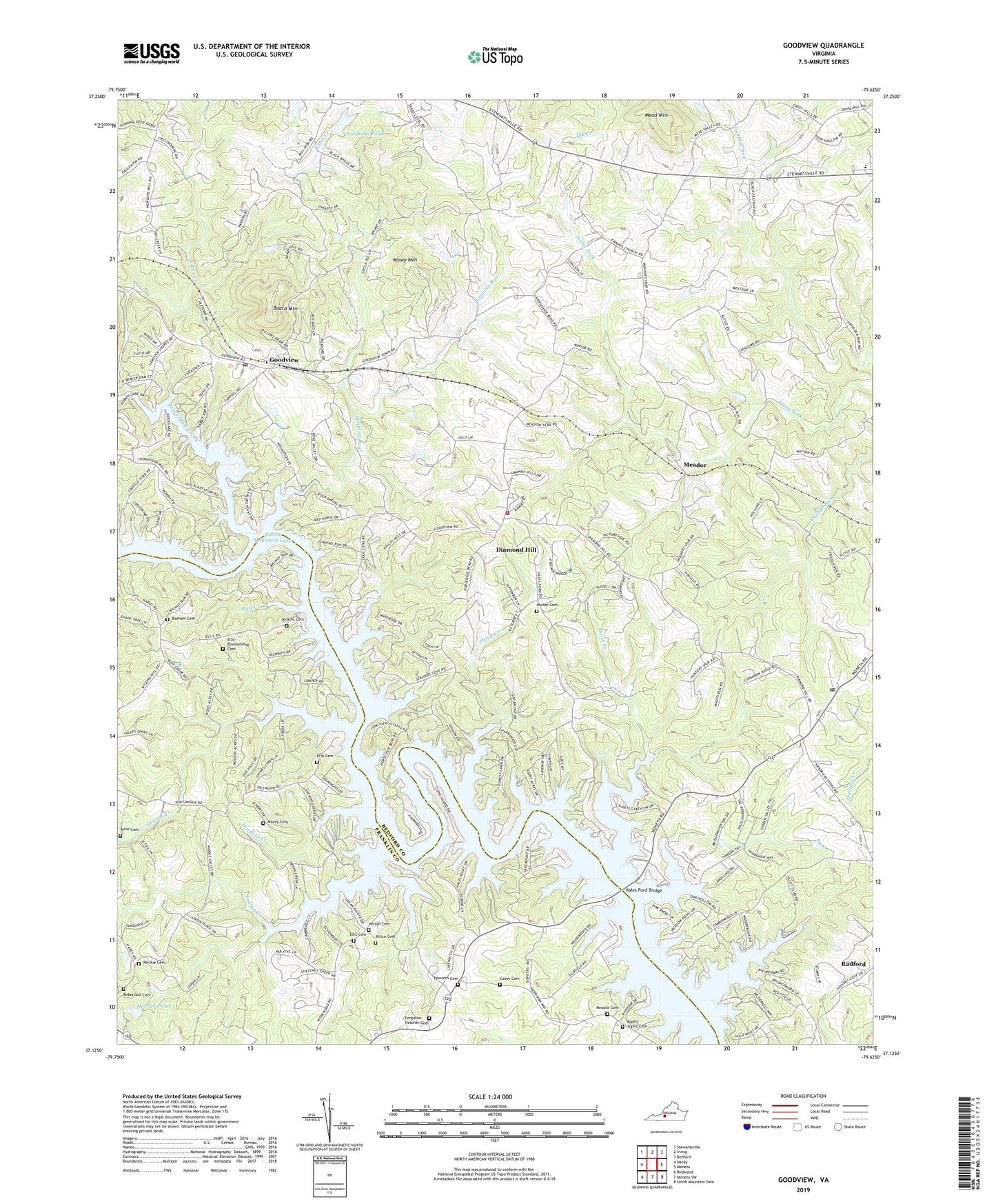
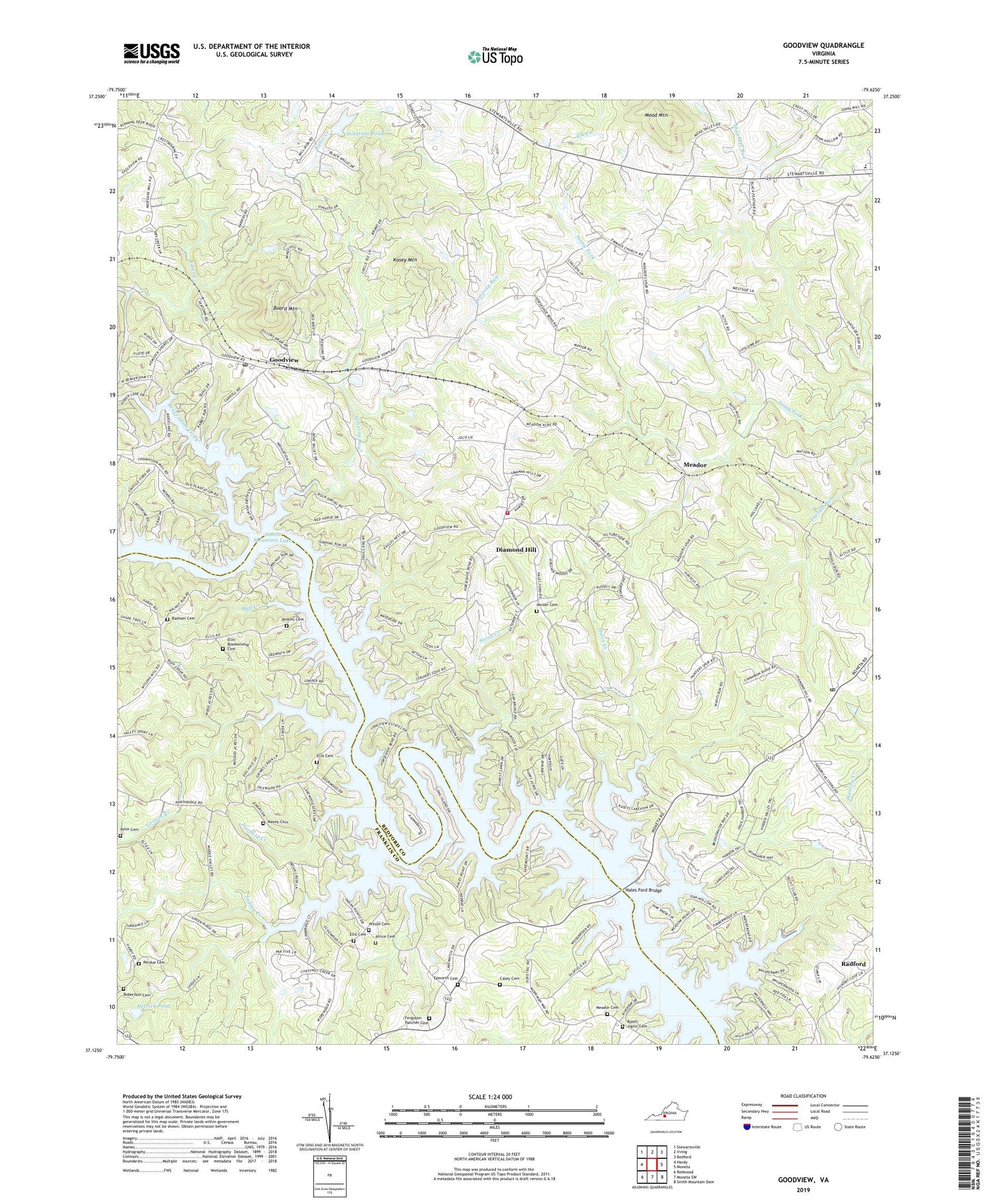
2019 topographic map quadrangle Goodview in the state of Virginia. Scale: 1:24000. Based on the newly updated USGS 7.5' US Topo map series, this map is in the following counties: Bedford, Franklin. The map contains contour data, water features, and other items you are used to seeing on USGS maps, but also has updated roads and other features. This is the next generation of topographic maps. Printed on high-quality waterproof paper with UV fade-resistant inks.
Quads adjacent to this one:
West: Hardy
Northwest: Stewartsville
North: Irving
Northeast: Bedford
East: Moneta
Southeast: Smith Mountain Dam
South: Moneta SW
Southwest: Redwood
Contains the following named places: Altice Cemetery, Aylor Cemetery, Basham Cemetery, Beaverdam Creek, Beechwood Shores, Board Mountain, Booth - Joplin Cemetery, Buff Creek, Cape Carlyn, Carters Island Ford, Casey Cemetery, Clevilas, Diamond Hill, Diamond Hill Church, Ellis Cemetery, Ellis-Blankenship Cemetery, Emmaus, Emmaus Church, Emmaus School, Epworth Church, Epworth United Methodist Church Cemetery, Ferguson - Hatcher Cemetery, Goodview, Goodview Church, Goodview Post Office, Green Spring Church, Grimes Creek, Haleford, Hales Creek, Hales Ford, Hales Ford Bridge, Hatfield Creek, Hendricks Store, Hetrick Dam, Hetrick Pond, Holdrens Dam, Holdrens Pond, Indian Creek, Jenkins Cemetery, Jumping Run, Kasey Mountain, Kates Creek, Maxey Cemetery, Mead Mountain, Meador, Meador Cemetery, Meadows Mill, Meads Store, Minter Cemetery, Moneta Post Office, Moneta Volunteer Fire Department Station 3, Olive Branch Church, Perdue Cemetery, Promised Land School, Robertson Cemetery, Staunton River Middle School, Stony Creek, Teels Mill, Turners Ford, WBLU-AM (Moneta), Western Light Church, Westlake Golf and Country Club, Wilson Cemetery, ZIP Codes: 24095, 24121