MyTopo
Hardy Virginia US Topo Map
Couldn't load pickup availability
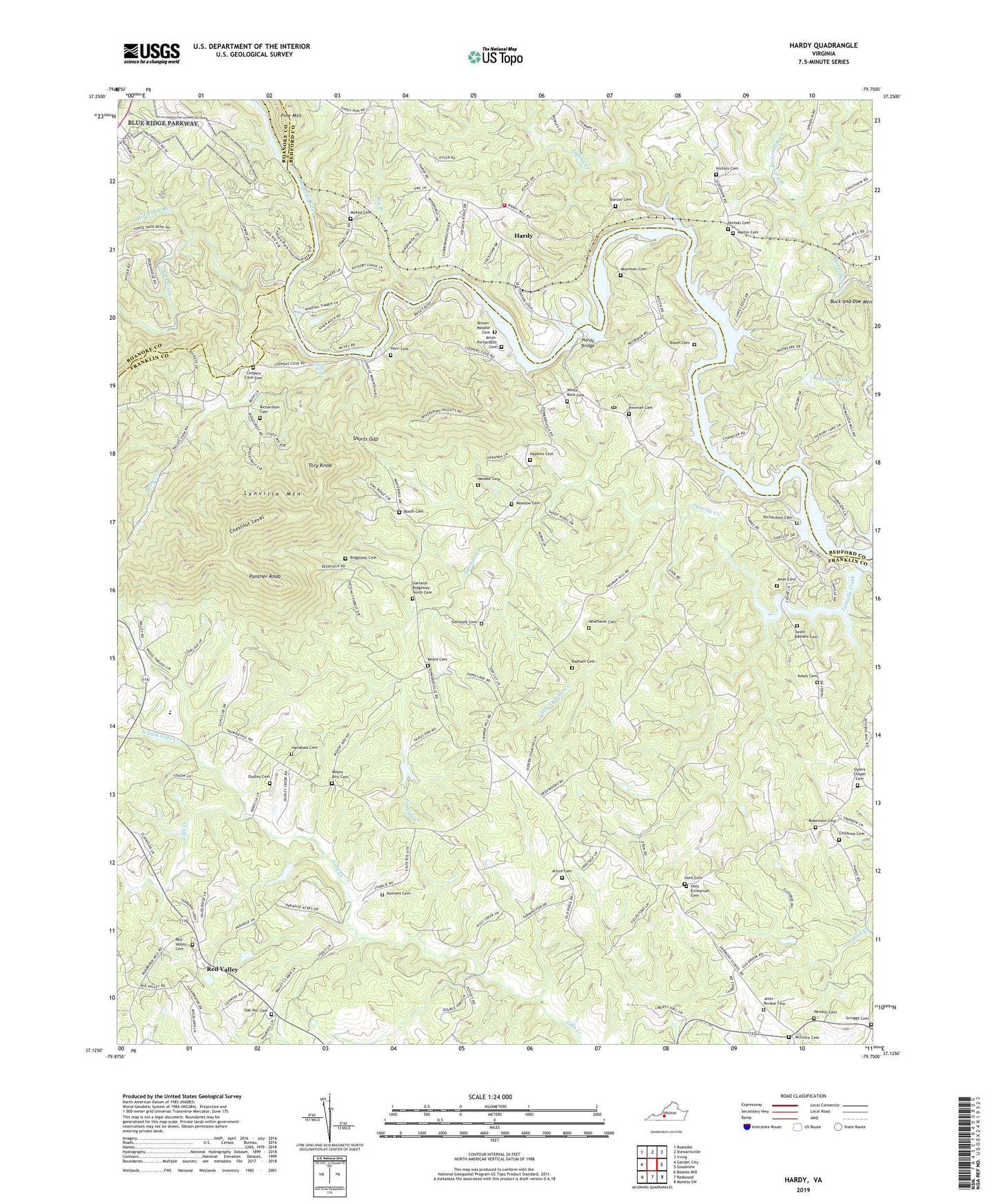
2022 topographic map quadrangle Hardy in the state of Virginia. Scale: 1:24000. Based on the newly updated USGS 7.5' US Topo map series, this map is in the following counties: Franklin, Bedford, Roanoke. The map contains contour data, water features, and other items you are used to seeing on USGS maps, but also has updated roads and other features. This is the next generation of topographic maps. Printed on high-quality waterproof paper with UV fade-resistant inks.
Quads adjacent to this one:
West: Garden City
Northwest: Roanoke
North: Stewartsville
Northeast: Irving
East: Goodview
Southeast: Moneta SW
South: Redwood
Southwest: Boones Mill
This map covers the same area as the classic USGS quad with code o37079b7.
Contains the following named places: Altice Cemetery, Amos-Richardson Cemetery, Back Creek, Barton Cemetery, Basham Cemetery, Beard Cemetery, Bellevue Church, Bellevue School, Big Branch, Blackwater Ford, Booth Cemetery, Brown Family Cemetery, Brown-Meador Cemetery, Buck and Doe Mountain, Chandler Boat Marina, Chestnut Level, Childress Cemetery, Clearview Lake, Cooper Cove Church, Coopers Cove, Coopers Cove Cemetery, Coopers Cove School, Dent Cemetery, District 1, Dudley Cemetery, Falling Creek, Falling Rock Falls, First Mount Airy Church, Garland-Ridgeway-Smith Cemetery, Gravel Hill Church, Hanabass Cemetery, Hardy, Hardy Bridge, Hardy Ford, Hardy Life Saving and Rescue Squad, Hardy Post Office, Hardy Volunteer Fire Department Company 12, Hardys Ford, Hickory Lake, Holy Emmanuel Cemetery, Holy Emmanuel Tabernacle, Hopkins Cemetery, Horn Cemetery, Horns Ford, Horseshoe Branch, Jeter - Perdue Cemetery, Jeter Cemetery, Kasey Cemetery, Kennett Cemetery, Little Falling River Number One Dam, Little Lynville Creek, Lynville Creek, Lynville Ford, Lynville Mountain, Lynville Ridge Church, Martin Cemetery, Mayflower Hills, Mayflower Hills Church, McGuire Cemetery, McKee Cemetery, McVeighs Ford, Meador Cemetery, Meadow Cemetery, Moorman Cemetery, Moorman Marina, Mount Airy Cemetery, Mount Lebanon School, Neathawk Cemetery, Newbill Cemetery, Nichols Cemetery, Ninevah Cemetery, Ninevah School, Nineveh Church, North Fork Gills Creek, Oak Hill Cemetery, Oak Hill Church, Old Mount Airy Church, Oylers Chapel, Oylers Chapel Cemetery, Panther Knob, Pine Mountain, Prater Creek, Red Gate School, Red Valley, Red Valley Cemetery, Red Valley Church, Red Valley Rescue Squad, Richardson Cemetery, Ridgeway Cemetery, Robertson Cemetery, Sandy Land School, Scruggs Cemetery, Shorts Gap, Simmons Cemetery, Stewartsville Station, Swain - Basham Cemetery, Tory Knob, Trinity Church, Webbs Ford, West Fork Beaverdam Creek, White Rock Cemetery, Whiterock Church, Wyatt, ZIP Code: 24101