MyTopo
Huddleston Virginia US Topo Map
Couldn't load pickup availability
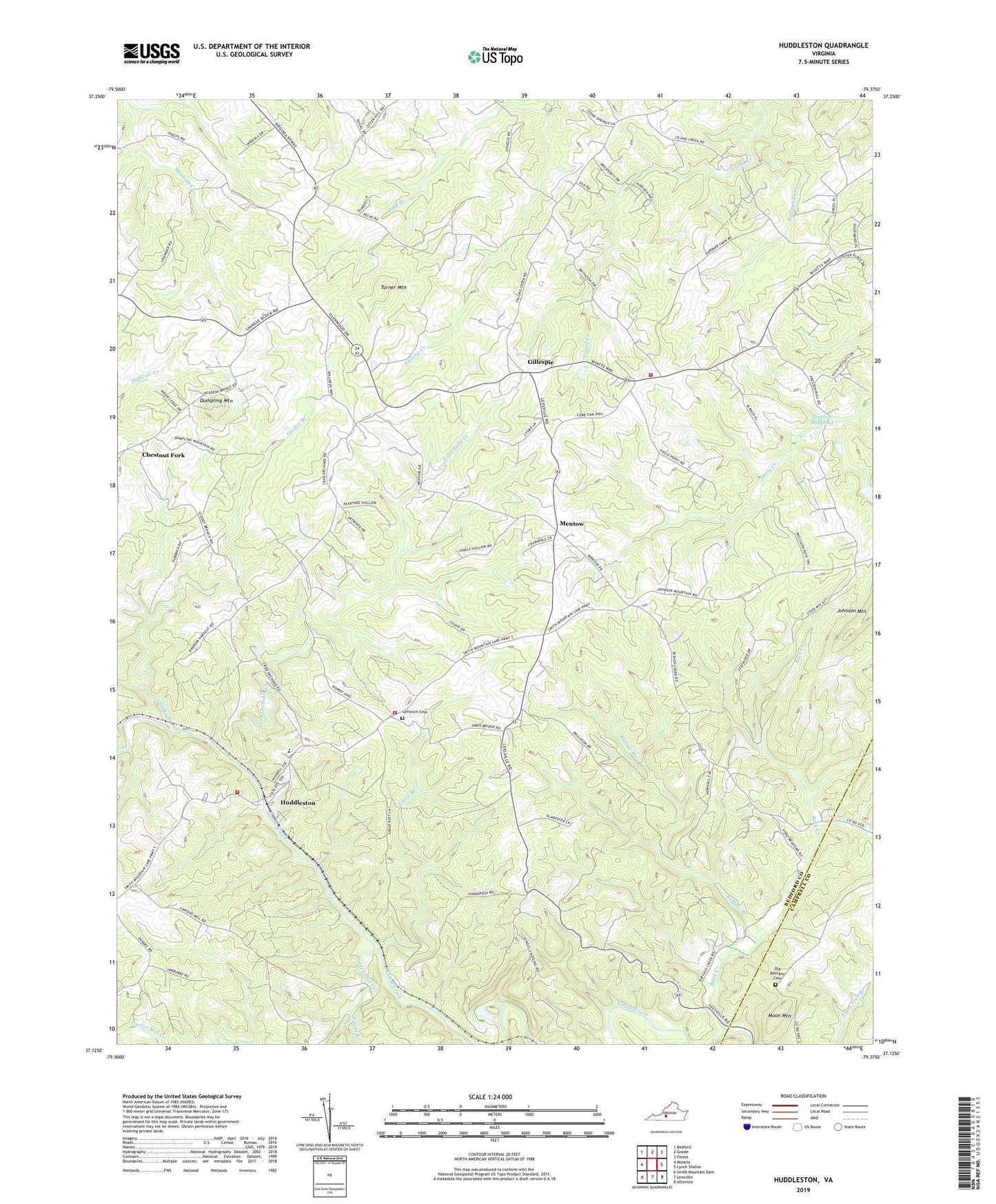
2019 topographic map quadrangle Huddleston in the state of Virginia. Scale: 1:24000. Based on the newly updated USGS 7.5' US Topo map series, this map is in the following counties: Bedford, Campbell. The map contains contour data, water features, and other items you are used to seeing on USGS maps, but also has updated roads and other features. This is the next generation of topographic maps. Printed on high-quality waterproof paper with UV fade-resistant inks.
Quads adjacent to this one:
West: Moneta
Northwest: Bedford
North: Goode
Northeast: Forest
East: Lynch Station
Southeast: Altavista
South: Leesville
Southwest: Smith Mountain Dam
Contains the following named places: Altavista Life Saving Crew, Altavista Police Department, Altavista Volunteer Fire Department, Amos Branch, Back Creek, Bethany Church, Bethany Memorial Cemetery, Bethesda Church, Bold Branch, Buffalo Branch, Buttermilk Creek, Carter Mill Creek, Chestnut Fork, Church Campground, Church of God, Crab Orchard Creek, Creasy School, District 3, Dumpling Mountain, Gillespie, Glader Branch, Huddleston, Huddleston Elementary School, Huddleston Fire Department Station 2, Huddleston Fire Department Station 4, Huddleston Life Saving and First Aid Crew, Huddleston Volunteer Fire Department Company 7, Independence Church, Island Branch, Leesville Temple, Leftwich Cemetery, Leftwich Church, Mentow, Moon Mountain, Mount Horeb Church, Pecks Church, Preston Millpond, Stony Fork, Turner Mountain, Waltons Store, Woodford Corner, ZIP Code: 24104