MyTopo
Altavista Virginia US Topo Map
Couldn't load pickup availability
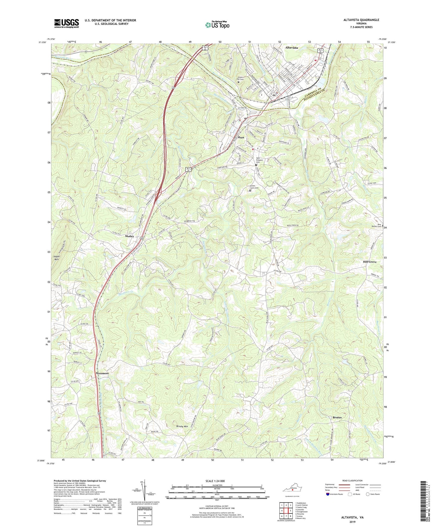
2022 topographic map quadrangle Altavista in the state of Virginia. Scale: 1:24000. Based on the newly updated USGS 7.5' US Topo map series, this map is in the following counties: Pittsylvania, Campbell. The map contains contour data, water features, and other items you are used to seeing on USGS maps, but also has updated roads and other features. This is the next generation of topographic maps. Printed on high-quality waterproof paper with UV fade-resistant inks.
Quads adjacent to this one:
West: Leesville
Northwest: Huddleston
North: Lynch Station
Northeast: Castle Craig
East: Straightstone
Southeast: Mount Airy
South: Gretna
Southwest: Pittsville
This map covers the same area as the classic USGS quad with code o37079a3.
Contains the following named places: Altavista, Altavista Combined School, Altavista Country Club, Altavista Filter Plant, Altavista Police Department, Altavista Post Office, Altavista Presbyterian Church, Altavista Town Hall, Altavista Volunteer Fire Company, Beverly Heights, Brushy Mountain, Brutus, Burkhardt Dam, Burntwood School, Bushy Mountain Dam, Church of God of Prophecy, Clement Memorial Wesleyan Church, Elim Assembly of God Church, English Heliport, Faith Christian Academy, First Baptist Church, First Pentecostal Holiness Church, Forest Hill, Green Hill Cemetery, Green Lawn Cemetery, Hill Grove, Holly Hills South, Holy Church, Hundley Church, Hurt, Hurt Church, Hurt City Hall, Hurt Community Center, Hurt Industrial Park, Hurt Police Department, Hurt Post Office, Hurt School, Hurt Volunteer Fire Department, Jasper Church, Jasper Mountain, John L Hurt Elementary School, Lane Memorial United Methodist Church, Little Sycamore Creek, Lynch Creek, Montevista Church, Moriah Church, Moseley Heights, Moseley Heights Elementary School, Motley, Motley Census Designated Place, New Bethel Cemetery, New Prospect Baptist Church, New Prospect Cemetery, Olive Church, Pine Ridge, Pittsylvania Wayside Park, Reed Creek, Saint Peters Episcopal Church, Slush Branch, Spring Road Church, Staunton Plaza Shopping Center, Staunton River District, Staunton River Memorial Library, Sycamore, Sycamore Baptist Church, Sycamore Creek, Town and Country Shopping Center, Town of Altavista, Town of Hurt, War Memorial Park, Wayside Church, WKDE-AM (Altavista), ZIP Code: 24563