MyTopo
Oak Level Virginia US Topo Map
Couldn't load pickup availability
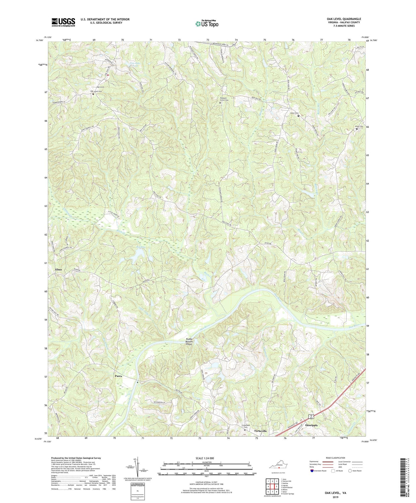
2019 topographic map quadrangle Oak Level in the state of Virginia. Scale: 1:24000. Based on the newly updated USGS 7.5' US Topo map series, this map is in the following counties: Halifax. The map contains contour data, water features, and other items you are used to seeing on USGS maps, but also has updated roads and other features. This is the next generation of topographic maps. Printed on high-quality waterproof paper with UV fade-resistant inks.
Quads adjacent to this one:
West: Ingram
Northwest: Java
North: Vernon Hill
Northeast: Halifax
East: South Boston
Southeast: Cluster Springs
South: Alton
Southwest: Milton
Contains the following named places: Ballous Creek, Bass Dam, Big Lake, Big Toby Creek, Birch Creek, Bosses, Carlton Creek, Chalmers Creek, Colmans Corner, Cross Road Baptist Church, Crossroad Church, Crossroads Cemetery, Danripple, East Temple Dam, Elmo, Five Oaks Dam, Five Oaks Pond, Flint Rock School, Fye Dam, Jones, Little Toby Creek, Locust Creek, Mount Pleasant Church, Mount Zion School, New Arbor Church, New Arbor School, New Vernon Church, News Ferry, Oak Level, Oak Level Cemetery, Oak Level Presbyterian Church, Oak Level Volunteer Fire Department, Oakes Dam, Owens Store, Paces, Pleasant Grove, Pleasant Grove Cemetery, Pleasant Grove Church, Ragland Dam, Ruddy Bottom Shoals, Temple Dam, Temple Pond, Terry School, Terrys Corner, Turbeville Elementary School, Union Cemetery, Union Church, Union Grove Church, Wade Dam Number Four, Wade Dam Number One, Wade Dam Number Three, Wade Dam Number Two, Wesley Chapel, Wesley Chapel School, West Temple Dam, Wilson Memorial School