MyTopo
Alton Virginia US Topo Map
Couldn't load pickup availability
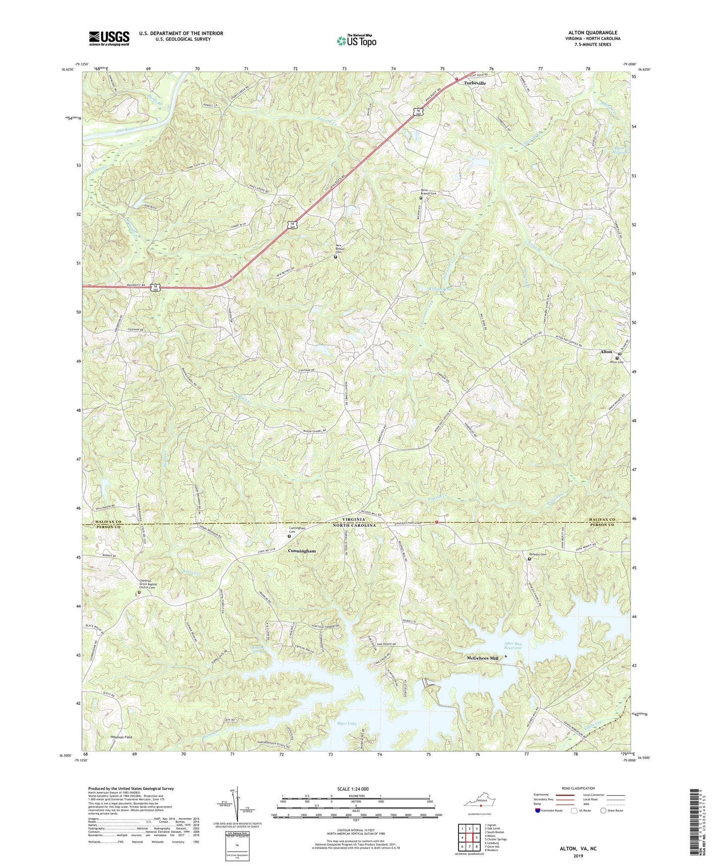
2022 topographic map quadrangle Alton in the states of Virginia, North Carolina. Scale: 1:24000. Based on the newly updated USGS 7.5' US Topo map series, this map is in the following counties: Halifax, Person. The map contains contour data, water features, and other items you are used to seeing on USGS maps, but also has updated roads and other features. This is the next generation of topographic maps. Printed on high-quality waterproof paper with UV fade-resistant inks.
Quads adjacent to this one:
West: Milton
Northwest: Ingram
North: Oak Level
Northeast: South Boston
East: Cluster Springs
Southeast: Roxboro
South: Olive Hill
Southwest: Leasburg
This map covers the same area as the classic USGS quad with code o36079e1.
Contains the following named places: After Bay Reservoir, Alton, Alton Baptist Church, Alton Cemetery, Alton Post Office, Black Creek, Boyds Store, Brandon Creek, Butrum Creek, Byrds Branch, Cane Creek, Ceffo Fire and Rescue Department Station 2, Chestnut Grove Baptist Church, Chestnut Grove Baptist Church Cemetery, Cunningham, Cunningham Cemetery, District 6, Ephesus Cemetery, Ephesus Church, Franklin Spring, Holeman Field, Lawsons Chapel, Lawsons Chapel School, Long Branch, Maidens Chapel School, Mason Chapel, McGehees Mill, Mount Carmer Church, New Bethel Cemetery, New Bethel Church, New Ephesus Church, Olive Branch Cemetery, Olive Branch Church, Piney Grove School, Powells Creek, Turbeville, Turbeville Volunteer Fire Department, West Long Branch, Whitt Dam, Wilkins Mill Dam, Wilkins Pond, Wilsons Chapel, Winns Creek, Woodburn Post Office, ZIP Codes: 24520, 27343