MyTopo
Purcellville Virginia US Topo Map
Couldn't load pickup availability
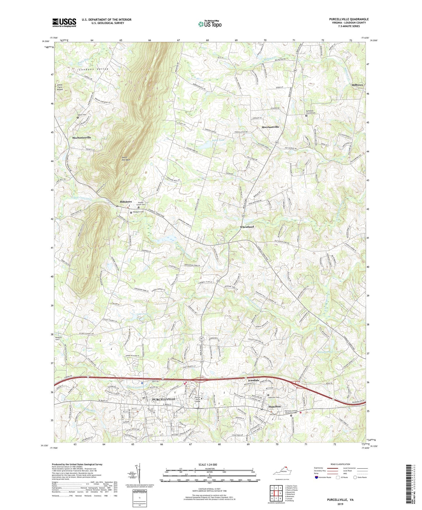
2019 topographic map quadrangle Purcellville in the state of Virginia. Scale: 1:24000. Based on the newly updated USGS 7.5' US Topo map series, this map is in the following counties: Loudoun. The map contains contour data, water features, and other items you are used to seeing on USGS maps, but also has updated roads and other features. This is the next generation of topographic maps. Printed on high-quality waterproof paper with UV fade-resistant inks.
Quads adjacent to this one:
Northwest: Charles Town
North: Harpers Ferry
Northeast: Point of Rocks
East: Waterford
Southeast: Leesburg
South: Lincoln
Southwest: Bluemont
Contains the following named places: Arlington Corner, Arnold Grove Methodist Episcopal Church Cemetery, Asbury United Methodist Church, Ashbury Church Road Dam, Beamertown, Bethany United Methodist Church, Blue Ridge Middle School, Brownsville, Buckskin Manor, Calvary Temple, Carver Center, Catoctin Free Church Cemetery, Crooked Run Orchard, Daley Dam, Daley Pond, Emerick Elementary School, Everharts Crossroads, Firemens Field Park, Franklin Park, Franklin Park Performing and Visual Arts Center, George Washington Carver School, Godfrey Dam, Godfrey Pond, Grace Annex United Methodist Church, Hamilton, Hamilton Elementary School, Hamilton Post Office, Hamilton Safety Center, Hamilton Station, Hamilton Town Hall, Hamilton-Thompson Lodge No. 37, Harmony Middle School, Harmony United Methodist Cemetery, Harmony United Methodist Church, Hillsboro, Hillsboro Charter Academy, Hillsboro Community Center, Hillsboro Historic District, Hillsboro Old Stone School, Hillsboro Post Office, Hillsboro United Methodist Cemetery, Hillsboro United Methodist Church, Ivandale, J T Gable Dam, James Chapel, Kalnasy Dam, Kalnasy Pond, Ketoctin Baptist Church, Koerner Lane Dam, Krens Farm Airport, Lakeview Cemetery, Loudoun County Animal Shelter, Loudoun County Fire and Rescue Hamilton Station 17, Loudoun County Fire and Rescue Hamilton Station 5, Loudoun County Fire and Rescue Purcellville Station 2, Loudoun County Fire and Rescue Station 26, Loudoun Golf & Country Club Dam, Loudoun Golf and Country Club, Loudoun Valley Church, Loudoun Valley Community Center, Loudoun Valley High School, Luhrs Dam, Luhrs Lake, Maple Business Center, Mechanicsville, Mill Creek, Milltown, Morrisonville, Mount Zion United Methodist Church, Mountain View Elementary School, Patrick Henry College, Purcellville, Purcellville Baptist Church, Purcellville Branch Loudoun County Public Library, Purcellville Police Department, Purcellville Post Office, Purcellville Public Safety Center, Purcellville Town Hall, Purcellville Volunteer Rescue Squad Company 14, Rehoboth Church Cemetery, Rehoboth United Methodist Church, Rosemont Farm, Saint Andrews Presbyterian Church, Saint Francis de Sales Church, Saint Peter's Episcopal Church, Salem Cemetery, Salem Church, Second Mount Olive Baptist Church, Shelbourne Parish American Legion Post 293, Shoemaker, The Shoppes at Main & Maple, Town of Hamilton, Town of Hillsboro, Town of Purcellville, Upper Godfrey Dam, Valley Industrial Park, Western Loudoun Community Church, Wheatland, WLPY-AM (Purcellville), Woodgrove High School, Zion Lutheran Church, ZIP Codes: 20132, 20158, 20197