
MyTopo
Republican Grove Virginia US Topo Map
Couldn't load pickup availability
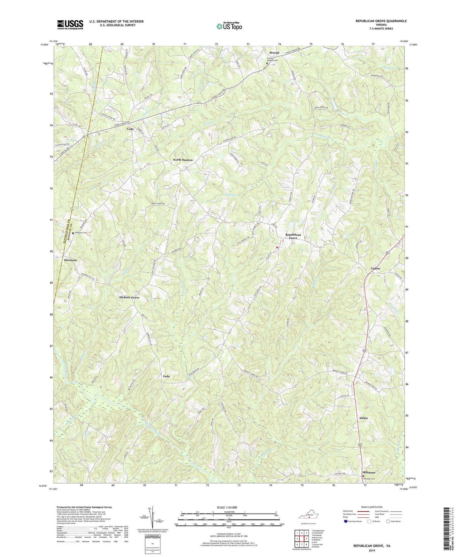
2019 topographic map quadrangle Republican Grove in the state of Virginia. Scale: 1:24000. Based on the newly updated USGS 7.5' US Topo map series, this map is in the following counties: Halifax, Pittsylvania. The map contains contour data, water features, and other items you are used to seeing on USGS maps, but also has updated roads and other features. This is the next generation of topographic maps. Printed on high-quality waterproof paper with UV fade-resistant inks.
Quads adjacent to this one:
West: Mount Airy
Northwest: Straightstone
North: Long Island
Northeast: Brookneal
East: Nathalie
Southeast: Halifax
South: Vernon Hill
Southwest: Java
Contains the following named places: Alchie, Brush Creek, Buffalo School, Clover Bottom Cemetery, Clover Bottom Church, Cluster Pines Church, Cody, Cow Creek, District 1, Duncan Dam, Elkhorn Creek, First Baptist Church of Millstone, Green Valley School, Hermosa, Hickory Grove, Hickory Grove Church, Hickory Grove School, Leda, Leda School, Long Branch, Memorial Church, Millstone, Millstone Cemetery, Millstone School, Mulberry Cemetery, Mulberry Church, North Halifax Volunteer Fire Department, North Stanton, Oak Ridge Church, Oak Ridge School, Republican Grove, Runaway Creek, Spider Creek, Stovall, Sydnor Jennings Elementary School, Volens, Volens Elementary School


