MyTopo
Straightstone Virginia US Topo Map
Couldn't load pickup availability
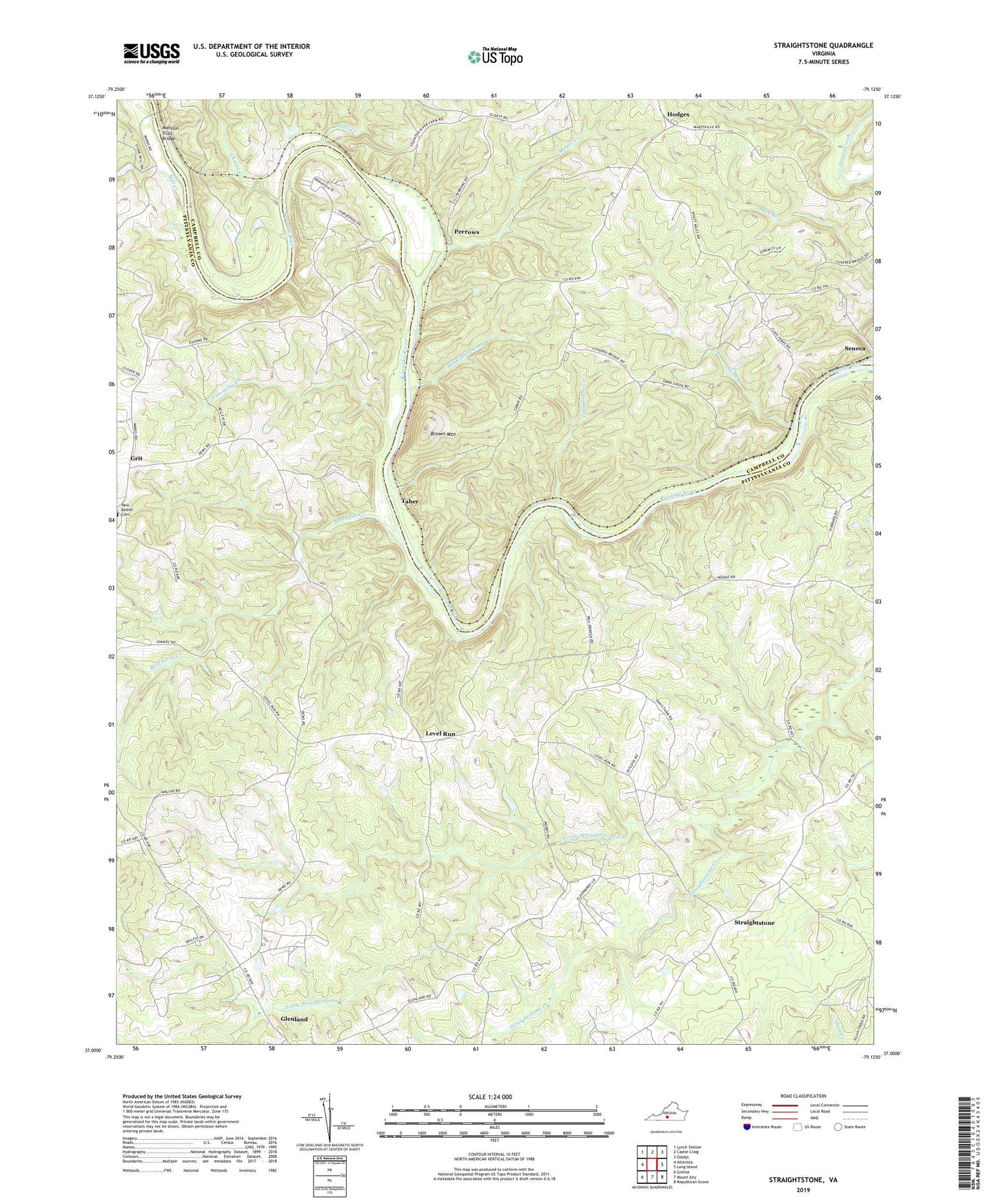
2022 topographic map quadrangle Straightstone in the state of Virginia. Scale: 1:24000. Based on the newly updated USGS 7.5' US Topo map series, this map is in the following counties: Pittsylvania, Campbell. The map contains contour data, water features, and other items you are used to seeing on USGS maps, but also has updated roads and other features. This is the next generation of topographic maps. Printed on high-quality waterproof paper with UV fade-resistant inks.
Quads adjacent to this one:
West: Altavista
Northwest: Lynch Station
North: Castle Craig
Northeast: Gladys
East: Long Island
Southeast: Republican Grove
South: Mount Airy
Southwest: Gretna
This map covers the same area as the classic USGS quad with code o37079a2.
Contains the following named places: Beechtree Creek, Bethel Church, Brown Mountain, Catamount Creek, Cedar Forest School, Cheese Creek, Dews Dam, Edge Hill Church, Fellowship Church, Grit, Hill Grove School, Hills Creek, Hodges, Jacob Stone Memorial Church, Level Run, Level Run Church, Level Run School, Little Straightstone Creek, Mansion, Mansion Truss Bridge, Mink Hollow Branch, Minter Creek, New Bethel Church, Perrows, Perrows Chapel, Pleasant Grove Church, Saint Johns Church, Seneca, Staunton Church, Straightstone, Straightstone Baptist Church, Straightstone School, Swan Creek, Swan Creek Church, Taber, Valentine Creek, Waller Farms, Worshams Pasture Ultralight Airport, ZIP Code: 24569